
Original file (3,024 × 1,998 pixels, file size: 2.09 MB, MIME type: image/jpeg)
| This is a file from the
Wikimedia Commons. Information from its
description page there is shown below. Commons is a freely licensed media file repository. You can help. |
| Description |
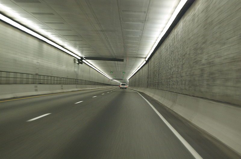
The Eisenhower Tunnel is a vehicular tunnel on Interstate 70 approximately 60 miles west of Denver, Colorado. The tunnel was built under the Continental Divide, and at a maximum elevation of 11,158 feet (3401 m) it is the highest vehicular tunnel in the world. It is also the longest tunnel built under the Interstate highway program and one of the last major pieces of the system to be completed. Its full official name is the Eisenhower-Johnson Memorial Tunnel (EJMT); the westbound bore is named after U.S. President Dwight D. Eisenhower (for whom the Interstate system is also named), the eastbound bore after Edwin C. Johnson, a former governor and U.S. Senator from Colorado. From Eisenhower Tunnel, Wikipedia |
| Date | |
| Source |
Eisenhower-Johnson Memorial Tunnel
|
| Author | Benjamin Clark from Tallahassee, Florida, USA |
| Camera location |
| View this and other nearby images on: OpenStreetMap |
|
|---|
Licensing
- You are free:
- to share – to copy, distribute and transmit the work
- to remix – to adapt the work
- Under the following conditions:
- attribution – You must give appropriate credit, provide a link to the license, and indicate if changes were made. You may do so in any reasonable manner, but not in any way that suggests the licensor endorses you or your use.
| This image, originally posted to Flickr, was reviewed on July 5, 2009 by the administrator or reviewer File Upload Bot (Magnus Manske), who confirmed that it was available on Flickr under the stated license on that date. |
File history
Click on a date/time to view the file as it appeared at that time.
| Date/Time | Thumbnail | Dimensions | User | Comment | |
|---|---|---|---|---|---|
| current | 02:30, 5 July 2009 |
| 3,024 × 1,998 (2.09 MB) | File Upload Bot (Magnus Manske) | {{Information |Description= The Eisenhower Tunnel is a vehicular tunnel on Interstate 70 approximately 60 miles west of Denver, Colorado. The tunnel was built under the Continental Divide, and at a maximum elevation of 11,158 feet (3401 m) it is the hig |
File usage
Global file usage
The following other wikis use this file:
- Usage on hi.wikipedia.org
- Usage on uk.wikipedia.org
Metadata
Original file (3,024 × 1,998 pixels, file size: 2.09 MB, MIME type: image/jpeg)
| This is a file from the
Wikimedia Commons. Information from its
description page there is shown below. Commons is a freely licensed media file repository. You can help. |
| Description |
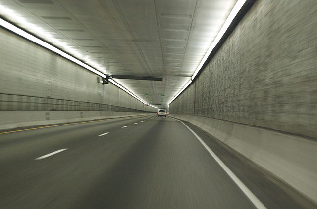
The Eisenhower Tunnel is a vehicular tunnel on Interstate 70 approximately 60 miles west of Denver, Colorado. The tunnel was built under the Continental Divide, and at a maximum elevation of 11,158 feet (3401 m) it is the highest vehicular tunnel in the world. It is also the longest tunnel built under the Interstate highway program and one of the last major pieces of the system to be completed. Its full official name is the Eisenhower-Johnson Memorial Tunnel (EJMT); the westbound bore is named after U.S. President Dwight D. Eisenhower (for whom the Interstate system is also named), the eastbound bore after Edwin C. Johnson, a former governor and U.S. Senator from Colorado. From Eisenhower Tunnel, Wikipedia |
| Date | |
| Source |
Eisenhower-Johnson Memorial Tunnel
|
| Author | Benjamin Clark from Tallahassee, Florida, USA |
| Camera location |
| View this and other nearby images on: OpenStreetMap |
|
|---|
Licensing
- You are free:
- to share – to copy, distribute and transmit the work
- to remix – to adapt the work
- Under the following conditions:
- attribution – You must give appropriate credit, provide a link to the license, and indicate if changes were made. You may do so in any reasonable manner, but not in any way that suggests the licensor endorses you or your use.
| This image, originally posted to Flickr, was reviewed on July 5, 2009 by the administrator or reviewer File Upload Bot (Magnus Manske), who confirmed that it was available on Flickr under the stated license on that date. |
File history
Click on a date/time to view the file as it appeared at that time.
| Date/Time | Thumbnail | Dimensions | User | Comment | |
|---|---|---|---|---|---|
| current | 02:30, 5 July 2009 |
| 3,024 × 1,998 (2.09 MB) | File Upload Bot (Magnus Manske) | {{Information |Description= The Eisenhower Tunnel is a vehicular tunnel on Interstate 70 approximately 60 miles west of Denver, Colorado. The tunnel was built under the Continental Divide, and at a maximum elevation of 11,158 feet (3401 m) it is the hig |
File usage
Global file usage
The following other wikis use this file:
- Usage on hi.wikipedia.org
- Usage on uk.wikipedia.org