Size of this preview:
782 × 600 pixels. Other resolutions:
313 × 240 pixels |
626 × 480 pixels |
1,002 × 768 pixels |
1,280 × 981 pixels |
1,500 × 1,150 pixels.
Original file (1,500 × 1,150 pixels, file size: 1.01 MB, MIME type: image/png)
| This is a file from the
Wikimedia Commons. Information from its
description page there is shown below. Commons is a freely licensed media file repository. You can help. |
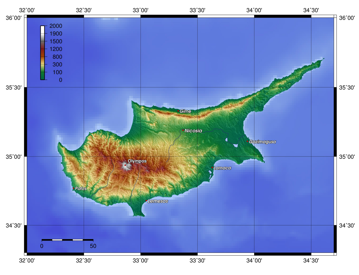
| Description | Description: Topography of Cyprus, created with GMT 4.1.3 | ||||||||||
| Date | |||||||||||
| Source |
At least one of the following Public Domain data sources |
||||||||||
| Author | Zamonin | ||||||||||
| Permission ( Reusing this file) |
|

File history
Click on a date/time to view the file as it appeared at that time.
| Date/Time | Thumbnail | Dimensions | User | Comment | |
|---|---|---|---|---|---|
| current | 13:18, 20 November 2012 |
| 1,500 × 1,150 (1.01 MB) | Zamonin | new labels |
| 07:26, 8 May 2009 |
 | 1,500 × 1,082 (895 KB) | Zamonin | added cities used etopo1 instead of etopo2 | |
| 09:47, 7 May 2009 |
 | 1,500 × 1,078 (905 KB) | Zamonin | (added cities used etopo1 instead of etopo2) | |
| 13:16, 11 July 2006 |
 | 1,363 × 865 (886 KB) | Zamonin | Category:Maps of Cyprus == Description, Source == * Description: Topography of Cyprus, created with [http://gmt.soest.hawaii.edu/ GMT] 4.1.3 * Source: At least one of the following Public Domain data sources ** [http://http://dss.ucar.edu/datasets/d |
File usage
The following pages on the English Wikipedia use this file (pages on other projects are not listed):
Global file usage
The following other wikis use this file:
- Usage on af.wikipedia.org
- Usage on als.wikipedia.org
- Usage on ar.wikipedia.org
- Usage on bg.wikipedia.org
- Usage on bn.wikipedia.org
- Usage on cs.wikipedia.org
- Usage on de.wikibooks.org
- Usage on el.wikipedia.org
- Usage on eo.wikipedia.org
- Usage on es.wikipedia.org
- Usage on fi.wikipedia.org
- Usage on fr.wikipedia.org
- Usage on gd.wikipedia.org
- Usage on he.wikipedia.org
- Usage on hr.wikipedia.org
- Usage on hu.wikipedia.org
- Usage on id.wikipedia.org
- Usage on incubator.wikimedia.org
- Usage on io.wikipedia.org
- Usage on ja.wikipedia.org
- Usage on ka.wikipedia.org
- Usage on ko.wikipedia.org
- Usage on ku.wikipedia.org
- Usage on lij.wikipedia.org
- Usage on lt.wikipedia.org
- Usage on nn.wikipedia.org
- Usage on no.wikipedia.org
- Usage on pl.wikipedia.org
- Usage on pl.wiktionary.org
- Usage on pnb.wikipedia.org
- Usage on pt.wikipedia.org
- Usage on qu.wikipedia.org
- Usage on ru.wikipedia.org
- Usage on skr.wikipedia.org
View more global usage of this file.
Metadata
Size of this preview:
782 × 600 pixels. Other resolutions:
313 × 240 pixels |
626 × 480 pixels |
1,002 × 768 pixels |
1,280 × 981 pixels |
1,500 × 1,150 pixels.
Original file (1,500 × 1,150 pixels, file size: 1.01 MB, MIME type: image/png)
| This is a file from the
Wikimedia Commons. Information from its
description page there is shown below. Commons is a freely licensed media file repository. You can help. |
| Description | Description: Topography of Cyprus, created with GMT 4.1.3 | ||||||||||
| Date | |||||||||||
| Source |
At least one of the following Public Domain data sources |
||||||||||
| Author | Zamonin | ||||||||||
| Permission ( Reusing this file) |
|
File history
Click on a date/time to view the file as it appeared at that time.
| Date/Time | Thumbnail | Dimensions | User | Comment | |
|---|---|---|---|---|---|
| current | 13:18, 20 November 2012 |
| 1,500 × 1,150 (1.01 MB) | Zamonin | new labels |
| 07:26, 8 May 2009 |
| 1,500 × 1,082 (895 KB) | Zamonin | added cities used etopo1 instead of etopo2 | |
| 09:47, 7 May 2009 |
| 1,500 × 1,078 (905 KB) | Zamonin | (added cities used etopo1 instead of etopo2) | |
| 13:16, 11 July 2006 |
| 1,363 × 865 (886 KB) | Zamonin | Category:Maps of Cyprus == Description, Source == * Description: Topography of Cyprus, created with [http://gmt.soest.hawaii.edu/ GMT] 4.1.3 * Source: At least one of the following Public Domain data sources ** [http://http://dss.ucar.edu/datasets/d |
File usage
The following pages on the English Wikipedia use this file (pages on other projects are not listed):
Global file usage
The following other wikis use this file:
- Usage on af.wikipedia.org
- Usage on als.wikipedia.org
- Usage on ar.wikipedia.org
- Usage on bg.wikipedia.org
- Usage on bn.wikipedia.org
- Usage on cs.wikipedia.org
- Usage on de.wikibooks.org
- Usage on el.wikipedia.org
- Usage on eo.wikipedia.org
- Usage on es.wikipedia.org
- Usage on fi.wikipedia.org
- Usage on fr.wikipedia.org
- Usage on gd.wikipedia.org
- Usage on he.wikipedia.org
- Usage on hr.wikipedia.org
- Usage on hu.wikipedia.org
- Usage on id.wikipedia.org
- Usage on incubator.wikimedia.org
- Usage on io.wikipedia.org
- Usage on ja.wikipedia.org
- Usage on ka.wikipedia.org
- Usage on ko.wikipedia.org
- Usage on ku.wikipedia.org
- Usage on lij.wikipedia.org
- Usage on lt.wikipedia.org
- Usage on nn.wikipedia.org
- Usage on no.wikipedia.org
- Usage on pl.wikipedia.org
- Usage on pl.wiktionary.org
- Usage on pnb.wikipedia.org
- Usage on pt.wikipedia.org
- Usage on qu.wikipedia.org
- Usage on ru.wikipedia.org
- Usage on skr.wikipedia.org
View more global usage of this file.