
Size of this preview:
800 × 488 pixels. Other resolutions:
320 × 195 pixels |
640 × 390 pixels |
1,024 × 625 pixels |
1,280 × 781 pixels |
2,560 × 1,562 pixels |
8,576 × 5,232 pixels.
Original file (8,576 × 5,232 pixels, file size: 4.11 MB, MIME type: image/jpeg)
| This is a file from the
Wikimedia Commons. Information from its
description page there is shown below. Commons is a freely licensed media file repository. You can help. |
Summary
| Description |
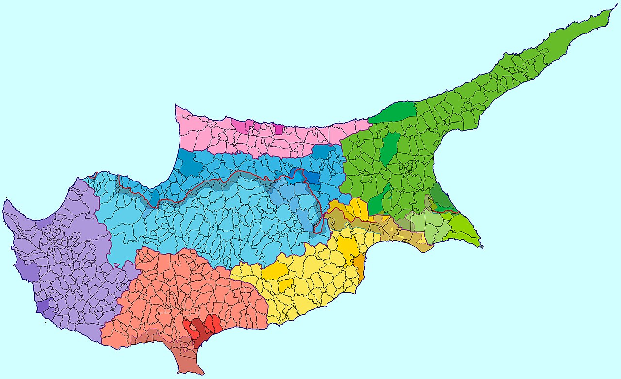
English: Administrative map of Cyprus showing districts. |
| Source | Own work |
| Author | Alexander-Michael Hadjilyra |
| Other versions |
 |


Licensing
I, the copyright holder of this work, hereby publish it under the following license:
This file is licensed under the
Creative Commons
Attribution 3.0 Unported license.
- You are free:
- to share – to copy, distribute and transmit the work
- to remix – to adapt the work
- Under the following conditions:
- attribution – You must give appropriate credit, provide a link to the license, and indicate if changes were made. You may do so in any reasonable manner, but not in any way that suggests the licensor endorses you or your use.
File history
Click on a date/time to view the file as it appeared at that time.
| Date/Time | Thumbnail | Dimensions | User | Comment | |
|---|---|---|---|---|---|
| current | 02:09, 2 December 2020 |
| 8,576 × 5,232 (4.11 MB) | Ras67 | losslessly cropped with Jpegcrop |
| 07:52, 5 October 2009 |
 | 8,610 × 5,270 (4.77 MB) | NeoCy | ||
| 17:48, 8 September 2009 |
 | 8,610 × 5,270 (4.77 MB) | NeoCy | {{Information |Description={{en|1=Administrative map of Cyprus showing districts.}} |Source=Own work by uploader |Author= Alexander-Michael Hadjilyra |Date= |Permission= |other_versions= }} |
File usage
The following pages on the English Wikipedia use this file (pages on other projects are not listed):
Global file usage
The following other wikis use this file:
- Usage on bg.wikipedia.org
- Usage on de.wikipedia.org
- Usage on eu.wikipedia.org
- Usage on fa.wikipedia.org
- Usage on hr.wikipedia.org
- Usage on id.wikipedia.org
- Usage on ka.wikipedia.org
- Usage on ro.wikipedia.org
- Usage on sl.wikipedia.org
- Usage on sr.wikipedia.org
- Usage on tr.wikipedia.org
- Usage on ur.wikipedia.org
- Usage on xmf.wikipedia.org
Metadata
Size of this preview:
800 × 488 pixels. Other resolutions:
320 × 195 pixels |
640 × 390 pixels |
1,024 × 625 pixels |
1,280 × 781 pixels |
2,560 × 1,562 pixels |
8,576 × 5,232 pixels.
Original file (8,576 × 5,232 pixels, file size: 4.11 MB, MIME type: image/jpeg)
| This is a file from the
Wikimedia Commons. Information from its
description page there is shown below. Commons is a freely licensed media file repository. You can help. |
Summary
| Description |
English: Administrative map of Cyprus showing districts. |
| Source | Own work |
| Author | Alexander-Michael Hadjilyra |
| Other versions |
|
Licensing
I, the copyright holder of this work, hereby publish it under the following license:
This file is licensed under the
Creative Commons
Attribution 3.0 Unported license.
- You are free:
- to share – to copy, distribute and transmit the work
- to remix – to adapt the work
- Under the following conditions:
- attribution – You must give appropriate credit, provide a link to the license, and indicate if changes were made. You may do so in any reasonable manner, but not in any way that suggests the licensor endorses you or your use.
File history
Click on a date/time to view the file as it appeared at that time.
| Date/Time | Thumbnail | Dimensions | User | Comment | |
|---|---|---|---|---|---|
| current | 02:09, 2 December 2020 |
| 8,576 × 5,232 (4.11 MB) | Ras67 | losslessly cropped with Jpegcrop |
| 07:52, 5 October 2009 |
| 8,610 × 5,270 (4.77 MB) | NeoCy | ||
| 17:48, 8 September 2009 |
| 8,610 × 5,270 (4.77 MB) | NeoCy | {{Information |Description={{en|1=Administrative map of Cyprus showing districts.}} |Source=Own work by uploader |Author= Alexander-Michael Hadjilyra |Date= |Permission= |other_versions= }} |
File usage
The following pages on the English Wikipedia use this file (pages on other projects are not listed):
Global file usage
The following other wikis use this file:
- Usage on bg.wikipedia.org
- Usage on de.wikipedia.org
- Usage on eu.wikipedia.org
- Usage on fa.wikipedia.org
- Usage on hr.wikipedia.org
- Usage on id.wikipedia.org
- Usage on ka.wikipedia.org
- Usage on ro.wikipedia.org
- Usage on sl.wikipedia.org
- Usage on sr.wikipedia.org
- Usage on tr.wikipedia.org
- Usage on ur.wikipedia.org
- Usage on xmf.wikipedia.org