
Original file (SVG file, nominally 1,097 × 1,062 pixels, file size: 480 KB)
| This is a file from the
Wikimedia Commons. Information from its
description page there is shown below. Commons is a freely licensed media file repository. You can help. |
Summary
| Description |
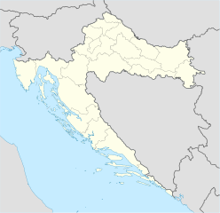
Deutsch: Positionskarte von
Kroatien
Quadratische Plattkarte, N-S-Streckung 140 %. Geographische Begrenzung der Karte:
English: Location map of
Croatia
Equirectangular projection, N/S stretching 140 %. Geographic limits of the map:
|
| Date | |
| Source | own work, using United States National Imagery and Mapping Agency data |
| Author | NordNordWest |
| Other versions |
Derivative works of this file: |

|
This map has been made or improved in the German
Kartenwerkstatt (Map Lab). You can
propose maps to improve as well.
|
Licensing

|
Permission is granted to copy, distribute and/or modify this document under the terms of the GNU Free Documentation License, Version 1.2 or any later version published by the Free Software Foundation; with no Invariant Sections, no Front-Cover Texts, and no Back-Cover Texts. A copy of the license is included in the section entitled GNU Free Documentation License. |
- You are free:
- to share – to copy, distribute and transmit the work
- to remix – to adapt the work
- Under the following conditions:
- attribution – You must give appropriate credit, provide a link to the license, and indicate if changes were made. You may do so in any reasonable manner, but not in any way that suggests the licensor endorses you or your use.
- share alike – If you remix, transform, or build upon the material, you must distribute your contributions under the same or compatible license as the original.
File history
Click on a date/time to view the file as it appeared at that time.
| Date/Time | Thumbnail | Dimensions | User | Comment | |
|---|---|---|---|---|---|
| current | 08:00, 29 August 2008 |
| 1,097 × 1,062 (480 KB) | NordNordWest | |
| 15:54, 30 July 2008 |
 | 548 × 531 (412 KB) | NordNordWest | more detailed borderlines | |
| 16:55, 16 July 2008 |
 | 548 × 531 (454 KB) | NordNordWest | {{Information |Description= {{de|Positionskarte von Kroatien}} Quadratische Plattkarte, N-S-Streckung 140 %. Geographische Begrenzung der Karte: * N: 46.8° N * S: 42.1° N * W: 13.1° O * O: 19.9° O {{en|Location map of [[:en:Croatia|Cr |
File usage
More than 100 pages use this file. The following list shows the first 100 pages that use this file only. A full list is available.
- 2000 European Men's Handball Championship
- Bakar, Croatia
- Battle of Lissa (1866)
- Belišće
- Bjelovar
- Bol, Croatia
- Borovo, Croatia
- Brač
- Buje
- Buzet
- Cerna, Croatia
- Cetingrad
- Cres
- Crikvenica
- Croatia national football team
- Croatian Radiotelevision
- Daruvar
- Diocletian's Palace
- Dubrovnik
- Goli Otok
- Gospić
- Karlovac
- Knin
- Komiža
- Koprivnica
- Kornati
- Krapina
- Križ, Zagreb County
- Križevci
- Krka National Park
- Kumrovec
- Lovrijenac
- Makarska
- Metković
- Mljet
- Mursko Središće
- Nadin, Croatia
- Našice
- Nedelišće
- Nin, Croatia
- Nova Gradiška
- Novi Marof
- Ogulin
- Opatija
- Operation Storm
- Osijek
- Otavice, Croatia
- Otok, Vukovar-Syrmia County
- Pag (town)
- Paklenica
- Pazin
- Plitvice Lakes National Park
- Ploče
- Podgora, Split-Dalmatia County
- Poreč
- Posedarje
- Požega, Croatia
- Prelog, Croatia
- Pula Arena
- Rijeka
- Rovinj
- Roč
- Rudina, Croatia
- Salona
- Samobor
- Senj
- Sinj
- Sisak
- Skradin
- Slatina, Croatia
- Slavonski Brod
- Smiljan, Croatia
- Solin
- Stara Gradiška
- Stari Jankovci
- Ston
- Sukošan
- Sućuraj
- Sveta Nedjelja, Hvar
- Trakošćan Castle
- Trogir
- Tvrđa
- Umag
- Valpovo
- Varaždin
- Velika Gorica
- Vinkovci
- Virovitica
- Vis (town)
- Višnjan
- Vodice, Croatia
- Vrbovsko
- Vrlika
- Vukovar
- Zadar
- Zaprešić
- Čakovec
- Đakovo
- Šenkovec
- Šibenik
View more links to this file.
Global file usage
The following other wikis use this file:
- Usage on ab.wikipedia.org
- Usage on af.wikipedia.org
- Usage on als.wikipedia.org
- Usage on am.wikipedia.org
- Usage on an.wikipedia.org
- Usage on ar.wikipedia.org
- قالب:خريطة مواقع
- قالب:خريطة مواقع كرواتيا
- قالب:خريطة مواقع/شرح
- بطولة أوروبا لكرة الصالات 2012
- قالب:خريطة مواقع/ملعب
- قالب:Location map/sandbox quick/doc
- وحدة:Location map/data/Croatia
- وحدة:Location map/data/Croatia/شرح
- اشتباك باكراتش
- حادثة بحيرات بليتفيتش
- معركة بوروفو سيلو
- حصار كييفو (1991)
- عملية العاصفة (حرب البوسنة والهرسك)
- Usage on arz.wikipedia.org
- Usage on ast.wikipedia.org
View more global usage of this file.
Metadata
Original file (SVG file, nominally 1,097 × 1,062 pixels, file size: 480 KB)
| This is a file from the
Wikimedia Commons. Information from its
description page there is shown below. Commons is a freely licensed media file repository. You can help. |
Summary
| Description |
Deutsch: Positionskarte von
Kroatien
Quadratische Plattkarte, N-S-Streckung 140 %. Geographische Begrenzung der Karte:
English: Location map of
Croatia
Equirectangular projection, N/S stretching 140 %. Geographic limits of the map:
|
| Date | |
| Source | own work, using United States National Imagery and Mapping Agency data |
| Author | NordNordWest |
| Other versions |
Derivative works of this file: |
|
|
This map has been made or improved in the German
Kartenwerkstatt (Map Lab). You can
propose maps to improve as well.
|
Licensing
|
|
Permission is granted to copy, distribute and/or modify this document under the terms of the GNU Free Documentation License, Version 1.2 or any later version published by the Free Software Foundation; with no Invariant Sections, no Front-Cover Texts, and no Back-Cover Texts. A copy of the license is included in the section entitled GNU Free Documentation License. |
- You are free:
- to share – to copy, distribute and transmit the work
- to remix – to adapt the work
- Under the following conditions:
- attribution – You must give appropriate credit, provide a link to the license, and indicate if changes were made. You may do so in any reasonable manner, but not in any way that suggests the licensor endorses you or your use.
- share alike – If you remix, transform, or build upon the material, you must distribute your contributions under the same or compatible license as the original.
File history
Click on a date/time to view the file as it appeared at that time.
| Date/Time | Thumbnail | Dimensions | User | Comment | |
|---|---|---|---|---|---|
| current | 08:00, 29 August 2008 |
| 1,097 × 1,062 (480 KB) | NordNordWest | |
| 15:54, 30 July 2008 |
| 548 × 531 (412 KB) | NordNordWest | more detailed borderlines | |
| 16:55, 16 July 2008 |
| 548 × 531 (454 KB) | NordNordWest | {{Information |Description= {{de|Positionskarte von Kroatien}} Quadratische Plattkarte, N-S-Streckung 140 %. Geographische Begrenzung der Karte: * N: 46.8° N * S: 42.1° N * W: 13.1° O * O: 19.9° O {{en|Location map of [[:en:Croatia|Cr |
File usage
More than 100 pages use this file. The following list shows the first 100 pages that use this file only. A full list is available.
- 2000 European Men's Handball Championship
- Bakar, Croatia
- Battle of Lissa (1866)
- Belišće
- Bjelovar
- Bol, Croatia
- Borovo, Croatia
- Brač
- Buje
- Buzet
- Cerna, Croatia
- Cetingrad
- Cres
- Crikvenica
- Croatia national football team
- Croatian Radiotelevision
- Daruvar
- Diocletian's Palace
- Dubrovnik
- Goli Otok
- Gospić
- Karlovac
- Knin
- Komiža
- Koprivnica
- Kornati
- Krapina
- Križ, Zagreb County
- Križevci
- Krka National Park
- Kumrovec
- Lovrijenac
- Makarska
- Metković
- Mljet
- Mursko Središće
- Nadin, Croatia
- Našice
- Nedelišće
- Nin, Croatia
- Nova Gradiška
- Novi Marof
- Ogulin
- Opatija
- Operation Storm
- Osijek
- Otavice, Croatia
- Otok, Vukovar-Syrmia County
- Pag (town)
- Paklenica
- Pazin
- Plitvice Lakes National Park
- Ploče
- Podgora, Split-Dalmatia County
- Poreč
- Posedarje
- Požega, Croatia
- Prelog, Croatia
- Pula Arena
- Rijeka
- Rovinj
- Roč
- Rudina, Croatia
- Salona
- Samobor
- Senj
- Sinj
- Sisak
- Skradin
- Slatina, Croatia
- Slavonski Brod
- Smiljan, Croatia
- Solin
- Stara Gradiška
- Stari Jankovci
- Ston
- Sukošan
- Sućuraj
- Sveta Nedjelja, Hvar
- Trakošćan Castle
- Trogir
- Tvrđa
- Umag
- Valpovo
- Varaždin
- Velika Gorica
- Vinkovci
- Virovitica
- Vis (town)
- Višnjan
- Vodice, Croatia
- Vrbovsko
- Vrlika
- Vukovar
- Zadar
- Zaprešić
- Čakovec
- Đakovo
- Šenkovec
- Šibenik
View more links to this file.
Global file usage
The following other wikis use this file:
- Usage on ab.wikipedia.org
- Usage on af.wikipedia.org
- Usage on als.wikipedia.org
- Usage on am.wikipedia.org
- Usage on an.wikipedia.org
- Usage on ar.wikipedia.org
- قالب:خريطة مواقع
- قالب:خريطة مواقع كرواتيا
- قالب:خريطة مواقع/شرح
- بطولة أوروبا لكرة الصالات 2012
- قالب:خريطة مواقع/ملعب
- قالب:Location map/sandbox quick/doc
- وحدة:Location map/data/Croatia
- وحدة:Location map/data/Croatia/شرح
- اشتباك باكراتش
- حادثة بحيرات بليتفيتش
- معركة بوروفو سيلو
- حصار كييفو (1991)
- عملية العاصفة (حرب البوسنة والهرسك)
- Usage on arz.wikipedia.org
- Usage on ast.wikipedia.org
View more global usage of this file.