Photos • Location


Size of this preview:
800 × 549 pixels. Other resolutions:
320 × 220 pixels |
640 × 439 pixels |
1,024 × 703 pixels |
1,280 × 878 pixels |
2,560 × 1,757 pixels |
4,334 × 2,974 pixels.
Original file (4,334 × 2,974 pixels, file size: 2.99 MB, MIME type: image/jpeg)
| This is a file from the
Wikimedia Commons. Information from its
description page there is shown below. Commons is a freely licensed media file repository. You can help. |
Summary
| Description |
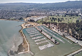
English: View is looking south |
| Date | |
| Source | Own work |
| Author | Alfred Twu |
| Camera location |
| View this and other nearby images on: OpenStreetMap |
|
|---|
Licensing
I, the copyright holder of this work, hereby publish it under the following license:
| This file is made available under the Creative Commons CC0 1.0 Universal Public Domain Dedication. | |
| The person who associated a work with this deed has dedicated the work to the
public domain by waiving all of their rights to the work worldwide under copyright law, including all related and neighboring rights, to the extent allowed by law. You can copy, modify, distribute and perform the work, even for commercial purposes, all without asking permission.
|
File history
Click on a date/time to view the file as it appeared at that time.
| Date/Time | Thumbnail | Dimensions | User | Comment | |
|---|---|---|---|---|---|
| current | 21:59, 12 August 2021 |
| 4,334 × 2,974 (2.99 MB) | Firstcultural | Uploaded own work with UploadWizard |
File usage
The following pages on the English Wikipedia use this file (pages on other projects are not listed):
Global file usage
The following other wikis use this file:
- Usage on es.wikipedia.org
Metadata
Size of this preview:
800 × 549 pixels. Other resolutions:
320 × 220 pixels |
640 × 439 pixels |
1,024 × 703 pixels |
1,280 × 878 pixels |
2,560 × 1,757 pixels |
4,334 × 2,974 pixels.
Original file (4,334 × 2,974 pixels, file size: 2.99 MB, MIME type: image/jpeg)
| This is a file from the
Wikimedia Commons. Information from its
description page there is shown below. Commons is a freely licensed media file repository. You can help. |
Summary
| Description |
English: View is looking south |
| Date | |
| Source | Own work |
| Author | Alfred Twu |
| Camera location |
| View this and other nearby images on: OpenStreetMap |
|
|---|
Licensing
I, the copyright holder of this work, hereby publish it under the following license:
| This file is made available under the Creative Commons CC0 1.0 Universal Public Domain Dedication. | |
| The person who associated a work with this deed has dedicated the work to the
public domain by waiving all of their rights to the work worldwide under copyright law, including all related and neighboring rights, to the extent allowed by law. You can copy, modify, distribute and perform the work, even for commercial purposes, all without asking permission.
|
File history
Click on a date/time to view the file as it appeared at that time.
| Date/Time | Thumbnail | Dimensions | User | Comment | |
|---|---|---|---|---|---|
| current | 21:59, 12 August 2021 |
| 4,334 × 2,974 (2.99 MB) | Firstcultural | Uploaded own work with UploadWizard |
File usage
The following pages on the English Wikipedia use this file (pages on other projects are not listed):
Global file usage
The following other wikis use this file:
- Usage on es.wikipedia.org