This is a file from the Wikimedia Commons
From Wikipedia, the free encyclopedia

Original file(SVG file, nominally 388 × 417 pixels, file size: 1.72 MB)


Summary

Description
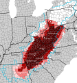
English: Counties included in the cultural definition of Appalachia:
 
Always included in Appalachia
 
Usually included in Appalachia
 
Sometimes included in Appalachia
 
Rarely included in Appalachia
 
Physically contains the Appalachian Mountains or associated features; not culturally Appalachian

The blue dotted line shows the counties included in the w:Appalachian Regional Commission definition
Cities (labeled with dots) are only for reference and are not meant to represent all major cities

Source: from the Mapping Appalachia ( https://mapappalachia.geography.vt.edu/about-2/) interactive map viewer: https://www.arcgis.com/home/webmap/viewer.html?webmap=67230740ae2641e9828e48f531cce9a6&extent=-103.5955,26.1117,-60.1995,46.6462 The ten cultural definitions were used: 1896 Berea by William G. Frost and C. Willard Hayes, 1918 Berea Catalog, 1935 USDA Small Region, 1935 USDA Full Region, 1962 Ford Region, 1994 Salstrom, 2002 Core Appalachia from Williams, 1996 Consensus Appalachia from Williams, 1996 Loose Appalachia from Williams

If a county appears in all the definitions, it is marked "always considered", if it appears in at least 6, it is marked "usually considered", if it appears in at least 2, it is marked "sometimes considered", and if it appears in only 1, it is marked "rarely considered"
Date   Edit this at Structured Data on Commons
Source Own work  Edit this at Structured Data on Commons
Author Leviavery  Edit this at Structured Data on Commons

Licensing

I, the copyright holder of this work, hereby publish it under the following license:
Creative Commons CC-Zero This file is made available under the Creative Commons CC0 1.0 Universal Public Domain Dedication.
The person who associated a work with this deed has dedicated the work to the public domain by waiving all of their rights to the work worldwide under copyright law, including all related and neighboring rights, to the extent allowed by law. You can copy, modify, distribute and perform the work, even for commercial purposes, all without asking permission.

Information

Captions

Add a one-line explanation of what this file represents

Items portrayed in this file

depicts

13 May 2023

image/svg+xml

94e2ff809f9d3cc0e9387434d26cdd60f9a06b0e

1,808,572 byte

417 pixel

388 pixel

File history

Click on a date/time to view the file as it appeared at that time.

Date/TimeThumbnailDimensionsUserComment
current 19:32, 24 February 2024 Thumbnail for version as of 19:32, 24 February 2024388 × 417 (1.72 MB)BrooklaikaRemade the county map in-line with the first half of the description (no original research). While I agree Ohio and Pennsylvania are parts of Appalachia that is not what the sources say
12:49, 18 July 2023 Thumbnail for version as of 12:49, 18 July 2023388 × 417 (1.72 MB)WWWHHHHYYYYYYOops. Didn't remove the outline on one last label. It should be fixed now.
12:46, 18 July 2023 Thumbnail for version as of 12:46, 18 July 2023388 × 417 (1.72 MB)WWWHHHHYYYYYYGoofed the last file with outlines on the text
12:31, 18 July 2023 Thumbnail for version as of 12:31, 18 July 2023388 × 417 (1.72 MB)WWWHHHHYYYYYYUpdated ARC boundaries - Union County, SC plus Cleveland and Catawba Counties, NC are now part of the ARC. Additionally expanded counties which may be included in Appalachia, reflecting the Little Cities of Black Diamonds which are locally identified as Appalachian. Pittsburg's nickname, the Paris of Appalachia, in addition to sources which I will add this file, means Pittsburgh could be considered as part of Appalachia in certain scenarios. Additionally, I have highlighted counties in white...
19:02, 15 May 2023 Thumbnail for version as of 19:02, 15 May 2023388 × 417 (1.66 MB)LeviaveryScale and text to path
18:57, 15 May 2023 Thumbnail for version as of 18:57, 15 May 2023259 × 278 (1.51 MB)LeviaveryPittsburg -> Pittsburgh
19:41, 13 May 2023 Thumbnail for version as of 19:41, 13 May 2023259 × 278 (1.52 MB)LeviaveryAshville -> Asheville
13:53, 13 May 2023 Thumbnail for version as of 13:53, 13 May 2023259 × 278 (1.64 MB)LeviaveryUploaded own work with UploadWizard
The following pages on the English Wikipedia use this file (pages on other projects are not listed):

Global file usage

The following other wikis use this file:

Metadata


Videos

Youtube | Vimeo | Bing

Websites

Google | Yahoo | Bing

Encyclopedia

Google | Yahoo | Bing

Facebook