Photos • Location


Size of this preview:
800 × 492 pixels. Other resolutions:
320 × 197 pixels |
640 × 393 pixels |
1,024 × 629 pixels |
1,280 × 786 pixels |
3,037 × 1,866 pixels.
Original file (3,037 × 1,866 pixels, file size: 1.33 MB, MIME type: image/jpeg)
| This is a file from the
Wikimedia Commons. Information from its
description page there is shown below. Commons is a freely licensed media file repository. You can help. |
Summary
| Description |
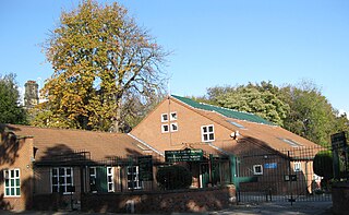
English: Church of God of Prophecy, 196 Chapeltown Road, Leeds, West Yorkshire LS7 |
| Date | |
| Source | Own work |
| Author | Chemical Engineer |
| Camera location |
| View this and other nearby images on: OpenStreetMap |
|
|---|
Licensing
| I, the copyright holder of this work, release this work into the
public domain. This applies worldwide. In some countries this may not be legally possible; if so: I grant anyone the right to use this work for any purpose, without any conditions, unless such conditions are required by law. |
File history
Click on a date/time to view the file as it appeared at that time.
| Date/Time | Thumbnail | Dimensions | User | Comment | |
|---|---|---|---|---|---|
| current | 16:43, 24 January 2009 |
| 3,037 × 1,866 (1.33 MB) | Chemical Engineer | {{Information |Description={{en|1=Church of God of Prophecy, Chapeltown Road, Leeds LS7. Holiness Pentecostal}} |Source=Own work by uploader |Author= Chemical Engineer |Date=29 October 2008 |Permission= |other_versions= }} {{Loc |
File usage
The following pages on the English Wikipedia use this file (pages on other projects are not listed):
Metadata
Size of this preview:
800 × 492 pixels. Other resolutions:
320 × 197 pixels |
640 × 393 pixels |
1,024 × 629 pixels |
1,280 × 786 pixels |
3,037 × 1,866 pixels.
Original file (3,037 × 1,866 pixels, file size: 1.33 MB, MIME type: image/jpeg)
| This is a file from the
Wikimedia Commons. Information from its
description page there is shown below. Commons is a freely licensed media file repository. You can help. |
Summary
| Description |
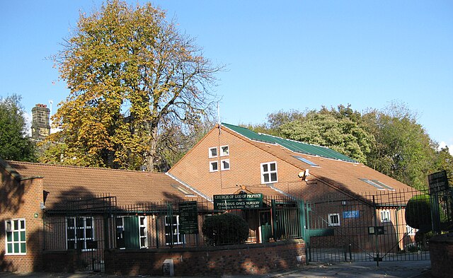
English: Church of God of Prophecy, 196 Chapeltown Road, Leeds, West Yorkshire LS7 |
| Date | |
| Source | Own work |
| Author | Chemical Engineer |
| Camera location |
| View this and other nearby images on: OpenStreetMap |
|
|---|
Licensing
| I, the copyright holder of this work, release this work into the
public domain. This applies worldwide. In some countries this may not be legally possible; if so: I grant anyone the right to use this work for any purpose, without any conditions, unless such conditions are required by law. |
File history
Click on a date/time to view the file as it appeared at that time.
| Date/Time | Thumbnail | Dimensions | User | Comment | |
|---|---|---|---|---|---|
| current | 16:43, 24 January 2009 |
| 3,037 × 1,866 (1.33 MB) | Chemical Engineer | {{Information |Description={{en|1=Church of God of Prophecy, Chapeltown Road, Leeds LS7. Holiness Pentecostal}} |Source=Own work by uploader |Author= Chemical Engineer |Date=29 October 2008 |Permission= |other_versions= }} {{Loc |
File usage
The following pages on the English Wikipedia use this file (pages on other projects are not listed):