PhotosLocation

This is a file from the Wikimedia Commons
From Wikipedia, the free encyclopedia

Original file(1,245 × 816 pixels, file size: 502 KB, MIME type: image/jpeg)

Description
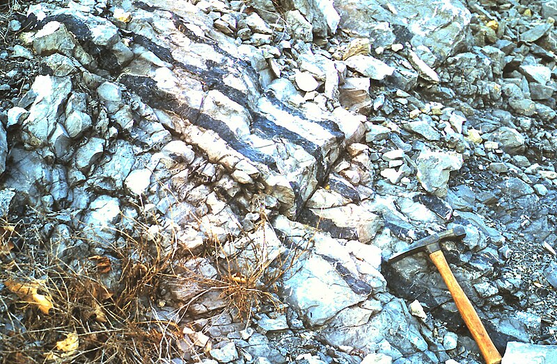
English: Outcrop of the Devonian Corriganville-New Creek limestone, showing chert (dark bands). Located at U.S. Route 30 (Everett Bypass) roadcut through Warrior Ridge, Bedford County, Pennsylvania. Taken March 2002. See also: Bedford-co-rt30-warrior.jpg
Date 1 May 2009 (original upload date)
Source Transferred from en.wikipedia to Commons.
Author Jstuby at English Wikipedia
Object location 40° 01′ 39″ N, 78° 22′ 10″ W  Kartographer map based on OpenStreetMap.View this and other nearby images on: OpenStreetMap info

Licensing

Public domain This work has been released into the public domain by its author, Jstuby at English Wikipedia. This applies worldwide.
In some countries this may not be legally possible; if so:
Jstuby grants anyone the right to use this work for any purpose, without any conditions, unless such conditions are required by law.

Original upload log

The original description page was here. All following user names refer to en.wikipedia.
  • 2009-05-01 18:54 Jstuby 1245×816× (514344 bytes) Outcrop of the [[Devonian]] Corriganville-New Creek [[limestone]], showing [[chert]] (dark bands). Located at [[U.S. Route 30]] (Everett Bypass) roadcut through [[Warrior Mountain|Warrior Ridge]], [[Bedford County, Pennsylvania|Bedford County]], Pennsylv

Information (Geography)

Captions

Add a one-line explanation of what this file represents

Items portrayed in this file

depicts

1 May 2009

40°1'39.000"N, 78°22'9.998"W

image/jpeg

2e4789f2c4976d5c6477f351cdd342060a95de55

514,344 byte

816 pixel

1,245 pixel

File history

Click on a date/time to view the file as it appeared at that time.

Date/TimeThumbnailDimensionsUserComment
current 13:58, 24 February 2010 Thumbnail for version as of 13:58, 24 February 20101,245 × 816 (502 KB)Jo Weber{{Information |Description={{en|Outcrop of the en:Devonian Corriganville-New Creek en:limestone, showing en:chert (dark bands). Located at en:U.S. Route 30 (Everett Bypass) roadcut through Warrior Ridge, [
The following pages on the English Wikipedia use this file (pages on other projects are not listed):

Global file usage

The following other wikis use this file:

Metadata


Videos

Youtube | Vimeo | Bing

Websites

Google | Yahoo | Bing

Encyclopedia

Google | Yahoo | Bing

Facebook