
Size of this PNG preview of this SVG file:
800 × 480 pixels. Other resolutions:
320 × 192 pixels |
1,024 × 614 pixels |
1,280 × 768 pixels |
2,560 × 1,536 pixels |
1,500 × 900 pixels.
Original file (SVG file, nominally 1,500 × 900 pixels, file size: 102 KB)
| This is a file from the
Wikimedia Commons. Information from its
description page there is shown below. Commons is a freely licensed media file repository. You can help. |
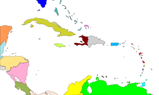
| Description | Mapa de las costas del mar Caribe Mar |
| Date | 4 August 2007 (upload date) |
| Source | It is based in en:Image:CaribbeanIslands.png, converted to svg by User:FAR |
| Author |
| I, the copyright holder of this work, release this work into the
public domain. This applies worldwide. In some countries this may not be legally possible; if so: I grant anyone the right to use this work for any purpose, without any conditions, unless such conditions are required by law. |
File history
Click on a date/time to view the file as it appeared at that time.
| Date/Time | Thumbnail | Dimensions | User | Comment | |
|---|---|---|---|---|---|
| current | 20:31, 4 August 2007 |
| 1,500 × 900 (102 KB) | FAR | Some colours changed, as Fballesteros requested |
| 10:23, 4 August 2007 |
 | 1,500 × 900 (102 KB) | FAR | ||
| 10:13, 4 August 2007 |
 | 1,500 × 900 (102 KB) | FAR | {{Information |Description=Mapa de las costas del mar Caribe Mar |Source=It is based in en:Image:CaribbeanIslands.png, converted to svg by User:FAR |Date=4-08-2007 |Permission=See Below |other_versions= }} {{PD}} [[Category:Maps of the Caribbea |
File usage
The following pages on the English Wikipedia use this file (pages on other projects are not listed):
Global file usage
The following other wikis use this file:
- Usage on af.wikipedia.org
- Usage on ca.wikipedia.org
- Usage on el.wikipedia.org
- Usage on eo.wikipedia.org
- Usage on es.wikipedia.org
- Usage on eu.wikipedia.org
- Usage on fa.wikipedia.org
- Usage on id.wikipedia.org
- Usage on pt.wikipedia.org
- Usage on sat.wikipedia.org
- Usage on zh.wikipedia.org
Size of this PNG preview of this SVG file:
800 × 480 pixels. Other resolutions:
320 × 192 pixels |
1,024 × 614 pixels |
1,280 × 768 pixels |
2,560 × 1,536 pixels |
1,500 × 900 pixels.
Original file (SVG file, nominally 1,500 × 900 pixels, file size: 102 KB)
| This is a file from the
Wikimedia Commons. Information from its
description page there is shown below. Commons is a freely licensed media file repository. You can help. |
| Description | Mapa de las costas del mar Caribe Mar |
| Date | 4 August 2007 (upload date) |
| Source | It is based in en:Image:CaribbeanIslands.png, converted to svg by User:FAR |
| Author |
| I, the copyright holder of this work, release this work into the
public domain. This applies worldwide. In some countries this may not be legally possible; if so: I grant anyone the right to use this work for any purpose, without any conditions, unless such conditions are required by law. |
File history
Click on a date/time to view the file as it appeared at that time.
| Date/Time | Thumbnail | Dimensions | User | Comment | |
|---|---|---|---|---|---|
| current | 20:31, 4 August 2007 |
| 1,500 × 900 (102 KB) | FAR | Some colours changed, as Fballesteros requested |
| 10:23, 4 August 2007 |
| 1,500 × 900 (102 KB) | FAR | ||
| 10:13, 4 August 2007 |
| 1,500 × 900 (102 KB) | FAR | {{Information |Description=Mapa de las costas del mar Caribe Mar |Source=It is based in en:Image:CaribbeanIslands.png, converted to svg by User:FAR |Date=4-08-2007 |Permission=See Below |other_versions= }} {{PD}} [[Category:Maps of the Caribbea |
File usage
The following pages on the English Wikipedia use this file (pages on other projects are not listed):
Global file usage
The following other wikis use this file:
- Usage on af.wikipedia.org
- Usage on ca.wikipedia.org
- Usage on el.wikipedia.org
- Usage on eo.wikipedia.org
- Usage on es.wikipedia.org
- Usage on eu.wikipedia.org
- Usage on fa.wikipedia.org
- Usage on id.wikipedia.org
- Usage on pt.wikipedia.org
- Usage on sat.wikipedia.org
- Usage on zh.wikipedia.org