Photos • Location


Size of this preview:
800 × 600 pixels. Other resolutions:
320 × 240 pixels |
640 × 480 pixels |
1,024 × 768 pixels |
1,280 × 960 pixels |
2,560 × 1,920 pixels |
4,224 × 3,168 pixels.
Original file (4,224 × 3,168 pixels, file size: 4.31 MB, MIME type: image/jpeg)
| This is a file from the
Wikimedia Commons. Information from its
description page there is shown below. Commons is a freely licensed media file repository. You can help. |
|
|
This is a photo of
listed building number
10476. |
Summary
| Description |
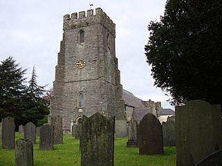
English: Photograph of the Parish Church of St Mary, Cardigan, Ceredigion, Wales |
| Date | |
| Source | Own work |
| Author | JohnArmagh |
| Object location |
| View this and other nearby images on: OpenStreetMap |
|
|---|
Licensing
| I, the copyright holder of this work, release this work into the
public domain. This applies worldwide. In some countries this may not be legally possible; if so: I grant anyone the right to use this work for any purpose, without any conditions, unless such conditions are required by law. |
File history
Click on a date/time to view the file as it appeared at that time.
| Date/Time | Thumbnail | Dimensions | User | Comment | |
|---|---|---|---|---|---|
| current | 18:45, 10 May 2009 |
| 4,224 × 3,168 (4.31 MB) | JohnArmagh | {{Information |Description={{en|1=Photograph of Cardigan Priory, Ceredigion, Wales}} |Source=Own work by uploader |Author= JohnArmagh |Date=2009-04-30 |Permission= |other_versions= }} <!--{{ImageUpload|full}}--> |
File usage
The following pages on the English Wikipedia use this file (pages on other projects are not listed):
Global file usage
The following other wikis use this file:
- Usage on cy.wikipedia.org
- Usage on es.wikipedia.org
- Usage on fa.wikipedia.org
- Usage on fi.wikipedia.org
- Usage on it.wikipedia.org
Metadata
Size of this preview:
800 × 600 pixels. Other resolutions:
320 × 240 pixels |
640 × 480 pixels |
1,024 × 768 pixels |
1,280 × 960 pixels |
2,560 × 1,920 pixels |
4,224 × 3,168 pixels.
Original file (4,224 × 3,168 pixels, file size: 4.31 MB, MIME type: image/jpeg)
| This is a file from the
Wikimedia Commons. Information from its
description page there is shown below. Commons is a freely licensed media file repository. You can help. |
|
|
This is a photo of
listed building number
10476. |
Summary
| Description |
English: Photograph of the Parish Church of St Mary, Cardigan, Ceredigion, Wales |
| Date | |
| Source | Own work |
| Author | JohnArmagh |
| Object location |
| View this and other nearby images on: OpenStreetMap |
|
|---|
Licensing
| I, the copyright holder of this work, release this work into the
public domain. This applies worldwide. In some countries this may not be legally possible; if so: I grant anyone the right to use this work for any purpose, without any conditions, unless such conditions are required by law. |
File history
Click on a date/time to view the file as it appeared at that time.
| Date/Time | Thumbnail | Dimensions | User | Comment | |
|---|---|---|---|---|---|
| current | 18:45, 10 May 2009 |
| 4,224 × 3,168 (4.31 MB) | JohnArmagh | {{Information |Description={{en|1=Photograph of Cardigan Priory, Ceredigion, Wales}} |Source=Own work by uploader |Author= JohnArmagh |Date=2009-04-30 |Permission= |other_versions= }} <!--{{ImageUpload|full}}--> |
File usage
The following pages on the English Wikipedia use this file (pages on other projects are not listed):
Global file usage
The following other wikis use this file:
- Usage on cy.wikipedia.org
- Usage on es.wikipedia.org
- Usage on fa.wikipedia.org
- Usage on fi.wikipedia.org
- Usage on it.wikipedia.org