
Original file (2,184 × 2,692 pixels, file size: 2.61 MB, MIME type: image/jpeg)
| This is a file from the
Wikimedia Commons. Information from its
description page there is shown below. Commons is a freely licensed media file repository. You can help. |
| Description |
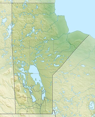
Quadratische Plattkarte, N-S-Streckung 170 %. Geographische Begrenzung der Karte:
Equirectangular projection, N/S stretching 170 %. Geographic limits of the map:
|
| Date | |
| Source |
Own work, using
|
| Author | Carport |
| Permission ( Reusing this file) |
This file is licensed under the
Creative Commons
Attribution-Share Alike 3.0 Unported license.
|
| Other versions |
|

File history
Click on a date/time to view the file as it appeared at that time.
| Date/Time | Thumbnail | Dimensions | User | Comment | |
|---|---|---|---|---|---|
| current | 17:09, 30 November 2012 |
| 2,184 × 2,692 (2.61 MB) | Carport | {{Information |Description= {{de|Physische Positionskarte von Manitoba, Kanada}} Quadratische Plattkarte, N-S-Streckung 170 %. Geographische Begrenzung der Karte: * N: 60.3° N * S: 48.7° N * W: 104.0° W * O: 88.0° W ... |
File usage
More than 100 pages use this file. The following list shows the first 100 pages that use this file only. A full list is available.
- Antler River
- Assiniboine River
- Aswapiswanan Lake
- Baldy Mountain (Manitoba)
- Beaver Creek Provincial Park (Manitoba)
- Berens River
- Berens River First Nation
- Bernic Lake
- Bloodvein First Nation
- Bloodvein River
- Bolton Lake (Manitoba)
- Bolton River (Manitoba)
- Booster Lake
- Boundary Lake
- Boyne River (Manitoba)
- Bunibonibee Cree Nation
- Caddy Lake
- Camperville, Manitoba
- Canada Life Centre
- Carrot River (Saskatchewan)
- Cedar Lake (Manitoba)
- Churchill River (Hudson Bay)
- Cross Lake (Manitoba)
- Dauphin Lake
- Echimamish River
- Echoing River
- Egenolf Lake
- Fairford River
- Falcon Lake (Manitoba)
- Fisher River Cree Nation
- Gainsborough Creek
- Gods Lake
- Gods Lake Narrows
- Gods River
- Great Falls Dam (Manitoba)
- Hart Mountain (Manitoba)
- Hayes River
- Island Lake (Manitoba)
- Kakwusis Lake
- Kasmere Lake
- Keystone Centre
- Kipahigan Lake
- Kississing Lake
- Knee Lake
- La Salle River
- Lac Brochet
- Lake Manitoba
- Lake Wahtopanah
- Lake Winnipeg
- Lake Winnipegosis
- List of longest rivers of the United States (by main stem)
- Little Bolton Lake (Manitoba)
- Little Limestone Lake
- Mackie Lake (Manitoba)
- Manigotagan River
- Manitoba
- Manitoba Escarpment
- Mink River (Manitoba)
- Minnedosa Lake
- Molson Lake (Manitoba)
- Munroe Lake
- Musketasonan Lake
- Nejanilini Lake
- Oxford Lake
- Pekwachnamaykoskwaskwaypinwanik Lake
- Pelican Lake (Manitoba)
- Pierre Gaultier de Varennes, sieur de La Vérendrye
- Pine Creek First Nation
- Playgreen Lake
- Poplar River (Manitoba)
- Porcupine Hills
- Putahow Lake
- Qu'Appelle River
- Red Deer Lake (Manitoba)
- Red River of the North
- Riding Mountain National Park
- Rushforth Lake
- Sayisi Dene
- Seal River (Manitoba)
- Seine River (Manitoba)
- Shellmouth Reservoir
- Shoal Lake (Kenora District, Ontario)
- Shoal Lakes (Manitoba)
- South Indian Lake
- Springer Lake
- Stony Lake (Manitoba)
- Sturgeon River (Manitoba)
- Swan Lake (Manitoba)
- Tadoule Lake
- Toews Lake
- Touchwood Lake (Manitoba)
- Turtle Mountain Provincial Park
- Vermilyea Lake
- Wekusko Falls Provincial Park
- Wesachewan River
- West Hawk Lake
- Whitefish River (Manitoba)
- Whitemud River
- Whiteshell River
- Winnipeg River
View more links to this file.
Global file usage
The following other wikis use this file:
- Usage on ar.wikipedia.org
- Usage on ast.wikipedia.org
- Usage on ban.wikipedia.org
- Usage on bg.wikipedia.org
- Usage on ca.wikipedia.org
- Usage on de.wikipedia.org
- Winnipegsee
- Winnipegosissee
- Manitobasee
- Vorlage:Positionskarte Kanada Manitoba
- Wikipedia:Kartenwerkstatt/Positionskarten/Nordamerika
- Molson Lake
- Gods Lake
- Cedar Lake (Saskatchewan River)
- Tanco-Mine
- Whiteshell Provincial Park
- Nopiming Provincial Park
- Atikaki Provincial Wilderness Park
- Hecla-Grindstone Provincial Park
- Wasserkraftwerk Kelsey
- Southern Indian Lake
- Island Lake
- Cross Lake
- Playgreen Lake
- Sipiwesk Lake
- Granville Lake
- Dauphin Lake
- Oxford Lake
- Swan Lake (Manitoba)
- West Hawk Lake
- Big Sand Lake (South Seal River)
- Clearwater Lake (Cormorant Lake)
- North Knife Lake
- Pelican Lake (Pembina River)
- Pelican Lake (Pelican River, Manitoba)
- Cormorant Lake
- Nejanilini Lake
- Waskaiowaka Lake
- Commonwealth Lake (Manitoba)
- CKX-TV-Sendemast
View more global usage of this file.
Original file (2,184 × 2,692 pixels, file size: 2.61 MB, MIME type: image/jpeg)
| This is a file from the
Wikimedia Commons. Information from its
description page there is shown below. Commons is a freely licensed media file repository. You can help. |
| Description |
Quadratische Plattkarte, N-S-Streckung 170 %. Geographische Begrenzung der Karte:
Equirectangular projection, N/S stretching 170 %. Geographic limits of the map:
|
| Date | |
| Source |
Own work, using
|
| Author | Carport |
| Permission ( Reusing this file) |
This file is licensed under the
Creative Commons
Attribution-Share Alike 3.0 Unported license.
|
| Other versions |
|
File history
Click on a date/time to view the file as it appeared at that time.
| Date/Time | Thumbnail | Dimensions | User | Comment | |
|---|---|---|---|---|---|
| current | 17:09, 30 November 2012 |
| 2,184 × 2,692 (2.61 MB) | Carport | {{Information |Description= {{de|Physische Positionskarte von Manitoba, Kanada}} Quadratische Plattkarte, N-S-Streckung 170 %. Geographische Begrenzung der Karte: * N: 60.3° N * S: 48.7° N * W: 104.0° W * O: 88.0° W ... |
File usage
More than 100 pages use this file. The following list shows the first 100 pages that use this file only. A full list is available.
- Antler River
- Assiniboine River
- Aswapiswanan Lake
- Baldy Mountain (Manitoba)
- Beaver Creek Provincial Park (Manitoba)
- Berens River
- Berens River First Nation
- Bernic Lake
- Bloodvein First Nation
- Bloodvein River
- Bolton Lake (Manitoba)
- Bolton River (Manitoba)
- Booster Lake
- Boundary Lake
- Boyne River (Manitoba)
- Bunibonibee Cree Nation
- Caddy Lake
- Camperville, Manitoba
- Canada Life Centre
- Carrot River (Saskatchewan)
- Cedar Lake (Manitoba)
- Churchill River (Hudson Bay)
- Cross Lake (Manitoba)
- Dauphin Lake
- Echimamish River
- Echoing River
- Egenolf Lake
- Fairford River
- Falcon Lake (Manitoba)
- Fisher River Cree Nation
- Gainsborough Creek
- Gods Lake
- Gods Lake Narrows
- Gods River
- Great Falls Dam (Manitoba)
- Hart Mountain (Manitoba)
- Hayes River
- Island Lake (Manitoba)
- Kakwusis Lake
- Kasmere Lake
- Keystone Centre
- Kipahigan Lake
- Kississing Lake
- Knee Lake
- La Salle River
- Lac Brochet
- Lake Manitoba
- Lake Wahtopanah
- Lake Winnipeg
- Lake Winnipegosis
- List of longest rivers of the United States (by main stem)
- Little Bolton Lake (Manitoba)
- Little Limestone Lake
- Mackie Lake (Manitoba)
- Manigotagan River
- Manitoba
- Manitoba Escarpment
- Mink River (Manitoba)
- Minnedosa Lake
- Molson Lake (Manitoba)
- Munroe Lake
- Musketasonan Lake
- Nejanilini Lake
- Oxford Lake
- Pekwachnamaykoskwaskwaypinwanik Lake
- Pelican Lake (Manitoba)
- Pierre Gaultier de Varennes, sieur de La Vérendrye
- Pine Creek First Nation
- Playgreen Lake
- Poplar River (Manitoba)
- Porcupine Hills
- Putahow Lake
- Qu'Appelle River
- Red Deer Lake (Manitoba)
- Red River of the North
- Riding Mountain National Park
- Rushforth Lake
- Sayisi Dene
- Seal River (Manitoba)
- Seine River (Manitoba)
- Shellmouth Reservoir
- Shoal Lake (Kenora District, Ontario)
- Shoal Lakes (Manitoba)
- South Indian Lake
- Springer Lake
- Stony Lake (Manitoba)
- Sturgeon River (Manitoba)
- Swan Lake (Manitoba)
- Tadoule Lake
- Toews Lake
- Touchwood Lake (Manitoba)
- Turtle Mountain Provincial Park
- Vermilyea Lake
- Wekusko Falls Provincial Park
- Wesachewan River
- West Hawk Lake
- Whitefish River (Manitoba)
- Whitemud River
- Whiteshell River
- Winnipeg River
View more links to this file.
Global file usage
The following other wikis use this file:
- Usage on ar.wikipedia.org
- Usage on ast.wikipedia.org
- Usage on ban.wikipedia.org
- Usage on bg.wikipedia.org
- Usage on ca.wikipedia.org
- Usage on de.wikipedia.org
- Winnipegsee
- Winnipegosissee
- Manitobasee
- Vorlage:Positionskarte Kanada Manitoba
- Wikipedia:Kartenwerkstatt/Positionskarten/Nordamerika
- Molson Lake
- Gods Lake
- Cedar Lake (Saskatchewan River)
- Tanco-Mine
- Whiteshell Provincial Park
- Nopiming Provincial Park
- Atikaki Provincial Wilderness Park
- Hecla-Grindstone Provincial Park
- Wasserkraftwerk Kelsey
- Southern Indian Lake
- Island Lake
- Cross Lake
- Playgreen Lake
- Sipiwesk Lake
- Granville Lake
- Dauphin Lake
- Oxford Lake
- Swan Lake (Manitoba)
- West Hawk Lake
- Big Sand Lake (South Seal River)
- Clearwater Lake (Cormorant Lake)
- North Knife Lake
- Pelican Lake (Pembina River)
- Pelican Lake (Pelican River, Manitoba)
- Cormorant Lake
- Nejanilini Lake
- Waskaiowaka Lake
- Commonwealth Lake (Manitoba)
- CKX-TV-Sendemast
View more global usage of this file.