Photos • Location


Size of this preview:
800 × 533 pixels. Other resolutions:
320 × 213 pixels |
640 × 427 pixels |
1,024 × 683 pixels |
1,280 × 853 pixels |
2,560 × 1,707 pixels |
3,543 × 2,362 pixels.
Original file (3,543 × 2,362 pixels, file size: 5 MB, MIME type: image/jpeg)
| This is a file from the
Wikimedia Commons. Information from its
description page there is shown below. Commons is a freely licensed media file repository. You can help. |
.jpg)
Summary
| Description |
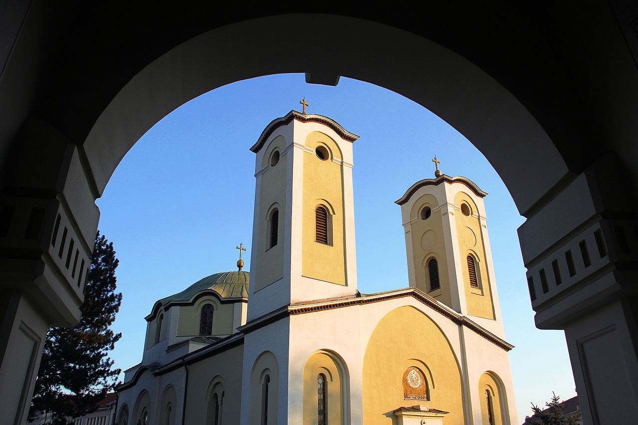
Српски (ћирилица): Црква Вазнесења Господњег у Чачку (некадашњи манастир Богородица Градачка) је задужбина Жупана Страцимира, брата Стефана Немање.
Не зна се тачна година оснивања цркве, али се претпоставља да је изграђена између 1179. и 1190. године. У то доба се звала Богородица Градачка. English: Church of the Ascension in Cacak, Serbia (former monastery of Virgin Mary Gradačka) is the foundation of Župan Stracimir from the thirteenth century.
|
||
| Date | |||
| Source | Own work | ||
| Author | BrankaVV |
| Camera location |
| View this and other nearby images on: OpenStreetMap |
|
|---|
.jpg¶ms=043.893632_N_0020.349232_E_globe:Earth_type:camera__&language=en)
Licensing
I, the copyright holder of this work, hereby publish it under the following license:
This file is licensed under the
Creative Commons
Attribution-Share Alike 3.0 Unported license.
- You are free:
- to share – to copy, distribute and transmit the work
- to remix – to adapt the work
- Under the following conditions:
- attribution – You must give appropriate credit, provide a link to the license, and indicate if changes were made. You may do so in any reasonable manner, but not in any way that suggests the licensor endorses you or your use.
- share alike – If you remix, transform, or build upon the material, you must distribute your contributions under the same or compatible license as the original.

|
This image was uploaded as part of
Wiki Loves Monuments 2014.
|
 |
File history
Click on a date/time to view the file as it appeared at that time.
| Date/Time | Thumbnail | Dimensions | User | Comment | |
|---|---|---|---|---|---|
| current | 22:15, 12 September 2014 |
| 3,543 × 2,362 (5 MB) | BrankaVV | User created page with UploadWizard |
File usage
The following pages on the English Wikipedia use this file (pages on other projects are not listed):
Global file usage
The following other wikis use this file:
- Usage on lv.wikipedia.org
- Usage on mk.wikipedia.org
- Usage on ru.wikipedia.org
- Usage on th.wikipedia.org
Metadata
.jpg)
Size of this preview:
800 × 533 pixels. Other resolutions:
320 × 213 pixels |
640 × 427 pixels |
1,024 × 683 pixels |
1,280 × 853 pixels |
2,560 × 1,707 pixels |
3,543 × 2,362 pixels.
Original file (3,543 × 2,362 pixels, file size: 5 MB, MIME type: image/jpeg)
| This is a file from the
Wikimedia Commons. Information from its
description page there is shown below. Commons is a freely licensed media file repository. You can help. |
Summary
| Description |
Српски (ћирилица): Црква Вазнесења Господњег у Чачку (некадашњи манастир Богородица Градачка) је задужбина Жупана Страцимира, брата Стефана Немање.
Не зна се тачна година оснивања цркве, али се претпоставља да је изграђена између 1179. и 1190. године. У то доба се звала Богородица Градачка. English: Church of the Ascension in Cacak, Serbia (former monastery of Virgin Mary Gradačka) is the foundation of Župan Stracimir from the thirteenth century.
|
||
| Date | |||
| Source | Own work | ||
| Author | BrankaVV |
| Camera location |
| View this and other nearby images on: OpenStreetMap |
|
|---|
Licensing
I, the copyright holder of this work, hereby publish it under the following license:
This file is licensed under the
Creative Commons
Attribution-Share Alike 3.0 Unported license.
- You are free:
- to share – to copy, distribute and transmit the work
- to remix – to adapt the work
- Under the following conditions:
- attribution – You must give appropriate credit, provide a link to the license, and indicate if changes were made. You may do so in any reasonable manner, but not in any way that suggests the licensor endorses you or your use.
- share alike – If you remix, transform, or build upon the material, you must distribute your contributions under the same or compatible license as the original.
|
|
This image was uploaded as part of
Wiki Loves Monuments 2014.
|
|
File history
Click on a date/time to view the file as it appeared at that time.
| Date/Time | Thumbnail | Dimensions | User | Comment | |
|---|---|---|---|---|---|
| current | 22:15, 12 September 2014 |
| 3,543 × 2,362 (5 MB) | BrankaVV | User created page with UploadWizard |
File usage
The following pages on the English Wikipedia use this file (pages on other projects are not listed):
Global file usage
The following other wikis use this file:
- Usage on lv.wikipedia.org
- Usage on mk.wikipedia.org
- Usage on ru.wikipedia.org
- Usage on th.wikipedia.org