No higher resolution available.
Burdell_Island,_USGS_map_CA_Petaluma_Creek_294065_1954_24000.png (200 × 200 pixels, file size: 87 KB, MIME type: image/png)
| This is a file from the
Wikimedia Commons. Information from its
description page there is shown below. Commons is a freely licensed media file repository. You can help. |
Summary
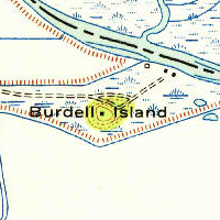
| Description | USGS aerial imagery of an island in the w:San Francisco Bay Area. Image cropped from USGS historical map, available from TopoViewer. | |||
| Date | ||||
| Source | https://ngmdb.usgs.gov/topoview/viewer/ | |||
| Author | USGS | |||
| Permission ( Reusing this file) |
|
File history
Click on a date/time to view the file as it appeared at that time.
| Date/Time | Thumbnail | Dimensions | User | Comment | |
|---|---|---|---|---|---|
| current | 10:02, 26 February 2021 |
| 200 × 200 (87 KB) | JPxG | == {{int:filedesc}} == {{Information |Description=USGS aerial imagery of an island in the w:San Francisco Bay Area. Image cropped from USGS historical map, available from TopoViewer. |Source=https://ngmdb.usgs.gov/topoview/viewer/ |Date=1954 |Author=USGS |Permission={{PD-USGov-USGS}} |other_versions= }} Category:Islands of California |
File usage
The following pages on the English Wikipedia use this file (pages on other projects are not listed):
Metadata
No higher resolution available.
Burdell_Island,_USGS_map_CA_Petaluma_Creek_294065_1954_24000.png (200 × 200 pixels, file size: 87 KB, MIME type: image/png)
| This is a file from the
Wikimedia Commons. Information from its
description page there is shown below. Commons is a freely licensed media file repository. You can help. |
Summary
| Description | USGS aerial imagery of an island in the w:San Francisco Bay Area. Image cropped from USGS historical map, available from TopoViewer. | |||
| Date | ||||
| Source | https://ngmdb.usgs.gov/topoview/viewer/ | |||
| Author | USGS | |||
| Permission ( Reusing this file) |
|
File history
Click on a date/time to view the file as it appeared at that time.
| Date/Time | Thumbnail | Dimensions | User | Comment | |
|---|---|---|---|---|---|
| current | 10:02, 26 February 2021 |
| 200 × 200 (87 KB) | JPxG | == {{int:filedesc}} == {{Information |Description=USGS aerial imagery of an island in the w:San Francisco Bay Area. Image cropped from USGS historical map, available from TopoViewer. |Source=https://ngmdb.usgs.gov/topoview/viewer/ |Date=1954 |Author=USGS |Permission={{PD-USGov-USGS}} |other_versions= }} Category:Islands of California |
File usage
The following pages on the English Wikipedia use this file (pages on other projects are not listed):