Photos • Location


Size of this preview:
800 × 533 pixels. Other resolutions:
320 × 213 pixels |
640 × 427 pixels |
1,024 × 683 pixels |
1,280 × 853 pixels |
2,560 × 1,706 pixels |
5,200 × 3,466 pixels.
Original file (5,200 × 3,466 pixels, file size: 7.3 MB, MIME type: image/jpeg)
| This is a file from the
Wikimedia Commons. Information from its
description page there is shown below. Commons is a freely licensed media file repository. You can help. |
Summary
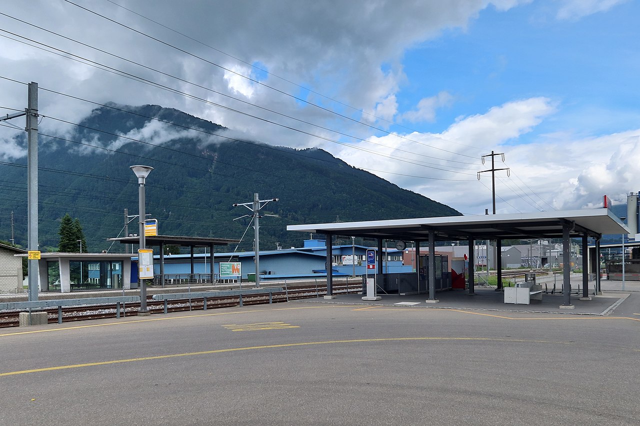
| Description | Bilten was connected to the Nordostbahn railway network in 1875. The old train station was demolished in 2011 and today's facilities were built. But there are no buildings except the signal box, just two new shelters. In terms of signal box technology (Thales Elektra2), Bilten is considered a train station. The central platform has existed since 1950. The first shelter on the platform (left) was built a short time later. But we live in fast moving times and train stations are no longer built to last a hundred years. Bilten station will be closed no later than 2027, only 15 years since the renovation. Maybe already earlier, and dismantled. The reason for this is a new passing track in Siebnen that is being built on this main line of Zurich-Chur. Already today only a few trains stop here. They were replaced by buses. |
| Date | |
| Source | SBB Station - Bilten GL (Intro) |
| Author | Kecko from Eastern Switzerland |
| Camera location |
| View this and other nearby images on: OpenStreetMap |
|
|---|
Licensing
This file is licensed under the
Creative Commons
Attribution 2.0 Generic license.
- You are free:
- to share – to copy, distribute and transmit the work
- to remix – to adapt the work
- Under the following conditions:
- attribution – You must give appropriate credit, provide a link to the license, and indicate if changes were made. You may do so in any reasonable manner, but not in any way that suggests the licensor endorses you or your use.
| This image was originally posted to Flickr by Kecko at https://flickr.com/photos/70981241@N00/51320472384. It was reviewed on 22 July 2021 by FlickreviewR 2 and was confirmed to be licensed under the terms of the cc-by-2.0. |
File history
Click on a date/time to view the file as it appeared at that time.
| Date/Time | Thumbnail | Dimensions | User | Comment | |
|---|---|---|---|---|---|
| current | 07:18, 22 July 2021 |
| 5,200 × 3,466 (7.3 MB) | 1-Byte | Transferred from Flickr via #flickr2commons |
File usage
The following pages on the English Wikipedia use this file (pages on other projects are not listed):
Global file usage
The following other wikis use this file:
- Usage on arz.wikipedia.org
- Usage on de.wikipedia.org
- Usage on es.wikipedia.org
- Usage on ko.wikipedia.org
- Usage on sv.wikipedia.org
- Usage on www.wikidata.org
Size of this preview:
800 × 533 pixels. Other resolutions:
320 × 213 pixels |
640 × 427 pixels |
1,024 × 683 pixels |
1,280 × 853 pixels |
2,560 × 1,706 pixels |
5,200 × 3,466 pixels.
Original file (5,200 × 3,466 pixels, file size: 7.3 MB, MIME type: image/jpeg)
| This is a file from the
Wikimedia Commons. Information from its
description page there is shown below. Commons is a freely licensed media file repository. You can help. |
Summary
| Description | Bilten was connected to the Nordostbahn railway network in 1875. The old train station was demolished in 2011 and today's facilities were built. But there are no buildings except the signal box, just two new shelters. In terms of signal box technology (Thales Elektra2), Bilten is considered a train station. The central platform has existed since 1950. The first shelter on the platform (left) was built a short time later. But we live in fast moving times and train stations are no longer built to last a hundred years. Bilten station will be closed no later than 2027, only 15 years since the renovation. Maybe already earlier, and dismantled. The reason for this is a new passing track in Siebnen that is being built on this main line of Zurich-Chur. Already today only a few trains stop here. They were replaced by buses. |
| Date | |
| Source | SBB Station - Bilten GL (Intro) |
| Author | Kecko from Eastern Switzerland |
| Camera location |
| View this and other nearby images on: OpenStreetMap |
|
|---|
Licensing
This file is licensed under the
Creative Commons
Attribution 2.0 Generic license.
- You are free:
- to share – to copy, distribute and transmit the work
- to remix – to adapt the work
- Under the following conditions:
- attribution – You must give appropriate credit, provide a link to the license, and indicate if changes were made. You may do so in any reasonable manner, but not in any way that suggests the licensor endorses you or your use.
| This image was originally posted to Flickr by Kecko at https://flickr.com/photos/70981241@N00/51320472384. It was reviewed on 22 July 2021 by FlickreviewR 2 and was confirmed to be licensed under the terms of the cc-by-2.0. |
File history
Click on a date/time to view the file as it appeared at that time.
| Date/Time | Thumbnail | Dimensions | User | Comment | |
|---|---|---|---|---|---|
| current | 07:18, 22 July 2021 |
| 5,200 × 3,466 (7.3 MB) | 1-Byte | Transferred from Flickr via #flickr2commons |
File usage
The following pages on the English Wikipedia use this file (pages on other projects are not listed):
Global file usage
The following other wikis use this file:
- Usage on arz.wikipedia.org
- Usage on de.wikipedia.org
- Usage on es.wikipedia.org
- Usage on ko.wikipedia.org
- Usage on sv.wikipedia.org
- Usage on www.wikidata.org