Original file (3,872 × 2,592 pixels, file size: 3.95 MB, MIME type: image/jpeg)
| This is a file from the
Wikimedia Commons. Information from its
description page there is shown below. Commons is a freely licensed media file repository. You can help. |
.jpg)
Summary
| Description |
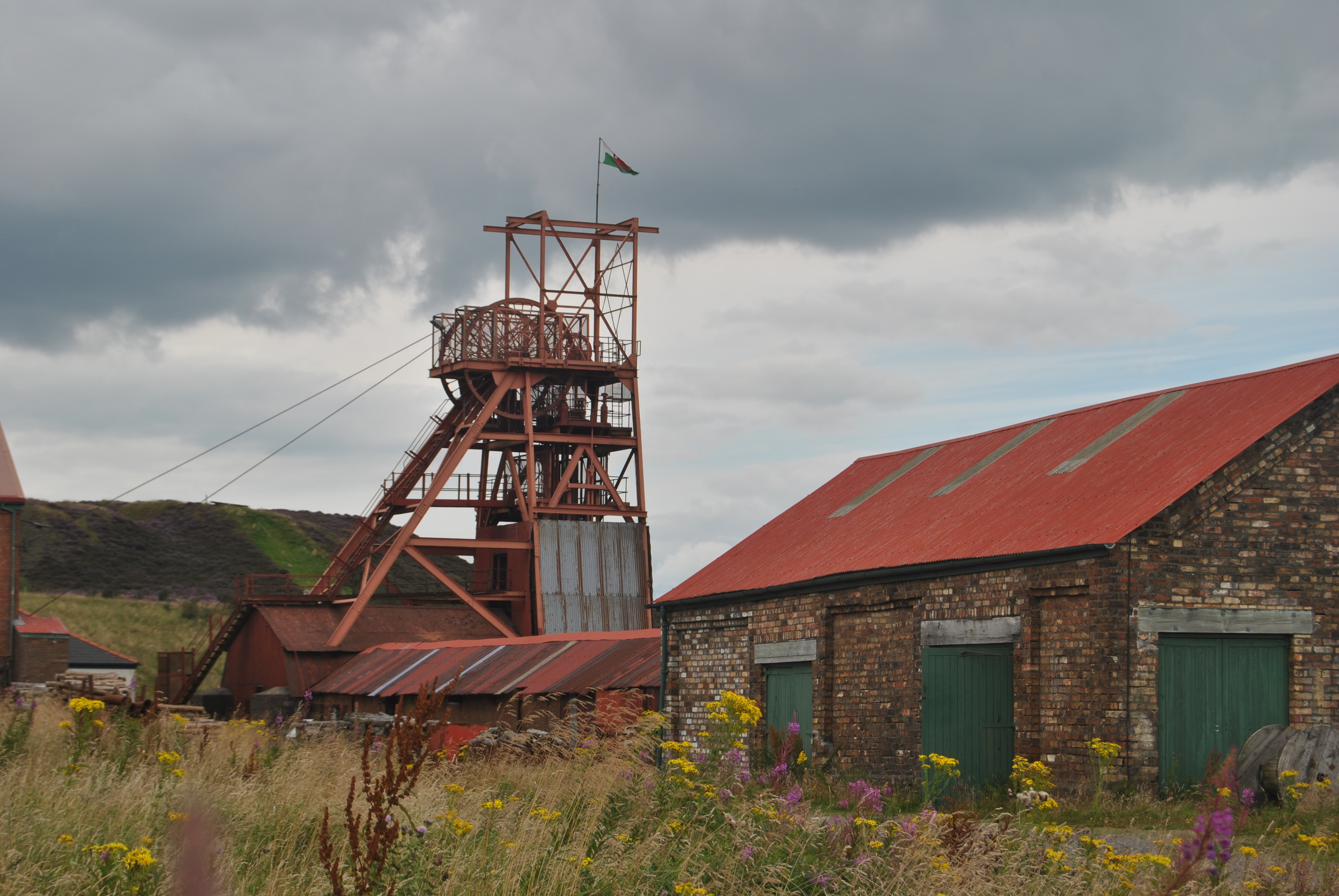
History of the working pit The site has some of the oldest large scale industrial coal mining developments in the South Wales Coalfield, with workings dating back to 1810 on the Coity Mountain. The nearby Coity pit had been driven in 1840, but was a then traditional circular single tramway 12 feet (3.7 m) in dimension. The new main shaft was sunk in 1860, named "Big Pit" due to its elliptical shape with dimensions of 18 feet (5.5 m) by 13 feet (4.0 m), the first shaft in Wales large enough to allow two tramways. On completion it became the coal-winding shaft, while the older Coity shaft was used for upcast air ventilation. In 1878, the main shaft was deepened to reach the Old Coal seam at 293 feet (89 m). By 1908, Big Pit provided employment for 1,122 people, and by 1923 at peak, there were 1,399 men employed, producing: House Coal, Steam Coal, Ironstone and Fireclay; from the Horn, No. 2 Yard, Old Coal and Elled seams. On nationalisation in 1947, the National Coal Board took over the mine from the Blaenavon Co. Ltd, which employed 789 men. By 1970 the workforce only numbered 494, as operations had focused solely on the Garw seam, with a maximum thickness of only 30 inches (760 mm). The NCB agreed the development of a drift mine, which by 1973 meant that windings at Big Pit had ceased, with coal extracted close to the refurbished Black Lion coal washery. The Coity shaft was abandoned, with the Big Pit shaft used for upcast air ventilation and emergency extraction. The pit finally closed on 2 February 1980. <a href=" http://en.wikipedia.org/wiki/Big_Pit_National_Coal_Museum#History_of_the_National_Coal_Museum" >Information from Wikipedia</a> |
| Date | |
| Source | Big Pit: National Coal Museum. Wales |
| Author | Loco Steve from Bromley , UK |
| Camera location |
| View this and other nearby images on: OpenStreetMap |
|
|---|
.jpg¶ms=051.771858_N_-003.106309_E_globe:Earth_type:camera_source:Flickr_&language=en)
Licensing
- You are free:
- to share – to copy, distribute and transmit the work
- to remix – to adapt the work
- Under the following conditions:
- attribution – You must give appropriate credit, provide a link to the license, and indicate if changes were made. You may do so in any reasonable manner, but not in any way that suggests the licensor endorses you or your use.
- share alike – If you remix, transform, or build upon the material, you must distribute your contributions under the same or compatible license as the original.
| This image was originally posted to Flickr by Loco Steve at https://flickr.com/photos/36989019@N08/7879351588 ( archive). It was reviewed on 28 December 2019 by FlickreviewR 2 and was confirmed to be licensed under the terms of the cc-by-sa-2.0. |
File history
Click on a date/time to view the file as it appeared at that time.
| Date/Time | Thumbnail | Dimensions | User | Comment | |
|---|---|---|---|---|---|
| current | 17:51, 28 December 2019 |
| 3,872 × 2,592 (3.95 MB) | Ham II | Transferred from Flickr via #flickr2commons |
File usage
Metadata
.jpg)
Original file (3,872 × 2,592 pixels, file size: 3.95 MB, MIME type: image/jpeg)
| This is a file from the
Wikimedia Commons. Information from its
description page there is shown below. Commons is a freely licensed media file repository. You can help. |
Summary
| Description |
History of the working pit The site has some of the oldest large scale industrial coal mining developments in the South Wales Coalfield, with workings dating back to 1810 on the Coity Mountain. The nearby Coity pit had been driven in 1840, but was a then traditional circular single tramway 12 feet (3.7 m) in dimension. The new main shaft was sunk in 1860, named "Big Pit" due to its elliptical shape with dimensions of 18 feet (5.5 m) by 13 feet (4.0 m), the first shaft in Wales large enough to allow two tramways. On completion it became the coal-winding shaft, while the older Coity shaft was used for upcast air ventilation. In 1878, the main shaft was deepened to reach the Old Coal seam at 293 feet (89 m). By 1908, Big Pit provided employment for 1,122 people, and by 1923 at peak, there were 1,399 men employed, producing: House Coal, Steam Coal, Ironstone and Fireclay; from the Horn, No. 2 Yard, Old Coal and Elled seams. On nationalisation in 1947, the National Coal Board took over the mine from the Blaenavon Co. Ltd, which employed 789 men. By 1970 the workforce only numbered 494, as operations had focused solely on the Garw seam, with a maximum thickness of only 30 inches (760 mm). The NCB agreed the development of a drift mine, which by 1973 meant that windings at Big Pit had ceased, with coal extracted close to the refurbished Black Lion coal washery. The Coity shaft was abandoned, with the Big Pit shaft used for upcast air ventilation and emergency extraction. The pit finally closed on 2 February 1980. <a href=" http://en.wikipedia.org/wiki/Big_Pit_National_Coal_Museum#History_of_the_National_Coal_Museum" >Information from Wikipedia</a> |
| Date | |
| Source | Big Pit: National Coal Museum. Wales |
| Author | Loco Steve from Bromley , UK |
| Camera location |
| View this and other nearby images on: OpenStreetMap |
|
|---|
Licensing
- You are free:
- to share – to copy, distribute and transmit the work
- to remix – to adapt the work
- Under the following conditions:
- attribution – You must give appropriate credit, provide a link to the license, and indicate if changes were made. You may do so in any reasonable manner, but not in any way that suggests the licensor endorses you or your use.
- share alike – If you remix, transform, or build upon the material, you must distribute your contributions under the same or compatible license as the original.
| This image was originally posted to Flickr by Loco Steve at https://flickr.com/photos/36989019@N08/7879351588 ( archive). It was reviewed on 28 December 2019 by FlickreviewR 2 and was confirmed to be licensed under the terms of the cc-by-sa-2.0. |
File history
Click on a date/time to view the file as it appeared at that time.
| Date/Time | Thumbnail | Dimensions | User | Comment | |
|---|---|---|---|---|---|
| current | 17:51, 28 December 2019 |
| 3,872 × 2,592 (3.95 MB) | Ham II | Transferred from Flickr via #flickr2commons |