Photos • Location


Size of this preview:
800 × 533 pixels. Other resolutions:
320 × 213 pixels |
640 × 427 pixels |
1,024 × 683 pixels |
1,280 × 853 pixels |
2,560 × 1,707 pixels |
3,072 × 2,048 pixels.
Original file (3,072 × 2,048 pixels, file size: 1.36 MB, MIME type: image/jpeg)
| This is a file from the
Wikimedia Commons. Information from its
description page there is shown below. Commons is a freely licensed media file repository. You can help. |
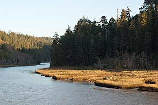
| Description | Big River, in the Big River Unit of Mendocino Headlands State Park, Mendocino, California. |
| Date | |
| Source | Own work |
| Author | David Eppstein |
| Permission ( Reusing this file) |
This file is licensed under the
Creative Commons
Attribution-Share Alike 2.5 Generic license.
|
| Camera location | | View this and other nearby images on: OpenStreetMap |
|
|---|
This image has been assessed using the
Quality image guidelines and is considered a
Quality image.
|
File history
Click on a date/time to view the file as it appeared at that time.
| Date/Time | Thumbnail | Dimensions | User | Comment | |
|---|---|---|---|---|---|
| current | 03:12, 13 May 2011 |
| 3,072 × 2,048 (1.36 MB) | David Eppstein | Higher resolution, better color |
| 16:58, 25 July 2007 |
 | 1,200 × 800 (170 KB) | David Eppstein | {{Information |Description= Big River, in the Big River Unit of Mendocino Headlands State Park. Taken with a Canon EOS D60 and 50mm/F1.4 lens, 1/100s @ F8.0, ISO 100. |Source=self-made | |
File usage
The following pages on the English Wikipedia use this file (pages on other projects are not listed):
Global file usage
The following other wikis use this file:
- Usage on ceb.wikipedia.org
- Usage on cy.wikipedia.org
- Usage on de.wikipedia.org
- Usage on fr.wikipedia.org
- Usage on nl.wikipedia.org
- Usage on ru.wikipedia.org
- Usage on www.wikidata.org
- Usage on xmf.wikipedia.org
Metadata
Size of this preview:
800 × 533 pixels. Other resolutions:
320 × 213 pixels |
640 × 427 pixels |
1,024 × 683 pixels |
1,280 × 853 pixels |
2,560 × 1,707 pixels |
3,072 × 2,048 pixels.
Original file (3,072 × 2,048 pixels, file size: 1.36 MB, MIME type: image/jpeg)
| This is a file from the
Wikimedia Commons. Information from its
description page there is shown below. Commons is a freely licensed media file repository. You can help. |
| Description | Big River, in the Big River Unit of Mendocino Headlands State Park, Mendocino, California. |
| Date | |
| Source | Own work |
| Author | David Eppstein |
| Permission ( Reusing this file) |
This file is licensed under the
Creative Commons
Attribution-Share Alike 2.5 Generic license.
|
| Camera location | | View this and other nearby images on: OpenStreetMap |
|
|---|
This image has been assessed using the
Quality image guidelines and is considered a
Quality image.
|
File history
Click on a date/time to view the file as it appeared at that time.
| Date/Time | Thumbnail | Dimensions | User | Comment | |
|---|---|---|---|---|---|
| current | 03:12, 13 May 2011 |
| 3,072 × 2,048 (1.36 MB) | David Eppstein | Higher resolution, better color |
| 16:58, 25 July 2007 |
| 1,200 × 800 (170 KB) | David Eppstein | {{Information |Description= Big River, in the Big River Unit of Mendocino Headlands State Park. Taken with a Canon EOS D60 and 50mm/F1.4 lens, 1/100s @ F8.0, ISO 100. |Source=self-made | |
File usage
The following pages on the English Wikipedia use this file (pages on other projects are not listed):
Global file usage
The following other wikis use this file:
- Usage on ceb.wikipedia.org
- Usage on cy.wikipedia.org
- Usage on de.wikipedia.org
- Usage on fr.wikipedia.org
- Usage on nl.wikipedia.org
- Usage on ru.wikipedia.org
- Usage on www.wikidata.org
- Usage on xmf.wikipedia.org