Photos • Location


Size of this preview:
800 × 532 pixels. Other resolutions:
320 × 213 pixels |
640 × 425 pixels |
1,024 × 681 pixels |
1,280 × 851 pixels |
2,906 × 1,932 pixels.
Original file (2,906 × 1,932 pixels, file size: 924 KB, MIME type: image/jpeg)
| This is a file from the
Wikimedia Commons. Information from its
description page there is shown below. Commons is a freely licensed media file repository. You can help. |
.jpg)
Summary
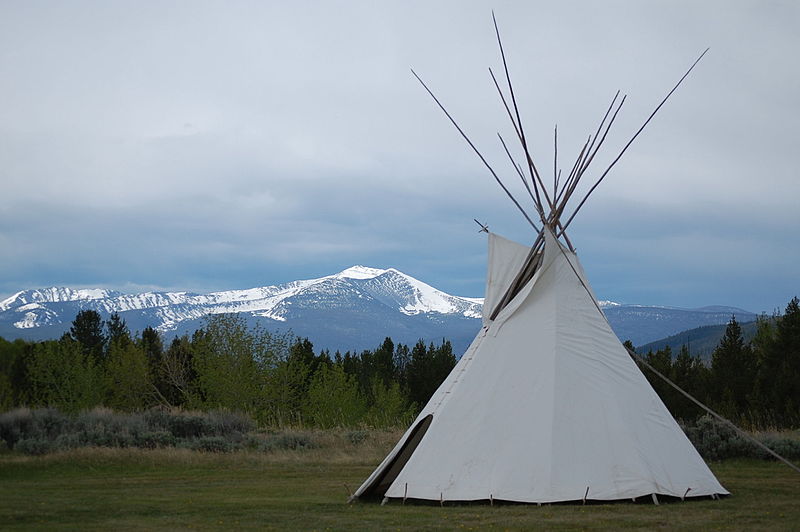
| Description | Along the Nez Perce National Historic Trail, Big Hole Valley, Big Hole National Battlefield near Wisdom, MT. US Forest Service photo, by Roger Peterson |
| Date | |
| Source | big-hole-national-battlefield-06022012-rogermpeterson-007 |
| Author | Forest Service Northern Region from Missoula, MT, USA |
| Camera location |
| View this and other nearby images on: OpenStreetMap |
|
|---|
.jpg¶ms=045.642848_N_-113.647212_E_globe:Earth_type:camera_source:Flickr_&language=en)
Licensing
This file is licensed under the
Creative Commons
Attribution 2.0 Generic license.
- You are free:
- to share – to copy, distribute and transmit the work
- to remix – to adapt the work
- Under the following conditions:
- attribution – You must give appropriate credit, provide a link to the license, and indicate if changes were made. You may do so in any reasonable manner, but not in any way that suggests the licensor endorses you or your use.
| This image was originally posted to Flickr by Forest Service - Northern Region at https://flickr.com/photos/40882383@N03/7351656778. It was reviewed on 4 February 2016 by FlickreviewR and was confirmed to be licensed under the terms of the cc-by-2.0. |
This image is a work of the
Forest Service of the
United States Department of Agriculture. As a
work of the
U.S. federal government, the image is in the
public domain.
|
File history
Click on a date/time to view the file as it appeared at that time.
| Date/Time | Thumbnail | Dimensions | User | Comment | |
|---|---|---|---|---|---|
| current | 22:46, 4 February 2016 |
| 2,906 × 1,932 (924 KB) | Holly Cheng | Transferred from Flickr via Flickr2Commons |
File usage
The following pages on the English Wikipedia use this file (pages on other projects are not listed):
Metadata
.jpg)
Size of this preview:
800 × 532 pixels. Other resolutions:
320 × 213 pixels |
640 × 425 pixels |
1,024 × 681 pixels |
1,280 × 851 pixels |
2,906 × 1,932 pixels.
Original file (2,906 × 1,932 pixels, file size: 924 KB, MIME type: image/jpeg)
| This is a file from the
Wikimedia Commons. Information from its
description page there is shown below. Commons is a freely licensed media file repository. You can help. |
Summary
| Description | Along the Nez Perce National Historic Trail, Big Hole Valley, Big Hole National Battlefield near Wisdom, MT. US Forest Service photo, by Roger Peterson |
| Date | |
| Source | big-hole-national-battlefield-06022012-rogermpeterson-007 |
| Author | Forest Service Northern Region from Missoula, MT, USA |
| Camera location |
| View this and other nearby images on: OpenStreetMap |
|
|---|
Licensing
This file is licensed under the
Creative Commons
Attribution 2.0 Generic license.
- You are free:
- to share – to copy, distribute and transmit the work
- to remix – to adapt the work
- Under the following conditions:
- attribution – You must give appropriate credit, provide a link to the license, and indicate if changes were made. You may do so in any reasonable manner, but not in any way that suggests the licensor endorses you or your use.
| This image was originally posted to Flickr by Forest Service - Northern Region at https://flickr.com/photos/40882383@N03/7351656778. It was reviewed on 4 February 2016 by FlickreviewR and was confirmed to be licensed under the terms of the cc-by-2.0. |
This image is a work of the
Forest Service of the
United States Department of Agriculture. As a
work of the
U.S. federal government, the image is in the
public domain.
|
File history
Click on a date/time to view the file as it appeared at that time.
| Date/Time | Thumbnail | Dimensions | User | Comment | |
|---|---|---|---|---|---|
| current | 22:46, 4 February 2016 |
| 2,906 × 1,932 (924 KB) | Holly Cheng | Transferred from Flickr via Flickr2Commons |
File usage
The following pages on the English Wikipedia use this file (pages on other projects are not listed):