Size of this preview:
800 × 523 pixels. Other resolutions:
320 × 209 pixels |
640 × 418 pixels |
1,024 × 670 pixels |
1,508 × 986 pixels.
Original file (1,508 × 986 pixels, file size: 1.39 MB, MIME type: image/png)
| This is a file from the
Wikimedia Commons. Information from its
description page there is shown below. Commons is a freely licensed media file repository. You can help. |

|
This military map image could be re-created using
vector graphics as an
SVG file. This has several advantages; see
Commons:Media for cleanup for more information. If an SVG form of this image is available, please upload it and afterwards replace this template with
{{
vector version available|new image name}}
.
It is recommended to name the SVG file “Battle of Winterthur details.svg”—then the template Vector version available (or Vva) does not need the new image name parameter. |
Summary
| Description |
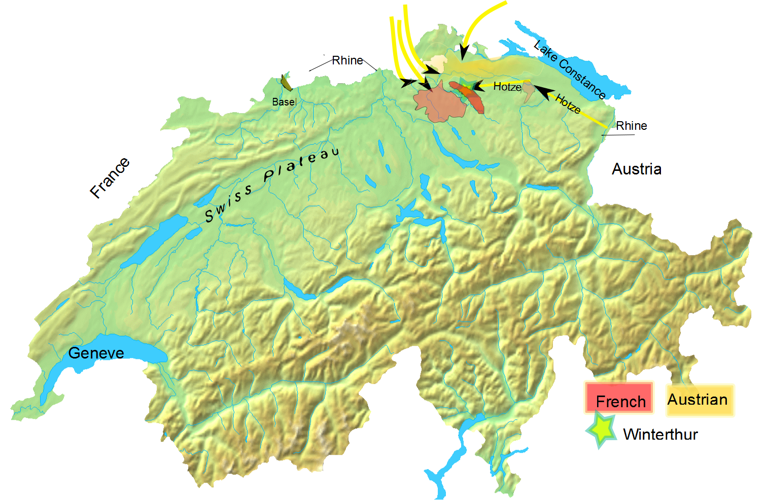
English: Overall troop positioning in late May 1799 for
Battle of Winterthur. |
| Date | (UTC) |
| Source |
Own work based on: Switzerland topographic.png |
| Author |
|
| This is a
retouched picture, which means that it has been digitally altered from its original version. Modifications: added Battle of Winterthur to it. The original can be viewed here:
Switzerland topographic.png:
|
I, the copyright holder of this work, hereby publish it under the following license:
| I, the copyright holder of this work, release this work into the
public domain. This applies worldwide. In some countries this may not be legally possible; if so: I grant anyone the right to use this work for any purpose, without any conditions, unless such conditions are required by law. |
Original upload log
This image is a derivative work of the following images:
-
File:Switzerland_topographic.png licensed with PD-self
- 2007-04-16T19:05:28Z Numerus Klausus 1508x958 (1819472 Bytes) {{Information |Description=Blanc topographic Map of Switzerland / Relief-Karte der Schweiz (blanko) |Source= Map created from [http://www2.demis.nl/mapserver/mapper.asp DEMIS Mapserver], which are public domain. |Date= 2007 |
Uploaded with derivativeFX
File history
Click on a date/time to view the file as it appeared at that time.
| Date/Time | Thumbnail | Dimensions | User | Comment | |
|---|---|---|---|---|---|
| current | 00:01, 11 February 2010 |
| 1,508 × 986 (1.39 MB) | Auntieruth55 | {{Information |Description=Overall troop positioning in late May 1799 for Battle of Winterthur |Source=* File:Switzerland_topographic.png |Date=2010-02-11 00:00 (UTC) |Author=* File:Switzerland_topographic.png: User:Numerus Klausus / [[:de:B |
File usage
The following pages on the English Wikipedia use this file (pages on other projects are not listed):
Global file usage
The following other wikis use this file:
- Usage on es.wikipedia.org
- Usage on et.wikipedia.org
- Usage on fa.wikipedia.org
- Usage on id.wikipedia.org
- Usage on uz.wikipedia.org
- Usage on zh.wikipedia.org
Size of this preview:
800 × 523 pixels. Other resolutions:
320 × 209 pixels |
640 × 418 pixels |
1,024 × 670 pixels |
1,508 × 986 pixels.
Original file (1,508 × 986 pixels, file size: 1.39 MB, MIME type: image/png)
| This is a file from the
Wikimedia Commons. Information from its
description page there is shown below. Commons is a freely licensed media file repository. You can help. |
|
|
This military map image could be re-created using
vector graphics as an
SVG file. This has several advantages; see
Commons:Media for cleanup for more information. If an SVG form of this image is available, please upload it and afterwards replace this template with
{{
vector version available|new image name}}
.
It is recommended to name the SVG file “Battle of Winterthur details.svg”—then the template Vector version available (or Vva) does not need the new image name parameter. |
Summary
| Description |
English: Overall troop positioning in late May 1799 for
Battle of Winterthur. |
| Date | (UTC) |
| Source |
Own work based on: Switzerland topographic.png |
| Author |
|
| This is a
retouched picture, which means that it has been digitally altered from its original version. Modifications: added Battle of Winterthur to it. The original can be viewed here:
Switzerland topographic.png:
|
I, the copyright holder of this work, hereby publish it under the following license:
| I, the copyright holder of this work, release this work into the
public domain. This applies worldwide. In some countries this may not be legally possible; if so: I grant anyone the right to use this work for any purpose, without any conditions, unless such conditions are required by law. |
Original upload log
This image is a derivative work of the following images:
-
File:Switzerland_topographic.png licensed with PD-self
- 2007-04-16T19:05:28Z Numerus Klausus 1508x958 (1819472 Bytes) {{Information |Description=Blanc topographic Map of Switzerland / Relief-Karte der Schweiz (blanko) |Source= Map created from [http://www2.demis.nl/mapserver/mapper.asp DEMIS Mapserver], which are public domain. |Date= 2007 |
Uploaded with derivativeFX
File history
Click on a date/time to view the file as it appeared at that time.
| Date/Time | Thumbnail | Dimensions | User | Comment | |
|---|---|---|---|---|---|
| current | 00:01, 11 February 2010 |
| 1,508 × 986 (1.39 MB) | Auntieruth55 | {{Information |Description=Overall troop positioning in late May 1799 for Battle of Winterthur |Source=* File:Switzerland_topographic.png |Date=2010-02-11 00:00 (UTC) |Author=* File:Switzerland_topographic.png: User:Numerus Klausus / [[:de:B |
File usage
The following pages on the English Wikipedia use this file (pages on other projects are not listed):
Global file usage
The following other wikis use this file:
- Usage on es.wikipedia.org
- Usage on et.wikipedia.org
- Usage on fa.wikipedia.org
- Usage on id.wikipedia.org
- Usage on uz.wikipedia.org
- Usage on zh.wikipedia.org