Photos • Location


Size of this preview:
800 × 535 pixels. Other resolutions:
320 × 214 pixels |
640 × 428 pixels |
1,024 × 685 pixels |
1,280 × 856 pixels |
2,560 × 1,712 pixels |
4,428 × 2,961 pixels.
Original file (4,428 × 2,961 pixels, file size: 8.03 MB, MIME type: image/jpeg)
| This is a file from the
Wikimedia Commons. Information from its
description page there is shown below. Commons is a freely licensed media file repository. You can help. |
.jpg)
Summary
| Description |
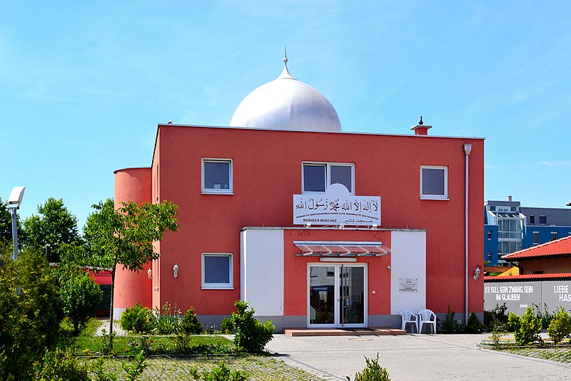
English: Basheer-Mosque in Bensheim
Deutsch: Baschir-Moschee in Bensheim |
| Date | |
| Source | Own work |
| Author | Ceddyfresse |
| Object location |
| View this and other nearby images on: OpenStreetMap |
|
|---|
.jpg¶ms=049.685590_N_0008.593480_E_globe:Earth_class:object_type:object__&language=en)
Licensing
| I, the copyright holder of this work, release this work into the
public domain. This applies worldwide. In some countries this may not be legally possible; if so: I grant anyone the right to use this work for any purpose, without any conditions, unless such conditions are required by law. |
File history
Click on a date/time to view the file as it appeared at that time.
| Date/Time | Thumbnail | Dimensions | User | Comment | |
|---|---|---|---|---|---|
| current | 21:50, 28 June 2011 |
| 4,428 × 2,961 (8.03 MB) | Ceddyfresse | {{Information |Description ={{en|1=Basheer-Mosque in Bensheim}} {{de|1=Baschir-Moschee in Bensheim}} |Source ={{own}} |Author = Ceddyfresse |Date =2011-06-28 |Permission = |other_versions = }} == {{int: |
File usage
The following pages on the English Wikipedia use this file (pages on other projects are not listed):
Global file usage
The following other wikis use this file:
- Usage on ar.wikipedia.org
- Usage on azb.wikipedia.org
- Usage on de.wikipedia.org
- Usage on fr.wikipedia.org
- Usage on hu.wikipedia.org
- Usage on hy.wikipedia.org
Metadata
.jpg)
Size of this preview:
800 × 535 pixels. Other resolutions:
320 × 214 pixels |
640 × 428 pixels |
1,024 × 685 pixels |
1,280 × 856 pixels |
2,560 × 1,712 pixels |
4,428 × 2,961 pixels.
Original file (4,428 × 2,961 pixels, file size: 8.03 MB, MIME type: image/jpeg)
| This is a file from the
Wikimedia Commons. Information from its
description page there is shown below. Commons is a freely licensed media file repository. You can help. |
Summary
| Description |
English: Basheer-Mosque in Bensheim
Deutsch: Baschir-Moschee in Bensheim |
| Date | |
| Source | Own work |
| Author | Ceddyfresse |
| Object location |
| View this and other nearby images on: OpenStreetMap |
|
|---|
Licensing
| I, the copyright holder of this work, release this work into the
public domain. This applies worldwide. In some countries this may not be legally possible; if so: I grant anyone the right to use this work for any purpose, without any conditions, unless such conditions are required by law. |
File history
Click on a date/time to view the file as it appeared at that time.
| Date/Time | Thumbnail | Dimensions | User | Comment | |
|---|---|---|---|---|---|
| current | 21:50, 28 June 2011 |
| 4,428 × 2,961 (8.03 MB) | Ceddyfresse | {{Information |Description ={{en|1=Basheer-Mosque in Bensheim}} {{de|1=Baschir-Moschee in Bensheim}} |Source ={{own}} |Author = Ceddyfresse |Date =2011-06-28 |Permission = |other_versions = }} == {{int: |
File usage
The following pages on the English Wikipedia use this file (pages on other projects are not listed):
Global file usage
The following other wikis use this file:
- Usage on ar.wikipedia.org
- Usage on azb.wikipedia.org
- Usage on de.wikipedia.org
- Usage on fr.wikipedia.org
- Usage on hu.wikipedia.org
- Usage on hy.wikipedia.org