No higher resolution available.
Balkans_AD125.png (495 × 261 pixels, file size: 241 KB, MIME type: image/png)
| This is a file from the
Wikimedia Commons. Information from its
description page there is shown below. Commons is a freely licensed media file repository. You can help. |
Summary
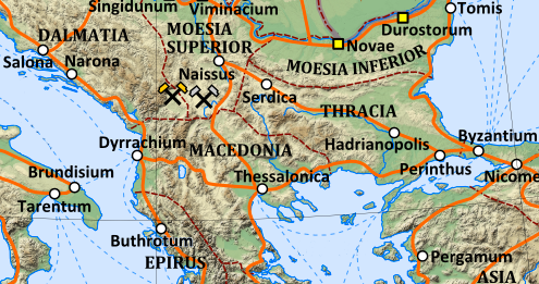
| Description | map of the Balkans in AD 125 |
| Date | 2010; 2012 |
| Source | Detail of File:Roman Empire 125.png |
| Author | Andrein, with the assistance of EraNavigator |
| Other versions | File:Roman provinces of Illyricum, Macedonia, Dacia, Moesia, Pannonia and Thracia.jpg |
Licensing
This file is licensed under the
Creative Commons
Attribution-Share Alike 3.0 Unported license.
- You are free:
- to share – to copy, distribute and transmit the work
- to remix – to adapt the work
- Under the following conditions:
- attribution – You must give appropriate credit, provide a link to the license, and indicate if changes were made. You may do so in any reasonable manner, but not in any way that suggests the licensor endorses you or your use.
- share alike – If you remix, transform, or build upon the material, you must distribute your contributions under the same or compatible license as the original.
File history
Click on a date/time to view the file as it appeared at that time.
| Date/Time | Thumbnail | Dimensions | User | Comment | |
|---|---|---|---|---|---|
| current | 13:18, 11 January 2013 |
| 495 × 261 (241 KB) | Dbachmann | {{Information |Description=map of the Balkans in AD 125 |Source=Detail of File:Roman Empire 125.png |Date=2010; 2012 |Author=Andrein, with the assistance of EraNavigator |Permission= |other_versions= }} [[Category:Maps of the history of the ancien... |
File usage
The following pages on the English Wikipedia use this file (pages on other projects are not listed):
Global file usage
The following other wikis use this file:
- Usage on es.wikipedia.org
Metadata
No higher resolution available.
Balkans_AD125.png (495 × 261 pixels, file size: 241 KB, MIME type: image/png)
| This is a file from the
Wikimedia Commons. Information from its
description page there is shown below. Commons is a freely licensed media file repository. You can help. |
Summary
| Description | map of the Balkans in AD 125 |
| Date | 2010; 2012 |
| Source | Detail of File:Roman Empire 125.png |
| Author | Andrein, with the assistance of EraNavigator |
| Other versions | File:Roman provinces of Illyricum, Macedonia, Dacia, Moesia, Pannonia and Thracia.jpg |
Licensing
This file is licensed under the
Creative Commons
Attribution-Share Alike 3.0 Unported license.
- You are free:
- to share – to copy, distribute and transmit the work
- to remix – to adapt the work
- Under the following conditions:
- attribution – You must give appropriate credit, provide a link to the license, and indicate if changes were made. You may do so in any reasonable manner, but not in any way that suggests the licensor endorses you or your use.
- share alike – If you remix, transform, or build upon the material, you must distribute your contributions under the same or compatible license as the original.
File history
Click on a date/time to view the file as it appeared at that time.
| Date/Time | Thumbnail | Dimensions | User | Comment | |
|---|---|---|---|---|---|
| current | 13:18, 11 January 2013 |
| 495 × 261 (241 KB) | Dbachmann | {{Information |Description=map of the Balkans in AD 125 |Source=Detail of File:Roman Empire 125.png |Date=2010; 2012 |Author=Andrein, with the assistance of EraNavigator |Permission= |other_versions= }} [[Category:Maps of the history of the ancien... |
File usage
The following pages on the English Wikipedia use this file (pages on other projects are not listed):
Global file usage
The following other wikis use this file:
- Usage on es.wikipedia.org