
Original file (2,758 × 2,038 pixels, file size: 3.37 MB, MIME type: image/jpeg)
| This is a file from the
Wikimedia Commons. Information from its
description page there is shown below. Commons is a freely licensed media file repository. You can help. |
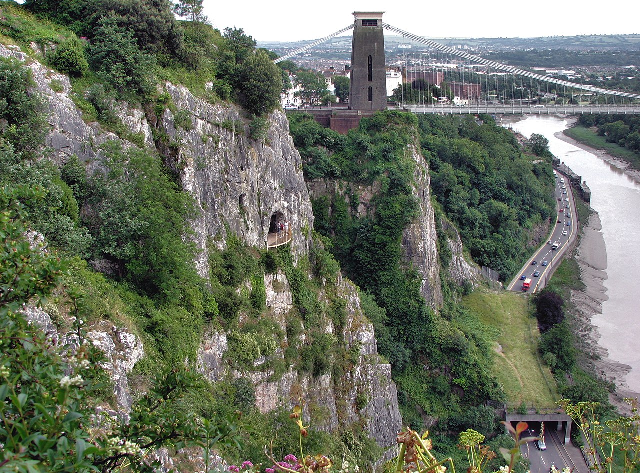
| Description | The Avon Gorge and Clifton Suspension Bridge, looking towards the city of Bristol. The cave (with the people) is Giant’s Cave, accessible to the public. The grass-roofed tunnel is to protect traffic from falling rocks. | ||
| Date | |||
| Source | Own work | ||
| Author | Arpingstone | ||
| Permission ( Reusing this file) |
|
| Camera location | | View this and other nearby images on: OpenStreetMap |
|
|---|
File history
Click on a date/time to view the file as it appeared at that time.
| Date/Time | Thumbnail | Dimensions | User | Comment | |
|---|---|---|---|---|---|
| current | 15:00, 19 January 2008 |
| 2,758 × 2,038 (3.37 MB) | Arpingstone | Avon Gorge |
File usage
Global file usage
The following other wikis use this file:
- Usage on azb.wikipedia.org
- Usage on de.wikipedia.org
- Usage on es.wikipedia.org
- Usage on fa.wikipedia.org
- Usage on it.wikipedia.org
- Usage on simple.wikipedia.org
- Usage on sr.wikipedia.org
- Usage on tr.wikipedia.org
Original file (2,758 × 2,038 pixels, file size: 3.37 MB, MIME type: image/jpeg)
| This is a file from the
Wikimedia Commons. Information from its
description page there is shown below. Commons is a freely licensed media file repository. You can help. |
| Description | The Avon Gorge and Clifton Suspension Bridge, looking towards the city of Bristol. The cave (with the people) is Giant’s Cave, accessible to the public. The grass-roofed tunnel is to protect traffic from falling rocks. | ||
| Date | |||
| Source | Own work | ||
| Author | Arpingstone | ||
| Permission ( Reusing this file) |
|
| Camera location | | View this and other nearby images on: OpenStreetMap |
|
|---|
File history
Click on a date/time to view the file as it appeared at that time.
| Date/Time | Thumbnail | Dimensions | User | Comment | |
|---|---|---|---|---|---|
| current | 15:00, 19 January 2008 |
| 2,758 × 2,038 (3.37 MB) | Arpingstone | Avon Gorge |
File usage
Global file usage
The following other wikis use this file:
- Usage on azb.wikipedia.org
- Usage on de.wikipedia.org
- Usage on es.wikipedia.org
- Usage on fa.wikipedia.org
- Usage on it.wikipedia.org
- Usage on simple.wikipedia.org
- Usage on sr.wikipedia.org
- Usage on tr.wikipedia.org