Photos • Location


Size of this preview:
800 × 531 pixels. Other resolutions:
320 × 213 pixels |
640 × 425 pixels |
1,024 × 680 pixels |
1,280 × 850 pixels |
2,560 × 1,700 pixels |
4,288 × 2,848 pixels.
Original file (4,288 × 2,848 pixels, file size: 3 MB, MIME type: image/jpeg)
| This is a file from the
Wikimedia Commons. Information from its
description page there is shown below. Commons is a freely licensed media file repository. You can help. |
.jpg)
Summary
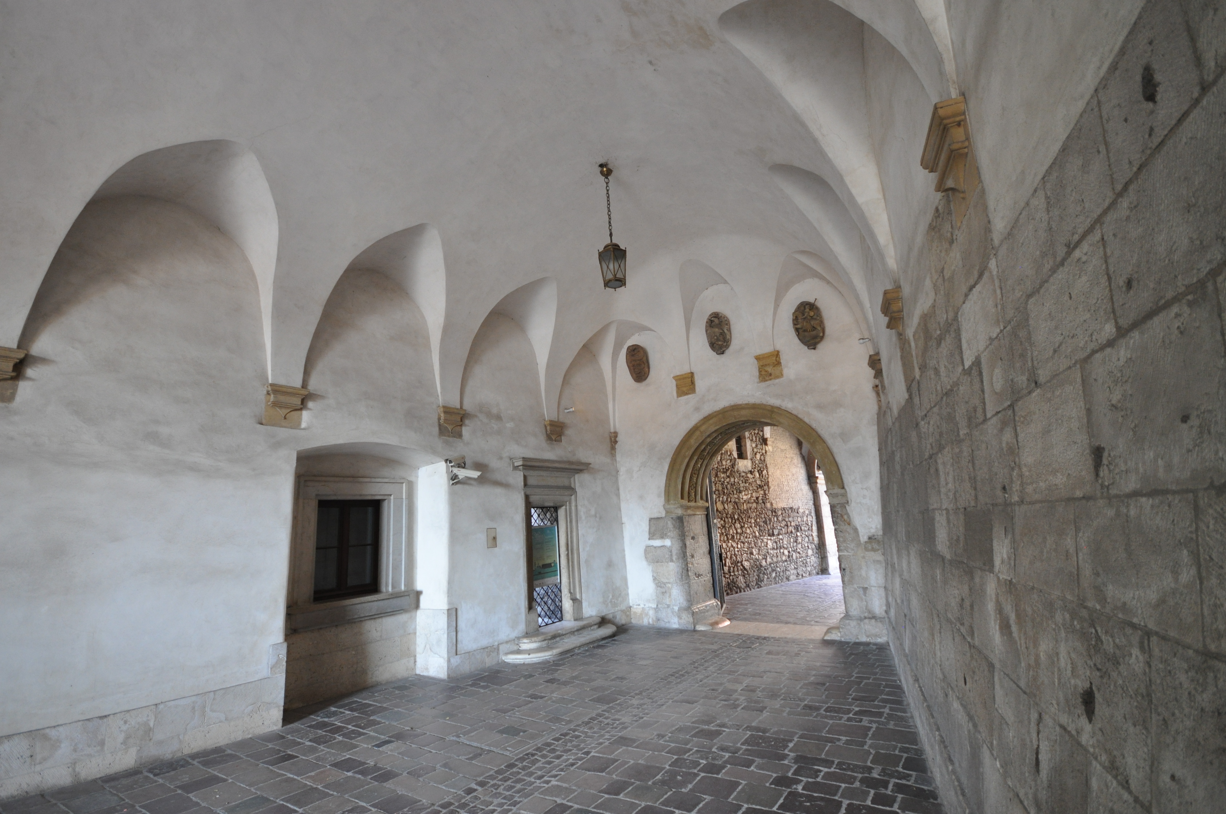
| Description | The Gothic Wawel Castle in Kraków in Poland was built at the behest of Casimir III the Great, who reigned from 1333 to 1370, and consists of a number of structures situated around the central courtyard. In the 14th century it was rebuilt by Jogaila and Jadwiga of Poland. Their reign saw the addition of the tower called the Hen's Foot (Kurza Stopka) and the Danish Tower. The Jadwiga and Jogaila Chamber, in which the sword Szczerbiec, was used in coronation ceremonies, is exhibited today and is another remnant of this period. Other structures were developed on the hill during that time as well, in order to serve as quarters for the numerous clergy, royal clerks and craftsmen. Defensive walls and towers such as Jordanka, Lubranka, Sandomierska, Tęczyńska, Szlachecka, Złodziejska and Panieńska were erected in the same period [Wikipedia.org] |
| Date | |
| Source | Arched entrance to courtyard of Wawel Royal Castle |
| Author | Jorge Láscar from Australia |
| Camera location |
| View this and other nearby images on: OpenStreetMap |
|
|---|
.jpg¶ms=050.054440_N_0019.936580_E_globe:Earth_type:camera_source:Flickr_&language=en)
Licensing
This file is licensed under the
Creative Commons
Attribution 2.0 Generic license.
- You are free:
- to share – to copy, distribute and transmit the work
- to remix – to adapt the work
- Under the following conditions:
- attribution – You must give appropriate credit, provide a link to the license, and indicate if changes were made. You may do so in any reasonable manner, but not in any way that suggests the licensor endorses you or your use.
| This image was originally posted to Flickr by Jorge Lascar at https://www.flickr.com/photos/8721758@N06/9156657115. It was reviewed on 2 April 2014 by FlickreviewR and was confirmed to be licensed under the terms of the cc-by-2.0. |
File history
Click on a date/time to view the file as it appeared at that time.
| Date/Time | Thumbnail | Dimensions | User | Comment | |
|---|---|---|---|---|---|
| current | 06:40, 2 April 2014 |
| 4,288 × 2,848 (3 MB) | Russavia | Transferred from Flickr |
File usage
The following pages on the English Wikipedia use this file (pages on other projects are not listed):
Global file usage
The following other wikis use this file:
- Usage on bg.wikipedia.org
Metadata
.jpg)
Size of this preview:
800 × 531 pixels. Other resolutions:
320 × 213 pixels |
640 × 425 pixels |
1,024 × 680 pixels |
1,280 × 850 pixels |
2,560 × 1,700 pixels |
4,288 × 2,848 pixels.
Original file (4,288 × 2,848 pixels, file size: 3 MB, MIME type: image/jpeg)
| This is a file from the
Wikimedia Commons. Information from its
description page there is shown below. Commons is a freely licensed media file repository. You can help. |
Summary
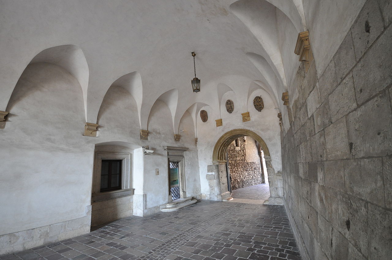
| Description | The Gothic Wawel Castle in Kraków in Poland was built at the behest of Casimir III the Great, who reigned from 1333 to 1370, and consists of a number of structures situated around the central courtyard. In the 14th century it was rebuilt by Jogaila and Jadwiga of Poland. Their reign saw the addition of the tower called the Hen's Foot (Kurza Stopka) and the Danish Tower. The Jadwiga and Jogaila Chamber, in which the sword Szczerbiec, was used in coronation ceremonies, is exhibited today and is another remnant of this period. Other structures were developed on the hill during that time as well, in order to serve as quarters for the numerous clergy, royal clerks and craftsmen. Defensive walls and towers such as Jordanka, Lubranka, Sandomierska, Tęczyńska, Szlachecka, Złodziejska and Panieńska were erected in the same period [Wikipedia.org] |
| Date | |
| Source | Arched entrance to courtyard of Wawel Royal Castle |
| Author | Jorge Láscar from Australia |
| Camera location |
| View this and other nearby images on: OpenStreetMap |
|
|---|
Licensing
This file is licensed under the
Creative Commons
Attribution 2.0 Generic license.
- You are free:
- to share – to copy, distribute and transmit the work
- to remix – to adapt the work
- Under the following conditions:
- attribution – You must give appropriate credit, provide a link to the license, and indicate if changes were made. You may do so in any reasonable manner, but not in any way that suggests the licensor endorses you or your use.
| This image was originally posted to Flickr by Jorge Lascar at https://www.flickr.com/photos/8721758@N06/9156657115. It was reviewed on 2 April 2014 by FlickreviewR and was confirmed to be licensed under the terms of the cc-by-2.0. |
File history
Click on a date/time to view the file as it appeared at that time.
| Date/Time | Thumbnail | Dimensions | User | Comment | |
|---|---|---|---|---|---|
| current | 06:40, 2 April 2014 |
| 4,288 × 2,848 (3 MB) | Russavia | Transferred from Flickr |
File usage
The following pages on the English Wikipedia use this file (pages on other projects are not listed):
Global file usage
The following other wikis use this file:
- Usage on bg.wikipedia.org