Photos • Location


Size of this preview:
800 × 477 pixels. Other resolutions:
320 × 191 pixels |
640 × 382 pixels |
815 × 486 pixels.
Original file (815 × 486 pixels, file size: 114 KB, MIME type: image/jpeg)
| This is a file from the
Wikimedia Commons. Information from its
description page there is shown below. Commons is a freely licensed media file repository. You can help. |
Summary
| Description |
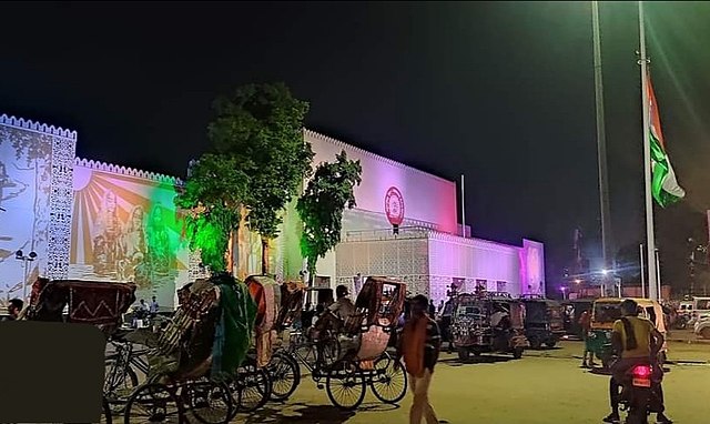
English: Night view of Ara Junction upon entrance through main gate |
| Date | |
| Source | Own work |
| Author | JaggaDaaku |
| Camera location |
| View this and other nearby images on: OpenStreetMap |
|
|---|
Licensing
I, the copyright holder of this work, hereby publish it under the following license:
| I, the copyright holder of this work, release this work into the
public domain. This applies worldwide. In some countries this may not be legally possible; if so: I grant anyone the right to use this work for any purpose, without any conditions, unless such conditions are required by law. |
File history
Click on a date/time to view the file as it appeared at that time.
| Date/Time | Thumbnail | Dimensions | User | Comment | |
|---|---|---|---|---|---|
| current | 11:02, 13 September 2022 |
| 815 × 486 (114 KB) | JaggaDaaku | New Picture After Renovation Work |
| 08:49, 28 November 2019 |
 | 3,000 × 2,299 (1,009 KB) | Trojanishere | Cross-wiki upload from en.wikipedia.org |
File usage
The following pages on the English Wikipedia use this file (pages on other projects are not listed):
Global file usage
The following other wikis use this file:
- Usage on bh.wikipedia.org
- Usage on bn.wikipedia.org
- Usage on hi.wikipedia.org
- Usage on incubator.wikimedia.org
- Usage on sat.wikipedia.org
Metadata
Size of this preview:
800 × 477 pixels. Other resolutions:
320 × 191 pixels |
640 × 382 pixels |
815 × 486 pixels.
Original file (815 × 486 pixels, file size: 114 KB, MIME type: image/jpeg)
| This is a file from the
Wikimedia Commons. Information from its
description page there is shown below. Commons is a freely licensed media file repository. You can help. |
Summary
| Description |
English: Night view of Ara Junction upon entrance through main gate |
| Date | |
| Source | Own work |
| Author | JaggaDaaku |
| Camera location |
| View this and other nearby images on: OpenStreetMap |
|
|---|
Licensing
I, the copyright holder of this work, hereby publish it under the following license:
| I, the copyright holder of this work, release this work into the
public domain. This applies worldwide. In some countries this may not be legally possible; if so: I grant anyone the right to use this work for any purpose, without any conditions, unless such conditions are required by law. |
File history
Click on a date/time to view the file as it appeared at that time.
| Date/Time | Thumbnail | Dimensions | User | Comment | |
|---|---|---|---|---|---|
| current | 11:02, 13 September 2022 |
| 815 × 486 (114 KB) | JaggaDaaku | New Picture After Renovation Work |
| 08:49, 28 November 2019 |
| 3,000 × 2,299 (1,009 KB) | Trojanishere | Cross-wiki upload from en.wikipedia.org |
File usage
The following pages on the English Wikipedia use this file (pages on other projects are not listed):
Global file usage
The following other wikis use this file:
- Usage on bh.wikipedia.org
- Usage on bn.wikipedia.org
- Usage on hi.wikipedia.org
- Usage on incubator.wikimedia.org
- Usage on sat.wikipedia.org