Photos • Location


Size of this preview:
800 × 519 pixels. Other resolutions:
320 × 208 pixels |
640 × 415 pixels |
1,024 × 664 pixels |
1,280 × 830 pixels |
2,560 × 1,661 pixels |
4,179 × 2,711 pixels.
Original file (4,179 × 2,711 pixels, file size: 1.76 MB, MIME type: image/jpeg)
| This is a file from the
Wikimedia Commons. Information from its
description page there is shown below. Commons is a freely licensed media file repository. You can help. |
Summary
| Description |
English:
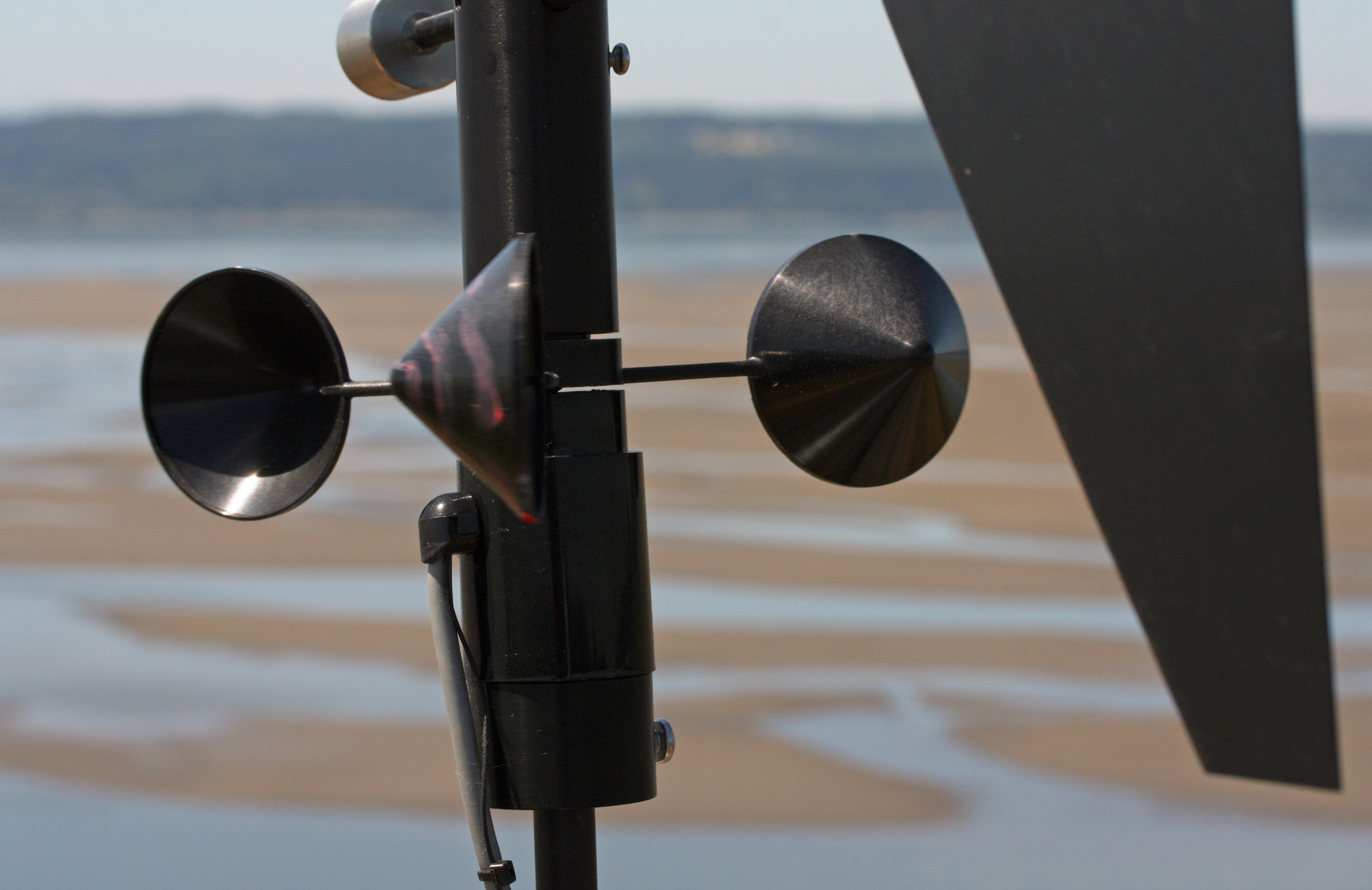
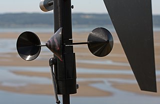
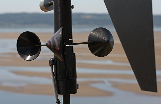
Anemometer (remote meteorological station;
Category: Anemometers) deployed July and August, 2009, for the Applied Physics Laboratory (University of Washington) Tidal Flats Project (ONR Office of Naval Research; Department Research Initiative), Jim Thomson and Chris Chickadel (investigators), a study of the thermal signatures of inter-tidal sediments |
| Date | 3 July 2009, 12:02:28 −07:00 |
| Source | Own work |
| Author | Walter Siegmund (talk) |
| Other versions |
|


| Camera location |
| View this and other nearby images on: OpenStreetMap |
|
|---|
- Location source: Garmin GPSmap 60CSx
- Location Datum: WGS84
- Viewpoint location: Craft Island Trail, Craft Island, Washington
- Viewpoint elevation: 28 meter (92 ft)
- Camera: Canon EOS DIGITAL REBEL XSi
- Exposure Time: 1/400
- F Number: f/11.0
- Focal Length: 60.0
- ISO Speed Rating: 200
©2010 Walter Siegmund
Licensing
I, the copyright holder of this work, hereby publish it under the following licenses:

|
Permission is granted to copy, distribute and/or modify this document under the terms of the GNU Free Documentation License, Version 1.2 or any later version published by the Free Software Foundation; with no Invariant Sections, no Front-Cover Texts, and no Back-Cover Texts. A copy of the license is included in the section entitled GNU Free Documentation License. |
This file is licensed under the
Creative Commons Attribution-Share Alike
3.0 Unported,
2.5 Generic,
2.0 Generic and
1.0 Generic license.
- You are free:
- to share – to copy, distribute and transmit the work
- to remix – to adapt the work
- Under the following conditions:
- attribution – You must give appropriate credit, provide a link to the license, and indicate if changes were made. You may do so in any reasonable manner, but not in any way that suggests the licensor endorses you or your use.
- share alike – If you remix, transform, or build upon the material, you must distribute your contributions under the same or compatible license as the original.
You may select the license of your choice.
File history
Click on a date/time to view the file as it appeared at that time.
| Date/Time | Thumbnail | Dimensions | User | Comment | |
|---|---|---|---|---|---|
| current | 01:15, 18 September 2010 |
| 4,179 × 2,711 (1.76 MB) | Wsiegmund | Photoshop Elements 4.0; Rotate, Auto Smart Fix, Levels tools |
| 20:33, 6 February 2010 |
 | 4,272 × 2,848 (2.69 MB) | Wsiegmund | {{Information |Description=Loop Road, Washington Park (Anacortes) |Source={{Own}} |Date= 2009:07:03 |Author= Walter Siegmund (talk) |Permission=Own work, attribution required (Multi-license wi |
File usage
The following pages on the English Wikipedia use this file (pages on other projects are not listed):
Global file usage
The following other wikis use this file:
- Usage on bh.wikipedia.org
- Usage on bs.wikipedia.org
- Usage on de.wikibooks.org
- Usage on gl.wikipedia.org
- Usage on ha.wikipedia.org
- Usage on he.wikipedia.org
- Usage on id.wikipedia.org
- Usage on jv.wikipedia.org
- Usage on la.wikipedia.org
- Usage on mwl.wikipedia.org
- Usage on nn.wikipedia.org
- Usage on pt.wikipedia.org
- Usage on ru.wikipedia.org
- Usage on sh.wikipedia.org
- Usage on sr.wikipedia.org
- Usage on ta.wikipedia.org
- Usage on vi.wikipedia.org
Metadata
Size of this preview:
800 × 519 pixels. Other resolutions:
320 × 208 pixels |
640 × 415 pixels |
1,024 × 664 pixels |
1,280 × 830 pixels |
2,560 × 1,661 pixels |
4,179 × 2,711 pixels.
Original file (4,179 × 2,711 pixels, file size: 1.76 MB, MIME type: image/jpeg)
| This is a file from the
Wikimedia Commons. Information from its
description page there is shown below. Commons is a freely licensed media file repository. You can help. |
Summary
| Description |
English:
Anemometer (remote meteorological station;
Category: Anemometers) deployed July and August, 2009, for the Applied Physics Laboratory (University of Washington) Tidal Flats Project (ONR Office of Naval Research; Department Research Initiative), Jim Thomson and Chris Chickadel (investigators), a study of the thermal signatures of inter-tidal sediments |
| Date | 3 July 2009, 12:02:28 −07:00 |
| Source | Own work |
| Author | Walter Siegmund (talk) |
| Other versions |
|
| Camera location |
| View this and other nearby images on: OpenStreetMap |
|
|---|
- Location source: Garmin GPSmap 60CSx
- Location Datum: WGS84
- Viewpoint location: Craft Island Trail, Craft Island, Washington
- Viewpoint elevation: 28 meter (92 ft)
- Camera: Canon EOS DIGITAL REBEL XSi
- Exposure Time: 1/400
- F Number: f/11.0
- Focal Length: 60.0
- ISO Speed Rating: 200
©2010 Walter Siegmund
Licensing
I, the copyright holder of this work, hereby publish it under the following licenses:
|
|
Permission is granted to copy, distribute and/or modify this document under the terms of the GNU Free Documentation License, Version 1.2 or any later version published by the Free Software Foundation; with no Invariant Sections, no Front-Cover Texts, and no Back-Cover Texts. A copy of the license is included in the section entitled GNU Free Documentation License. |
This file is licensed under the
Creative Commons Attribution-Share Alike
3.0 Unported,
2.5 Generic,
2.0 Generic and
1.0 Generic license.
- You are free:
- to share – to copy, distribute and transmit the work
- to remix – to adapt the work
- Under the following conditions:
- attribution – You must give appropriate credit, provide a link to the license, and indicate if changes were made. You may do so in any reasonable manner, but not in any way that suggests the licensor endorses you or your use.
- share alike – If you remix, transform, or build upon the material, you must distribute your contributions under the same or compatible license as the original.
You may select the license of your choice.
File history
Click on a date/time to view the file as it appeared at that time.
| Date/Time | Thumbnail | Dimensions | User | Comment | |
|---|---|---|---|---|---|
| current | 01:15, 18 September 2010 |
| 4,179 × 2,711 (1.76 MB) | Wsiegmund | Photoshop Elements 4.0; Rotate, Auto Smart Fix, Levels tools |
| 20:33, 6 February 2010 |
| 4,272 × 2,848 (2.69 MB) | Wsiegmund | {{Information |Description=Loop Road, Washington Park (Anacortes) |Source={{Own}} |Date= 2009:07:03 |Author= Walter Siegmund (talk) |Permission=Own work, attribution required (Multi-license wi |
File usage
The following pages on the English Wikipedia use this file (pages on other projects are not listed):
Global file usage
The following other wikis use this file:
- Usage on bh.wikipedia.org
- Usage on bs.wikipedia.org
- Usage on de.wikibooks.org
- Usage on gl.wikipedia.org
- Usage on ha.wikipedia.org
- Usage on he.wikipedia.org
- Usage on id.wikipedia.org
- Usage on jv.wikipedia.org
- Usage on la.wikipedia.org
- Usage on mwl.wikipedia.org
- Usage on nn.wikipedia.org
- Usage on pt.wikipedia.org
- Usage on ru.wikipedia.org
- Usage on sh.wikipedia.org
- Usage on sr.wikipedia.org
- Usage on ta.wikipedia.org
- Usage on vi.wikipedia.org