
Original file (1,161 × 1,019 pixels, file size: 220 KB, MIME type: image/jpeg)
| This is a file from the
Wikimedia Commons. Information from its
description page there is shown below. Commons is a freely licensed media file repository. You can help. |
Summary
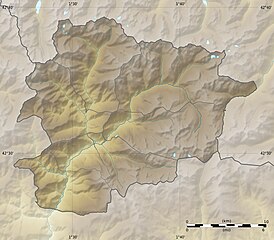
| Description |
English: Blank physical map of
Andorra with parishes boundaries for geo-location purpose.
Note: Dotted lines are boundaries estimated from very small scale reference maps. Français : Carte physique vierge de l'
Andorre avec limites des paroisses destinée à la géolocalisation. Note : les lignes pointillées sont des limites estimées à partir de cartes de référence à très petite échelle. Equirectangular projection, WGS84 datum
Topographic scale: 1:372,000 (precision: 93 m)
|
||
| Date | |||
| Source |
Own work |
||
| Author | Eric Gaba ( Sting - fr:Sting) | ||
| Permission ( Reusing this file) |
|
||
| Other versions |
|

| Camera location |
| View this and other nearby images on: OpenStreetMap |
|
|---|
Licensing
- You are free:
- to share – to copy, distribute and transmit the work
- to remix – to adapt the work
- Under the following conditions:
- attribution – You must give appropriate credit, provide a link to the license, and indicate if changes were made. You may do so in any reasonable manner, but not in any way that suggests the licensor endorses you or your use.
- share alike – If you remix, transform, or build upon the material, you must distribute your contributions under the same or compatible license as the original.

|
Permission is granted to copy, distribute and/or modify this document under the terms of the GNU Free Documentation License, Version 1.2 or any later version published by the Free Software Foundation; with no Invariant Sections, no Front-Cover Texts, and no Back-Cover Texts. A copy of the license is included in the section entitled GNU Free Documentation License. |
File history
Click on a date/time to view the file as it appeared at that time.
| Date/Time | Thumbnail | Dimensions | User | Comment | |
|---|---|---|---|---|---|
| current | 20:52, 27 December 2010 |
| 1,161 × 1,019 (220 KB) | Sting | Added parishes boundaries (some of them estimated) |
| 12:09, 19 July 2010 |
 | 1,161 × 1,019 (212 KB) | Sting | Color profile | |
| 20:04, 17 December 2008 |
 | 1,161 × 1,019 (181 KB) | Sting | Corrections on international boundaries | |
| 20:20, 16 December 2008 |
 | 1,161 × 1,019 (189 KB) | Sting | == Summary == {{Location|42|32|15|N|01|36|00|E|scale:200000}} <br/> {{Information |Description={{en|Blank physical map of Andorra for geo-location purpose.}} {{fr|Carte physique vierge de l' Andorre destinée à la géolocal |
File usage
- Aixirivall
- Aixovall
- Aixàs
- Andorra la Vella
- Ansalonga
- Anyós
- Arans
- Arinsal
- Aubinyà
- Bixessarri
- Bordes d'Envalira
- Canòlic
- Certers
- Col de Beixalis
- Coma Pedrosa
- El Fener
- El Forn
- El Pas de la Casa
- El Serrat
- El Tarter
- El Vilar
- Els Plans
- Els Vilars d'Engordany
- Engolasters
- Engordany
- Erts
- Escàs
- Fontaneda, Andorra
- Grau Roig
- Incles
- Juberri
- L'Aldosa de Canillo
- L'Aldosa de la Massana
- L'Armiana
- La Cortinada
- La Margineda
- Lake Engolasters
- Les Bons
- Les Escaldes
- Llorts
- Llumeneres
- Madriu-Perafita-Claror Valley
- Meritxell
- Molleres
- Nagol
- National Automobile Museum (Andorra)
- Pal, Andorra
- Parc Natural Comunal de les Valls del Comapedrosa
- Pic de Médécourbe
- Pic dels Aspres
- Port d'Envalira
- Port de Cabús
- Prats, Andorra
- Ransol
- Sant Pere, Andorra
- Santa Coloma d'Andorra
- Segudet
- Sispony
- Soldeu
- Sornàs
- Vallnord
- Vila, Andorra
- Xixerella
- Module:Location map/data/Andorra
- Module:Location map/data/Andorra/doc
Global file usage
The following other wikis use this file:
- Usage on ar.wikipedia.org
- Usage on ast.wikipedia.org
- Usage on av.wikipedia.org
- Usage on az.wikipedia.org
- Usage on ba.wikipedia.org
- Usage on be-tarask.wikipedia.org
- Usage on be.wikipedia.org
- Usage on bg.wikipedia.org
- Usage on bn.wikipedia.org
- Usage on bs.wikipedia.org
- Usage on ca.wikipedia.org
- Usuari:PereBot/cobertura/Andorra relleu/ranking
- Usuari:PereBot/cobertura/Andorra relleu/an
- Usuari:PereBot/cobertura/Andorra relleu/ca
- Usuari:PereBot/cobertura/Andorra relleu/de
- Usuari:PereBot/cobertura/Andorra relleu/en
- Usuari:PereBot/cobertura/Andorra relleu/es
- Usuari:PereBot/cobertura/Andorra relleu/eu
- Usuari:PereBot/cobertura/Andorra relleu/fr
- Usuari:PereBot/cobertura/Andorra relleu/nl
- Usuari:PereBot/cobertura/Andorra relleu/it
- Usuari:PereBot/cobertura/Andorra relleu/oc
- Usuari:PereBot/cobertura/Andorra relleu/zh
- Usuari Discussió:Lanxana
- Mòdul:Location map/data/Andorra
- Mòdul:Location map/data/Andorra/ús
- Usage on ceb.wikipedia.org
- Usage on ce.wikipedia.org
- Usage on ckb.wikipedia.org
- Usage on cs.wikipedia.org
- Usage on cv.wikipedia.org
- Usage on da.wikipedia.org
- Usage on de.wikipedia.org
View more global usage of this file.
Metadata
Original file (1,161 × 1,019 pixels, file size: 220 KB, MIME type: image/jpeg)
| This is a file from the
Wikimedia Commons. Information from its
description page there is shown below. Commons is a freely licensed media file repository. You can help. |
Summary
| Description |
English: Blank physical map of
Andorra with parishes boundaries for geo-location purpose.
Note: Dotted lines are boundaries estimated from very small scale reference maps. Français : Carte physique vierge de l'
Andorre avec limites des paroisses destinée à la géolocalisation. Note : les lignes pointillées sont des limites estimées à partir de cartes de référence à très petite échelle. Equirectangular projection, WGS84 datum
Topographic scale: 1:372,000 (precision: 93 m)
|
||
| Date | |||
| Source |
Own work |
||
| Author | Eric Gaba ( Sting - fr:Sting) | ||
| Permission ( Reusing this file) |
|
||
| Other versions |
|
| Camera location |
| View this and other nearby images on: OpenStreetMap |
|
|---|
Licensing
- You are free:
- to share – to copy, distribute and transmit the work
- to remix – to adapt the work
- Under the following conditions:
- attribution – You must give appropriate credit, provide a link to the license, and indicate if changes were made. You may do so in any reasonable manner, but not in any way that suggests the licensor endorses you or your use.
- share alike – If you remix, transform, or build upon the material, you must distribute your contributions under the same or compatible license as the original.
|
|
Permission is granted to copy, distribute and/or modify this document under the terms of the GNU Free Documentation License, Version 1.2 or any later version published by the Free Software Foundation; with no Invariant Sections, no Front-Cover Texts, and no Back-Cover Texts. A copy of the license is included in the section entitled GNU Free Documentation License. |
File history
Click on a date/time to view the file as it appeared at that time.
| Date/Time | Thumbnail | Dimensions | User | Comment | |
|---|---|---|---|---|---|
| current | 20:52, 27 December 2010 |
| 1,161 × 1,019 (220 KB) | Sting | Added parishes boundaries (some of them estimated) |
| 12:09, 19 July 2010 |
| 1,161 × 1,019 (212 KB) | Sting | Color profile | |
| 20:04, 17 December 2008 |
| 1,161 × 1,019 (181 KB) | Sting | Corrections on international boundaries | |
| 20:20, 16 December 2008 |
| 1,161 × 1,019 (189 KB) | Sting | == Summary == {{Location|42|32|15|N|01|36|00|E|scale:200000}} <br/> {{Information |Description={{en|Blank physical map of Andorra for geo-location purpose.}} {{fr|Carte physique vierge de l' Andorre destinée à la géolocal |
File usage
- Aixirivall
- Aixovall
- Aixàs
- Andorra la Vella
- Ansalonga
- Anyós
- Arans
- Arinsal
- Aubinyà
- Bixessarri
- Bordes d'Envalira
- Canòlic
- Certers
- Col de Beixalis
- Coma Pedrosa
- El Fener
- El Forn
- El Pas de la Casa
- El Serrat
- El Tarter
- El Vilar
- Els Plans
- Els Vilars d'Engordany
- Engolasters
- Engordany
- Erts
- Escàs
- Fontaneda, Andorra
- Grau Roig
- Incles
- Juberri
- L'Aldosa de Canillo
- L'Aldosa de la Massana
- L'Armiana
- La Cortinada
- La Margineda
- Lake Engolasters
- Les Bons
- Les Escaldes
- Llorts
- Llumeneres
- Madriu-Perafita-Claror Valley
- Meritxell
- Molleres
- Nagol
- National Automobile Museum (Andorra)
- Pal, Andorra
- Parc Natural Comunal de les Valls del Comapedrosa
- Pic de Médécourbe
- Pic dels Aspres
- Port d'Envalira
- Port de Cabús
- Prats, Andorra
- Ransol
- Sant Pere, Andorra
- Santa Coloma d'Andorra
- Segudet
- Sispony
- Soldeu
- Sornàs
- Vallnord
- Vila, Andorra
- Xixerella
- Module:Location map/data/Andorra
- Module:Location map/data/Andorra/doc
Global file usage
The following other wikis use this file:
- Usage on ar.wikipedia.org
- Usage on ast.wikipedia.org
- Usage on av.wikipedia.org
- Usage on az.wikipedia.org
- Usage on ba.wikipedia.org
- Usage on be-tarask.wikipedia.org
- Usage on be.wikipedia.org
- Usage on bg.wikipedia.org
- Usage on bn.wikipedia.org
- Usage on bs.wikipedia.org
- Usage on ca.wikipedia.org
- Usuari:PereBot/cobertura/Andorra relleu/ranking
- Usuari:PereBot/cobertura/Andorra relleu/an
- Usuari:PereBot/cobertura/Andorra relleu/ca
- Usuari:PereBot/cobertura/Andorra relleu/de
- Usuari:PereBot/cobertura/Andorra relleu/en
- Usuari:PereBot/cobertura/Andorra relleu/es
- Usuari:PereBot/cobertura/Andorra relleu/eu
- Usuari:PereBot/cobertura/Andorra relleu/fr
- Usuari:PereBot/cobertura/Andorra relleu/nl
- Usuari:PereBot/cobertura/Andorra relleu/it
- Usuari:PereBot/cobertura/Andorra relleu/oc
- Usuari:PereBot/cobertura/Andorra relleu/zh
- Usuari Discussió:Lanxana
- Mòdul:Location map/data/Andorra
- Mòdul:Location map/data/Andorra/ús
- Usage on ceb.wikipedia.org
- Usage on ce.wikipedia.org
- Usage on ckb.wikipedia.org
- Usage on cs.wikipedia.org
- Usage on cv.wikipedia.org
- Usage on da.wikipedia.org
- Usage on de.wikipedia.org
View more global usage of this file.