Photos • Location


Size of this preview:
800 × 533 pixels. Other resolutions:
320 × 213 pixels |
640 × 426 pixels |
1,024 × 682 pixels |
1,280 × 852 pixels |
3,069 × 2,044 pixels.
Original file (3,069 × 2,044 pixels, file size: 1.19 MB, MIME type: image/jpeg)
| This is a file from the
Wikimedia Commons. Information from its
description page there is shown below. Commons is a freely licensed media file repository. You can help. |
Summary
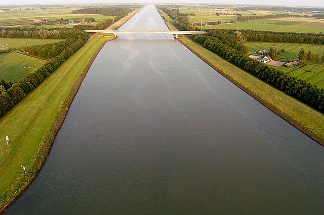
| Description | The Amsterdam-Rijnkanaal near Rijswijk (Gelderland). The bridge is the provincial road N320. |
| Date | |
| Source | Own work |
| Author | China Crisis |
| Camera location |
| View this and other nearby images on: OpenStreetMap |
|
|---|
Licensing
I,
China Crisis, the copyright holder of this work, hereby publishes it under the following licenses:

|
Permission is granted to copy, distribute and/or modify this document under the terms of the GNU Free Documentation License, Version 1.2 or any later version published by the Free Software Foundation; with no Invariant Sections, no Front-Cover Texts, and no Back-Cover Texts. A copy of the license is included in the section entitled GNU Free Documentation License. |
This file is licensed under the
Creative Commons
Attribution-Share Alike 3.0 Unported license.
Attribution: I,
China Crisis
- You are free:
- to share – to copy, distribute and transmit the work
- to remix – to adapt the work
- Under the following conditions:
- attribution – You must give appropriate credit, provide a link to the license, and indicate if changes were made. You may do so in any reasonable manner, but not in any way that suggests the licensor endorses you or your use.
- share alike – If you remix, transform, or build upon the material, you must distribute your contributions under the same or compatible license as the original.
You may select the license of your choice.
File history
Click on a date/time to view the file as it appeared at that time.
| Date/Time | Thumbnail | Dimensions | User | Comment | |
|---|---|---|---|---|---|
| current | 23:37, 13 July 2019 |
| 3,069 × 2,044 (1.19 MB) | Hohum | Colour adjust |
| 19:59, 11 December 2007 |
 | 3,069 × 2,044 (1.15 MB) | China Crisis | {{Information |Description= |Source=self-made |Date= |Author= China Crisis |Permission= |other_versions= }} |
File usage
The following pages on the English Wikipedia use this file (pages on other projects are not listed):
Global file usage
The following other wikis use this file:
- Usage on ar.wikipedia.org
- Usage on bh.wikipedia.org
- Usage on cv.wikipedia.org
- Usage on de.wikipedia.org
- Usage on eo.wikipedia.org
- Usage on he.wikipedia.org
- Usage on ja.wikipedia.org
- Usage on ka.wikipedia.org
- Usage on ko.wikipedia.org
- Usage on lt.wikipedia.org
- Usage on nl.wikipedia.org
- Usage on ru.wikipedia.org
- Usage on te.wikipedia.org
- Usage on uk.wikipedia.org
Size of this preview:
800 × 533 pixels. Other resolutions:
320 × 213 pixels |
640 × 426 pixels |
1,024 × 682 pixels |
1,280 × 852 pixels |
3,069 × 2,044 pixels.
Original file (3,069 × 2,044 pixels, file size: 1.19 MB, MIME type: image/jpeg)
| This is a file from the
Wikimedia Commons. Information from its
description page there is shown below. Commons is a freely licensed media file repository. You can help. |
Summary
| Description | The Amsterdam-Rijnkanaal near Rijswijk (Gelderland). The bridge is the provincial road N320. |
| Date | |
| Source | Own work |
| Author | China Crisis |
| Camera location |
| View this and other nearby images on: OpenStreetMap |
|
|---|
Licensing
I,
China Crisis, the copyright holder of this work, hereby publishes it under the following licenses:
|
|
Permission is granted to copy, distribute and/or modify this document under the terms of the GNU Free Documentation License, Version 1.2 or any later version published by the Free Software Foundation; with no Invariant Sections, no Front-Cover Texts, and no Back-Cover Texts. A copy of the license is included in the section entitled GNU Free Documentation License. |
This file is licensed under the
Creative Commons
Attribution-Share Alike 3.0 Unported license.
Attribution: I,
China Crisis
- You are free:
- to share – to copy, distribute and transmit the work
- to remix – to adapt the work
- Under the following conditions:
- attribution – You must give appropriate credit, provide a link to the license, and indicate if changes were made. You may do so in any reasonable manner, but not in any way that suggests the licensor endorses you or your use.
- share alike – If you remix, transform, or build upon the material, you must distribute your contributions under the same or compatible license as the original.
You may select the license of your choice.
File history
Click on a date/time to view the file as it appeared at that time.
| Date/Time | Thumbnail | Dimensions | User | Comment | |
|---|---|---|---|---|---|
| current | 23:37, 13 July 2019 |
| 3,069 × 2,044 (1.19 MB) | Hohum | Colour adjust |
| 19:59, 11 December 2007 |
| 3,069 × 2,044 (1.15 MB) | China Crisis | {{Information |Description= |Source=self-made |Date= |Author= China Crisis |Permission= |other_versions= }} |
File usage
The following pages on the English Wikipedia use this file (pages on other projects are not listed):
Global file usage
The following other wikis use this file:
- Usage on ar.wikipedia.org
- Usage on bh.wikipedia.org
- Usage on cv.wikipedia.org
- Usage on de.wikipedia.org
- Usage on eo.wikipedia.org
- Usage on he.wikipedia.org
- Usage on ja.wikipedia.org
- Usage on ka.wikipedia.org
- Usage on ko.wikipedia.org
- Usage on lt.wikipedia.org
- Usage on nl.wikipedia.org
- Usage on ru.wikipedia.org
- Usage on te.wikipedia.org
- Usage on uk.wikipedia.org