Original file (4,643 × 3,254 pixels, file size: 6.26 MB, MIME type: image/jpeg)
| This is a file from the
Wikimedia Commons. Information from its
description page there is shown below. Commons is a freely licensed media file repository. You can help. |
Summary
|
This is an image of a place or building that is listed on the
National Register of Historic Places in the
United States of America. Its reference number is
72001296. |
| Description |
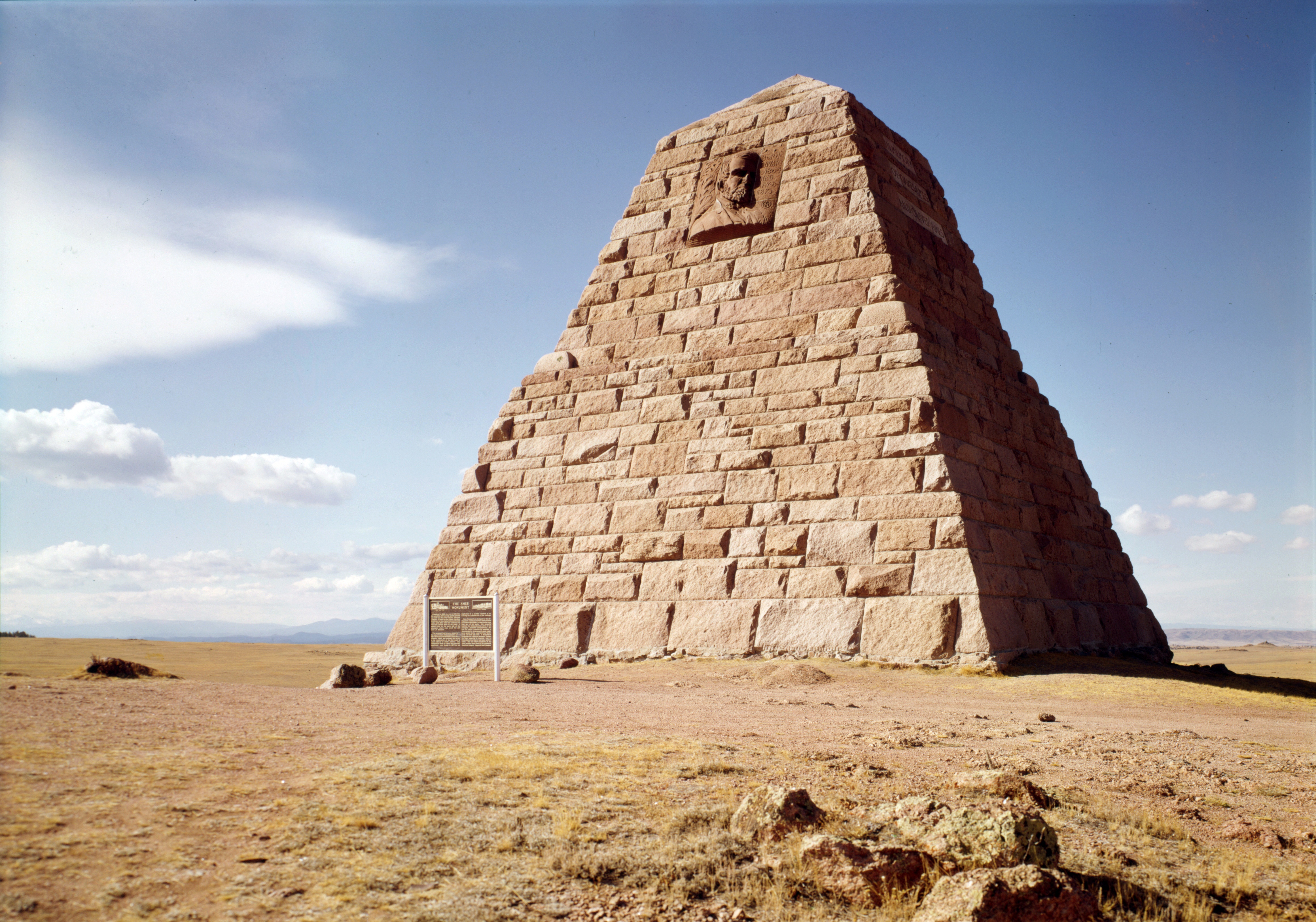
English: The
Ames Monument — 20 miles east of
Laramie, in Albany County,
Wyoming.
|
|||||||||||||||||||||||||
| Date | ||||||||||||||||||||||||||
| Source | Historic American Buildings Survey (Library of Congress); Call Number HABS WYO,1-LARAM,1; Survey number HABS WY-72; digital id: http://hdl.loc.gov/loc.pnp/hhh.wy0049. This photograph is in the public domain because it is original work of the US Federal Government. | |||||||||||||||||||||||||
| Author |
|
|||||||||||||||||||||||||
| Permission ( Reusing this file) |
|
|||||||||||||||||||||||||

.jpg)
| Object location |
| View this and other nearby images on: OpenStreetMap |
|
|---|
.jpg¶ms=041.131389_N_-105.397500_E_globe:Earth_class:object_region:US_type:landmark_scale:1500_&language=en)
File history
Click on a date/time to view the file as it appeared at that time.
| Date/Time | Thumbnail | Dimensions | User | Comment | |
|---|---|---|---|---|---|
| current | 15:54, 15 January 2012 |
| 4,643 × 3,254 (6.26 MB) | Hohum | Levels |
| 00:33, 30 April 2007 |
 | 4,643 × 3,254 (5.37 MB) | Daderot | {{Information |Description=Ames Monument, 20 miles east of Laramie, Wyoming. Architect H. H. Richardson and sculptor Augustus Saint-Gaudens. |Source=Historic American Buildings Survey (Library of Congress); Call Number HABS WYO,1-LARAM,1; Survey number HA |
File usage
Global file usage
The following other wikis use this file:
- Usage on de.wikipedia.org
- Usage on en.wikivoyage.org
- Usage on eo.wikipedia.org
- Usage on fr.wikipedia.org
- Usage on fr.wikibooks.org
- Usage on ja.wikipedia.org
- Usage on sv.wikipedia.org
- Usage on www.wikidata.org
Metadata
.jpg)
Original file (4,643 × 3,254 pixels, file size: 6.26 MB, MIME type: image/jpeg)
| This is a file from the
Wikimedia Commons. Information from its
description page there is shown below. Commons is a freely licensed media file repository. You can help. |
Summary
|
This is an image of a place or building that is listed on the
National Register of Historic Places in the
United States of America. Its reference number is
72001296. |
| Description |
English: The
Ames Monument — 20 miles east of
Laramie, in Albany County,
Wyoming.
|
|||||||||||||||||||||||||
| Date | ||||||||||||||||||||||||||
| Source | Historic American Buildings Survey (Library of Congress); Call Number HABS WYO,1-LARAM,1; Survey number HABS WY-72; digital id: http://hdl.loc.gov/loc.pnp/hhh.wy0049. This photograph is in the public domain because it is original work of the US Federal Government. | |||||||||||||||||||||||||
| Author |
|
|||||||||||||||||||||||||
| Permission ( Reusing this file) |
|
|||||||||||||||||||||||||
| Object location |
| View this and other nearby images on: OpenStreetMap |
|
|---|
File history
Click on a date/time to view the file as it appeared at that time.
| Date/Time | Thumbnail | Dimensions | User | Comment | |
|---|---|---|---|---|---|
| current | 15:54, 15 January 2012 |
| 4,643 × 3,254 (6.26 MB) | Hohum | Levels |
| 00:33, 30 April 2007 |
| 4,643 × 3,254 (5.37 MB) | Daderot | {{Information |Description=Ames Monument, 20 miles east of Laramie, Wyoming. Architect H. H. Richardson and sculptor Augustus Saint-Gaudens. |Source=Historic American Buildings Survey (Library of Congress); Call Number HABS WYO,1-LARAM,1; Survey number HA |
File usage
Global file usage
The following other wikis use this file:
- Usage on de.wikipedia.org
- Usage on en.wikivoyage.org
- Usage on eo.wikipedia.org
- Usage on fr.wikipedia.org
- Usage on fr.wikibooks.org
- Usage on ja.wikipedia.org
- Usage on sv.wikipedia.org
- Usage on www.wikidata.org