
Original file (2,000 × 1,381 pixels, file size: 4.73 MB, MIME type: image/png)
| This is a file from the
Wikimedia Commons. Information from its
description page there is shown below. Commons is a freely licensed media file repository. You can help. |
.png)
.png)
.png)
.png)
.png)
.png)
.png)
.png)
.png)
.png)
.png)
.png)
.png)
.png)
.png)
.png)
.png)
.png)
.png)
.png)
.png)
.png)
.png)
.png)
.png)
.png)
.png)
.png)
.png)
.png)
.png)
.png)
.png)
.png)
.png)
.png)
.png)
.png)
.png)
.png)
.png)

|
This map has been made or improved in the German
Kartenwerkstatt (Map Lab). You can
propose maps to improve as well.
|
Licensing
The map has been created with the
Generic Mapping Tools:
https://www.generic-mapping-tools.org/ using one or more of these
public-domain datasets for the relief:
|

|
Permission is granted to copy, distribute and/or modify this document under the terms of the GNU Free Documentation License, Version 1.2 or any later version published by the Free Software Foundation; with no Invariant Sections, no Front-Cover Texts, and no Back-Cover Texts. A copy of the license is included in the section entitled GNU Free Documentation License. |
| This file is licensed under the Creative Commons Attribution-Share Alike 3.0 Unported license. | ||
| ||
| This licensing tag was added to this file as part of the GFDL licensing update. |
File history
Click on a date/time to view the file as it appeared at that time.
| Date/Time | Thumbnail | Dimensions | User | Comment | |
|---|---|---|---|---|---|
| current | 12:58, 20 February 2009 |
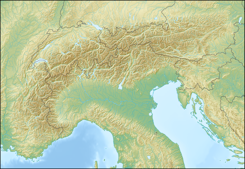
| 2,000 × 1,381 (4.73 MB) | Lencer | {{Information |Description= {{de|Positionskarte der Alpen}} Quadratische Plattkarte. Geographische Begrenzung der Karte: * N: 48.5 ° N * S: 42.75 ° N * W: 4.5 ° O * O: 17 ° O {{en|Location map of the Alps}} Equirecta |
File usage
More than 100 pages use this file. The following list shows the first 100 pages that use this file only. A full list is available.
- 1956 Winter Olympics
- Aletsch Glacier
- Alpe d'Huez
- Alpine skiing at the 1976 Winter Olympics
- Alpine skiing at the 2006 Winter Olympics
- Arlberg
- Battle of Ceresole
- Battle of the Frigidus
- Breithorn
- Brenner Pass
- Brenta group
- Campo Carlo Magno
- Col Agnel
- Col de Montgenèvre
- Col de Restefond
- Col de Tende
- Col de la Croix (Jura)
- Col de la Croix de Fer
- Col du Galibier
- Columbanus
- Cortina d'Ampezzo
- Courchevel
- Cresta Run
- Dolomites
- Dreiländerspitze
- Dufourspitze
- FIS Alpine World Ski Championships 2005
- Fellhorn
- Fluchthorn
- Grande Dixence Dam
- Grandes Jorasses
- Grauspitz
- Greifensee (lake)
- Großer Priel
- Hahnenkamm, Kitzbühel
- High Tauern
- Jungfrau
- Klingnauer Stausee
- Kranjska Gora
- La Plagne
- Lake Biel
- Lake Brienz
- Lake Constance
- Lake Garda
- Lake Geneva
- Lake Lucerne
- Lake Lugano
- Lake Morat
- Lake Neuchâtel
- Lake Thun
- Lake Zug
- Lake Zurich
- Les Menuires
- Les Trois Vallées
- Little St Bernard Pass
- Maddalena Pass
- Marmolada
- Matajur
- Matterhorn
- Mont Aiguille
- Mont Blanc
- Mont Blanc Tunnel
- Mont Cenis
- Mont Ventoux
- Monte Grappa
- Monte Toc
- Monte Viso
- Méribel
- Nebelhorn
- Nordend
- Ortler
- Patscherkofel
- Piz Bernina
- Piz Buin
- Pordoi Pass
- Portes du Soleil
- Reschen Pass
- Rhine Glacier
- Rhône Glacier
- Rocciamelone
- Rotsee
- Schilthorn
- Schlern
- Semmering Pass
- Serre Chevalier
- Sihlsee
- Slavnik
- Splügen Pass
- Thurn Pass
- Timmelsjoch
- Triglav
- Umbrail Pass
- Untersberg
- Val-d'Isère
- Val Camonica
- Val Thorens
- Walensee
- Wank (mountain)
- Watzmann
- Wengen
View more links to this file.
Global file usage
The following other wikis use this file:
- Usage on als.wikipedia.org
- Usage on an.wikipedia.org
- Usage on ar.wikipedia.org
- Usage on as.wikipedia.org
- Usage on az.wikipedia.org
- Usage on ba.wikipedia.org
- Usage on be.wikipedia.org
- Манблан
- Матэргорн
- Шаблон:На карце/Альпы
- Цугшпіцэ
- Грайскія Альпы
- Штахлеркопф
- Заходнія Альпы
- Лігурыйскія Альпы
- Бернскія Альпы
- Праванскія Альпы
- Алечгорн
- Мёнх
- Коцкія Альпы
- Альпы Дафінэ
- Лепанцінскія Альпы
- Высокі Таўэрн
- Гларнскія Альпы
- Юлійскія Альпы
- Юра (горы)
- Граўшпіц
- Рэтыйскія Альпы
- Паўднёвыя Вапняковыя Альпы
- Цэнтральныя Усходнія Альпы
- Лага-Маджорэ
- Адамела
- Берніна (горны масіў)
- Пунта-Перукеці
- Руая (рака)
- Usage on bg.wikipedia.org
View more global usage of this file.
Metadata
Original file (2,000 × 1,381 pixels, file size: 4.73 MB, MIME type: image/png)
| This is a file from the
Wikimedia Commons. Information from its
description page there is shown below. Commons is a freely licensed media file repository. You can help. |
|
|
This map has been made or improved in the German
Kartenwerkstatt (Map Lab). You can
propose maps to improve as well.
|
Licensing
The map has been created with the
Generic Mapping Tools:
https://www.generic-mapping-tools.org/ using one or more of these
public-domain datasets for the relief:
|
|
|
Permission is granted to copy, distribute and/or modify this document under the terms of the GNU Free Documentation License, Version 1.2 or any later version published by the Free Software Foundation; with no Invariant Sections, no Front-Cover Texts, and no Back-Cover Texts. A copy of the license is included in the section entitled GNU Free Documentation License. |
| This file is licensed under the Creative Commons Attribution-Share Alike 3.0 Unported license. | ||
| ||
| This licensing tag was added to this file as part of the GFDL licensing update. |
File history
Click on a date/time to view the file as it appeared at that time.
| Date/Time | Thumbnail | Dimensions | User | Comment | |
|---|---|---|---|---|---|
| current | 12:58, 20 February 2009 |
| 2,000 × 1,381 (4.73 MB) | Lencer | {{Information |Description= {{de|Positionskarte der Alpen}} Quadratische Plattkarte. Geographische Begrenzung der Karte: * N: 48.5 ° N * S: 42.75 ° N * W: 4.5 ° O * O: 17 ° O {{en|Location map of the Alps}} Equirecta |
File usage
More than 100 pages use this file. The following list shows the first 100 pages that use this file only. A full list is available.
- 1956 Winter Olympics
- Aletsch Glacier
- Alpe d'Huez
- Alpine skiing at the 1976 Winter Olympics
- Alpine skiing at the 2006 Winter Olympics
- Arlberg
- Battle of Ceresole
- Battle of the Frigidus
- Breithorn
- Brenner Pass
- Brenta group
- Campo Carlo Magno
- Col Agnel
- Col de Montgenèvre
- Col de Restefond
- Col de Tende
- Col de la Croix (Jura)
- Col de la Croix de Fer
- Col du Galibier
- Columbanus
- Cortina d'Ampezzo
- Courchevel
- Cresta Run
- Dolomites
- Dreiländerspitze
- Dufourspitze
- FIS Alpine World Ski Championships 2005
- Fellhorn
- Fluchthorn
- Grande Dixence Dam
- Grandes Jorasses
- Grauspitz
- Greifensee (lake)
- Großer Priel
- Hahnenkamm, Kitzbühel
- High Tauern
- Jungfrau
- Klingnauer Stausee
- Kranjska Gora
- La Plagne
- Lake Biel
- Lake Brienz
- Lake Constance
- Lake Garda
- Lake Geneva
- Lake Lucerne
- Lake Lugano
- Lake Morat
- Lake Neuchâtel
- Lake Thun
- Lake Zug
- Lake Zurich
- Les Menuires
- Les Trois Vallées
- Little St Bernard Pass
- Maddalena Pass
- Marmolada
- Matajur
- Matterhorn
- Mont Aiguille
- Mont Blanc
- Mont Blanc Tunnel
- Mont Cenis
- Mont Ventoux
- Monte Grappa
- Monte Toc
- Monte Viso
- Méribel
- Nebelhorn
- Nordend
- Ortler
- Patscherkofel
- Piz Bernina
- Piz Buin
- Pordoi Pass
- Portes du Soleil
- Reschen Pass
- Rhine Glacier
- Rhône Glacier
- Rocciamelone
- Rotsee
- Schilthorn
- Schlern
- Semmering Pass
- Serre Chevalier
- Sihlsee
- Slavnik
- Splügen Pass
- Thurn Pass
- Timmelsjoch
- Triglav
- Umbrail Pass
- Untersberg
- Val-d'Isère
- Val Camonica
- Val Thorens
- Walensee
- Wank (mountain)
- Watzmann
- Wengen
View more links to this file.
Global file usage
The following other wikis use this file:
- Usage on als.wikipedia.org
- Usage on an.wikipedia.org
- Usage on ar.wikipedia.org
- Usage on as.wikipedia.org
- Usage on az.wikipedia.org
- Usage on ba.wikipedia.org
- Usage on be.wikipedia.org
- Манблан
- Матэргорн
- Шаблон:На карце/Альпы
- Цугшпіцэ
- Грайскія Альпы
- Штахлеркопф
- Заходнія Альпы
- Лігурыйскія Альпы
- Бернскія Альпы
- Праванскія Альпы
- Алечгорн
- Мёнх
- Коцкія Альпы
- Альпы Дафінэ
- Лепанцінскія Альпы
- Высокі Таўэрн
- Гларнскія Альпы
- Юлійскія Альпы
- Юра (горы)
- Граўшпіц
- Рэтыйскія Альпы
- Паўднёвыя Вапняковыя Альпы
- Цэнтральныя Усходнія Альпы
- Лага-Маджорэ
- Адамела
- Берніна (горны масіў)
- Пунта-Перукеці
- Руая (рака)
- Usage on bg.wikipedia.org
View more global usage of this file.