Photos • Location


Size of this preview:
800 × 533 pixels. Other resolutions:
320 × 213 pixels |
640 × 427 pixels |
1,024 × 683 pixels |
1,280 × 853 pixels |
2,560 × 1,707 pixels |
3,888 × 2,592 pixels.
Original file (3,888 × 2,592 pixels, file size: 3.27 MB, MIME type: image/jpeg)
| This is a file from the
Wikimedia Commons. Information from its
description page there is shown below. Commons is a freely licensed media file repository. You can help. |
|
This is an image of a place or building that is listed on the
National Register of Historic Places in the
United States of America. Its reference number is
80002824. |
Summary
| Description |
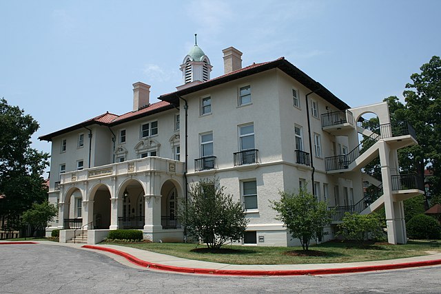
English:
North Carolina School of Science and Mathematics Watts Hall. This used to be
Watts Hospital. |
||
| Date | |||
| Source | Own work | ||
| Author | Ildar Sagdejev ( Specious) | ||
| Permission ( Reusing this file) |
|

| Camera location | | View this and other nearby images on: OpenStreetMap |
|
|---|
Licensing
I, the copyright holder of this work, hereby publish it under the following licenses:
This file is licensed under the
Creative Commons
Attribution-Share Alike 3.0 Unported license.
- You are free:
- to share – to copy, distribute and transmit the work
- to remix – to adapt the work
- Under the following conditions:
- attribution – You must give appropriate credit, provide a link to the license, and indicate if changes were made. You may do so in any reasonable manner, but not in any way that suggests the licensor endorses you or your use.
- share alike – If you remix, transform, or build upon the material, you must distribute your contributions under the same or compatible license as the original.

|
Permission is granted to copy, distribute and/or modify this document under the terms of the GNU Free Documentation License, Version 1.2 or any later version published by the Free Software Foundation; with no Invariant Sections, no Front-Cover Texts, and no Back-Cover Texts. A copy of the license is included in the section entitled GNU Free Documentation License. |
You may select the license of your choice.
File history
Click on a date/time to view the file as it appeared at that time.
| Date/Time | Thumbnail | Dimensions | User | Comment | |
|---|---|---|---|---|---|
| current | 03:25, 4 November 2008 |
| 3,888 × 2,592 (3.27 MB) | Specious | cloned out sensor dust spots |
| 22:35, 4 July 2008 |
 | 3,888 × 2,592 (3.29 MB) | Specious | {{Information |Description={{en|1= North Carolina School of Science and Mathematics Watts Hall. This used to be Watts Hospital.}} |Source=Own work |Author=Ildar Sagdejev ([[User:S |
File usage
The following pages on the English Wikipedia use this file (pages on other projects are not listed):
Global file usage
The following other wikis use this file:
- Usage on www.wikidata.org
Metadata
Size of this preview:
800 × 533 pixels. Other resolutions:
320 × 213 pixels |
640 × 427 pixels |
1,024 × 683 pixels |
1,280 × 853 pixels |
2,560 × 1,707 pixels |
3,888 × 2,592 pixels.
Original file (3,888 × 2,592 pixels, file size: 3.27 MB, MIME type: image/jpeg)
| This is a file from the
Wikimedia Commons. Information from its
description page there is shown below. Commons is a freely licensed media file repository. You can help. |
|
This is an image of a place or building that is listed on the
National Register of Historic Places in the
United States of America. Its reference number is
80002824. |
Summary
| Description |
English:
North Carolina School of Science and Mathematics Watts Hall. This used to be
Watts Hospital. |
||
| Date | |||
| Source | Own work | ||
| Author | Ildar Sagdejev ( Specious) | ||
| Permission ( Reusing this file) |
|
| Camera location | | View this and other nearby images on: OpenStreetMap |
|
|---|
Licensing
I, the copyright holder of this work, hereby publish it under the following licenses:
This file is licensed under the
Creative Commons
Attribution-Share Alike 3.0 Unported license.
- You are free:
- to share – to copy, distribute and transmit the work
- to remix – to adapt the work
- Under the following conditions:
- attribution – You must give appropriate credit, provide a link to the license, and indicate if changes were made. You may do so in any reasonable manner, but not in any way that suggests the licensor endorses you or your use.
- share alike – If you remix, transform, or build upon the material, you must distribute your contributions under the same or compatible license as the original.
|
|
Permission is granted to copy, distribute and/or modify this document under the terms of the GNU Free Documentation License, Version 1.2 or any later version published by the Free Software Foundation; with no Invariant Sections, no Front-Cover Texts, and no Back-Cover Texts. A copy of the license is included in the section entitled GNU Free Documentation License. |
You may select the license of your choice.
File history
Click on a date/time to view the file as it appeared at that time.
| Date/Time | Thumbnail | Dimensions | User | Comment | |
|---|---|---|---|---|---|
| current | 03:25, 4 November 2008 |
| 3,888 × 2,592 (3.27 MB) | Specious | cloned out sensor dust spots |
| 22:35, 4 July 2008 |
| 3,888 × 2,592 (3.29 MB) | Specious | {{Information |Description={{en|1= North Carolina School of Science and Mathematics Watts Hall. This used to be Watts Hospital.}} |Source=Own work |Author=Ildar Sagdejev ([[User:S |
File usage
The following pages on the English Wikipedia use this file (pages on other projects are not listed):
Global file usage
The following other wikis use this file:
- Usage on www.wikidata.org