
Size of this preview:
609 × 600 pixels. Other resolutions:
244 × 240 pixels |
487 × 480 pixels |
720 × 709 pixels.
Original file (720 × 709 pixels, file size: 93 KB, MIME type: image/jpeg)
| This is a file from the
Wikimedia Commons. Information from its
description page there is shown below. Commons is a freely licensed media file repository. You can help. |
Summary
| Description |
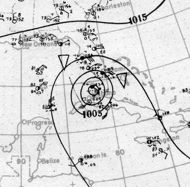
English: Surface analysis of the 1919 Florida Keys hurricane at peak intensity as a Category 4 hurricane-equivalent in the Florida Straits on September 10, 1919. |
| Date | |
| Source | http://www.aoml.noaa.gov/hrd/hurdat/weathermaps/191902-sept10.jpg |
| Author | Atlantic Oceanographic and Meteorological Laboratory, United States National Oceanic and Atmospheric Administration |
Licensing
{
This image is in the
public domain because it contains materials that originally came from the U.S.
National Oceanic and Atmospheric Administration, taken or made as part of an employee's official duties.
|
File history
Click on a date/time to view the file as it appeared at that time.
| Date/Time | Thumbnail | Dimensions | User | Comment | |
|---|---|---|---|---|---|
| current | 20:47, 10 January 2015 |
| 720 × 709 (93 KB) | TheAustinMan | User created page with UploadWizard |
File usage
The following pages on the English Wikipedia use this file (pages on other projects are not listed):
Global file usage
The following other wikis use this file:
- Usage on ru.wikipedia.org
- Usage on www.wikidata.org
Metadata
Size of this preview:
609 × 600 pixels. Other resolutions:
244 × 240 pixels |
487 × 480 pixels |
720 × 709 pixels.
Original file (720 × 709 pixels, file size: 93 KB, MIME type: image/jpeg)
| This is a file from the
Wikimedia Commons. Information from its
description page there is shown below. Commons is a freely licensed media file repository. You can help. |
Summary
| Description |
English: Surface analysis of the 1919 Florida Keys hurricane at peak intensity as a Category 4 hurricane-equivalent in the Florida Straits on September 10, 1919. |
| Date | |
| Source | http://www.aoml.noaa.gov/hrd/hurdat/weathermaps/191902-sept10.jpg |
| Author | Atlantic Oceanographic and Meteorological Laboratory, United States National Oceanic and Atmospheric Administration |
Licensing
{
This image is in the
public domain because it contains materials that originally came from the U.S.
National Oceanic and Atmospheric Administration, taken or made as part of an employee's official duties.
|
File history
Click on a date/time to view the file as it appeared at that time.
| Date/Time | Thumbnail | Dimensions | User | Comment | |
|---|---|---|---|---|---|
| current | 20:47, 10 January 2015 |
| 720 × 709 (93 KB) | TheAustinMan | User created page with UploadWizard |
File usage
The following pages on the English Wikipedia use this file (pages on other projects are not listed):
Global file usage
The following other wikis use this file:
- Usage on ru.wikipedia.org
- Usage on www.wikidata.org