Photos • Location


Size of this preview:
800 × 600 pixels. Other resolutions:
320 × 240 pixels |
640 × 480 pixels |
1,024 × 768 pixels |
1,280 × 960 pixels |
2,560 × 1,920 pixels |
4,000 × 3,000 pixels.
Original file (4,000 × 3,000 pixels, file size: 2.2 MB, MIME type: image/jpeg)
| This is a file from the
Wikimedia Commons. Information from its
description page there is shown below. Commons is a freely licensed media file repository. You can help. |
.jpg)
Summary
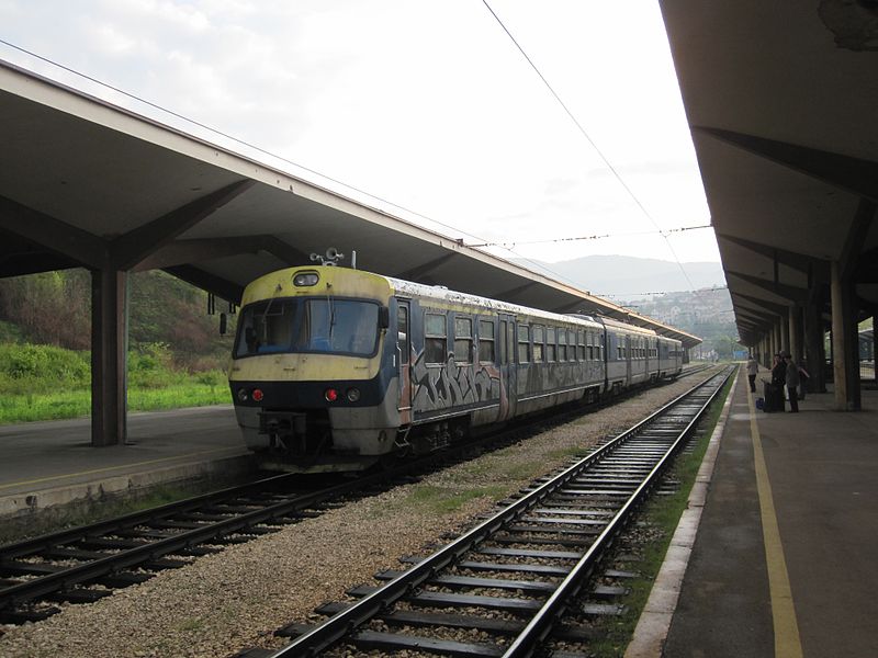
| Description | Bosnia is not quite unit free. The DMU between Tuzla and Doboj is featured elsewhere and if you plan to cover all lines you will get to travel on it. The EMUs based in Sarajevo work some of the stopping services. As a result for those on a straight "track bash" will just be a pose in front of the camera rather than a ride inside. Talgo stock from Spain has been ordered, tested but no definite date for introduction has yet been announced. |
| Date | |
| Source | 11.05.11 Sarajevo ŽFBH EMU |
| Author | Phil Richards from London, UK |
| Camera location |
| View this and other nearby images on: OpenStreetMap |
|
|---|
.jpg¶ms=043.860550_N_0018.398999_E_globe:Earth_type:camera_source:Flickr_&language=en)
Licensing
This file is licensed under the
Creative Commons
Attribution-Share Alike 2.0 Generic license.
- You are free:
- to share – to copy, distribute and transmit the work
- to remix – to adapt the work
- Under the following conditions:
- attribution – You must give appropriate credit, provide a link to the license, and indicate if changes were made. You may do so in any reasonable manner, but not in any way that suggests the licensor endorses you or your use.
- share alike – If you remix, transform, or build upon the material, you must distribute your contributions under the same or compatible license as the original.
| This image, originally posted to Flickr, was reviewed on 16 June 2013 by the administrator or reviewer File Upload Bot (Magnus Manske), who confirmed that it was available on Flickr under the stated license on that date. |
File history
Click on a date/time to view the file as it appeared at that time.
| Date/Time | Thumbnail | Dimensions | User | Comment | |
|---|---|---|---|---|---|
| current | 09:32, 16 June 2013 |
| 4,000 × 3,000 (2.2 MB) | File Upload Bot (Magnus Manske) | Transferred from Flickr by User:tm |
File usage
The following pages on the English Wikipedia use this file (pages on other projects are not listed):
Global file usage
The following other wikis use this file:
- Usage on bs.wikipedia.org
- Usage on fa.wikipedia.org
- Usage on ru.wikipedia.org
- Usage on sh.wikipedia.org
- Usage on sr.wikipedia.org
Metadata
.jpg)
Size of this preview:
800 × 600 pixels. Other resolutions:
320 × 240 pixels |
640 × 480 pixels |
1,024 × 768 pixels |
1,280 × 960 pixels |
2,560 × 1,920 pixels |
4,000 × 3,000 pixels.
Original file (4,000 × 3,000 pixels, file size: 2.2 MB, MIME type: image/jpeg)
| This is a file from the
Wikimedia Commons. Information from its
description page there is shown below. Commons is a freely licensed media file repository. You can help. |
Summary
| Description | Bosnia is not quite unit free. The DMU between Tuzla and Doboj is featured elsewhere and if you plan to cover all lines you will get to travel on it. The EMUs based in Sarajevo work some of the stopping services. As a result for those on a straight "track bash" will just be a pose in front of the camera rather than a ride inside. Talgo stock from Spain has been ordered, tested but no definite date for introduction has yet been announced. |
| Date | |
| Source | 11.05.11 Sarajevo ŽFBH EMU |
| Author | Phil Richards from London, UK |
| Camera location |
| View this and other nearby images on: OpenStreetMap |
|
|---|
Licensing
This file is licensed under the
Creative Commons
Attribution-Share Alike 2.0 Generic license.
- You are free:
- to share – to copy, distribute and transmit the work
- to remix – to adapt the work
- Under the following conditions:
- attribution – You must give appropriate credit, provide a link to the license, and indicate if changes were made. You may do so in any reasonable manner, but not in any way that suggests the licensor endorses you or your use.
- share alike – If you remix, transform, or build upon the material, you must distribute your contributions under the same or compatible license as the original.
| This image, originally posted to Flickr, was reviewed on 16 June 2013 by the administrator or reviewer File Upload Bot (Magnus Manske), who confirmed that it was available on Flickr under the stated license on that date. |
File history
Click on a date/time to view the file as it appeared at that time.
| Date/Time | Thumbnail | Dimensions | User | Comment | |
|---|---|---|---|---|---|
| current | 09:32, 16 June 2013 |
| 4,000 × 3,000 (2.2 MB) | File Upload Bot (Magnus Manske) | Transferred from Flickr by User:tm |
File usage
The following pages on the English Wikipedia use this file (pages on other projects are not listed):
Global file usage
The following other wikis use this file:
- Usage on bs.wikipedia.org
- Usage on fa.wikipedia.org
- Usage on ru.wikipedia.org
- Usage on sh.wikipedia.org
- Usage on sr.wikipedia.org