Photos • Location


Size of this preview:
800 أ— 532 pixels. Other resolutions:
320 أ— 213 pixels |
640 أ— 426 pixels |
1,022 أ— 680 pixels.
Original file (1,022 أ— 680 pixels, file size: 385 KB, MIME type: image/jpeg)
| This is a file from the
Wikimedia Commons. Information from its
description page there is shown below. Commons is a freely licensed media file repository. You can help. |
| Description |
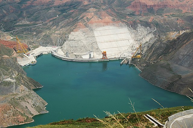
وژه®¶ه³،و°´ç”µç«™ English: Lijiaxia dam and Hydropower Station |
||
| Date | Taken on 7 September 2006 | ||
| Source | https://web.archive.org/web/20161016134301/http://www.panoramio.com/photo/48675812 | ||
| Author | neverdance | ||
| Permission ( Reusing this file) |
This file is licensed under the
Creative Commons
Attribution-Share Alike 3.0 Unported license. Attribution: neverdance
|
||
| Tags (from Panoramio photo page) | Haidong, 2006, ن¸ه›½, وژه®¶ه³،, é’وµ·çœپ |
| Camera location |
| View this and other nearby images on: OpenStreetMap |
|
|---|
File history
Click on a date/time to view the file as it appeared at that time.
| Date/Time | Thumbnail | Dimensions | User | Comment | |
|---|---|---|---|---|---|
| current | 12:47, 12 June 2021 |
| 1,022 أ— 680 (385 KB) | Hubert Kororo | Cropped 3 % horizontally, 9 % vertically using CropTool with lossless mode. |
| 20:01, 13 November 2016 |
 | 1,051 أ— 746 (394 KB) | Panoramio upload bot | {{Information |description=وژه®¶ه³،و°´ç”µç«™ |date={{Taken on|2006-09-07}} |source=http://www.panoramio.com/photo/48675812 |author=[http://www.panoramio.com/user/1176501?with_photo_id=48675812 neverdance] |permission={{cc-by-sa-3.0|neverdance}} {{Pano... |
File usage
The following pages on the English Wikipedia use this file (pages on other projects are not listed):
Global file usage
The following other wikis use this file:
- Usage on es.wikipedia.org
- Usage on fa.wikipedia.org
- Usage on la.wikipedia.org
- Usage on pt.wikipedia.org
Metadata
Size of this preview:
800 أ— 532 pixels. Other resolutions:
320 أ— 213 pixels |
640 أ— 426 pixels |
1,022 أ— 680 pixels.
Original file (1,022 أ— 680 pixels, file size: 385 KB, MIME type: image/jpeg)
| This is a file from the
Wikimedia Commons. Information from its
description page there is shown below. Commons is a freely licensed media file repository. You can help. |
| Description |
وژه®¶ه³،و°´ç”µç«™ English: Lijiaxia dam and Hydropower Station |
||
| Date | Taken on 7 September 2006 | ||
| Source | https://web.archive.org/web/20161016134301/http://www.panoramio.com/photo/48675812 | ||
| Author | neverdance | ||
| Permission ( Reusing this file) |
This file is licensed under the
Creative Commons
Attribution-Share Alike 3.0 Unported license. Attribution: neverdance
|
||
| Tags (from Panoramio photo page) | Haidong, 2006, ن¸ه›½, وژه®¶ه³،, é’وµ·çœپ |
| Camera location |
| View this and other nearby images on: OpenStreetMap |
|
|---|
File history
Click on a date/time to view the file as it appeared at that time.
| Date/Time | Thumbnail | Dimensions | User | Comment | |
|---|---|---|---|---|---|
| current | 12:47, 12 June 2021 |
| 1,022 أ— 680 (385 KB) | Hubert Kororo | Cropped 3 % horizontally, 9 % vertically using CropTool with lossless mode. |
| 20:01, 13 November 2016 |
| 1,051 أ— 746 (394 KB) | Panoramio upload bot | {{Information |description=وژه®¶ه³،و°´ç”µç«™ |date={{Taken on|2006-09-07}} |source=http://www.panoramio.com/photo/48675812 |author=[http://www.panoramio.com/user/1176501?with_photo_id=48675812 neverdance] |permission={{cc-by-sa-3.0|neverdance}} {{Pano... |
File usage
The following pages on the English Wikipedia use this file (pages on other projects are not listed):
Global file usage
The following other wikis use this file:
- Usage on es.wikipedia.org
- Usage on fa.wikipedia.org
- Usage on la.wikipedia.org
- Usage on pt.wikipedia.org