Original file (3,154 × 4,308 pixels, file size: 1.65 MB, MIME type: image/jpeg)
| This is a file from the
Wikimedia Commons. Information from its
description page there is shown below. Commons is a freely licensed media file repository. You can help. |
| Camera location |
| View this and other nearby images on: OpenStreetMap |
|
|---|
|
This is an image of a place or building that is listed on the
National Register of Historic Places in the
United States of America. Its reference number is
97000199. |
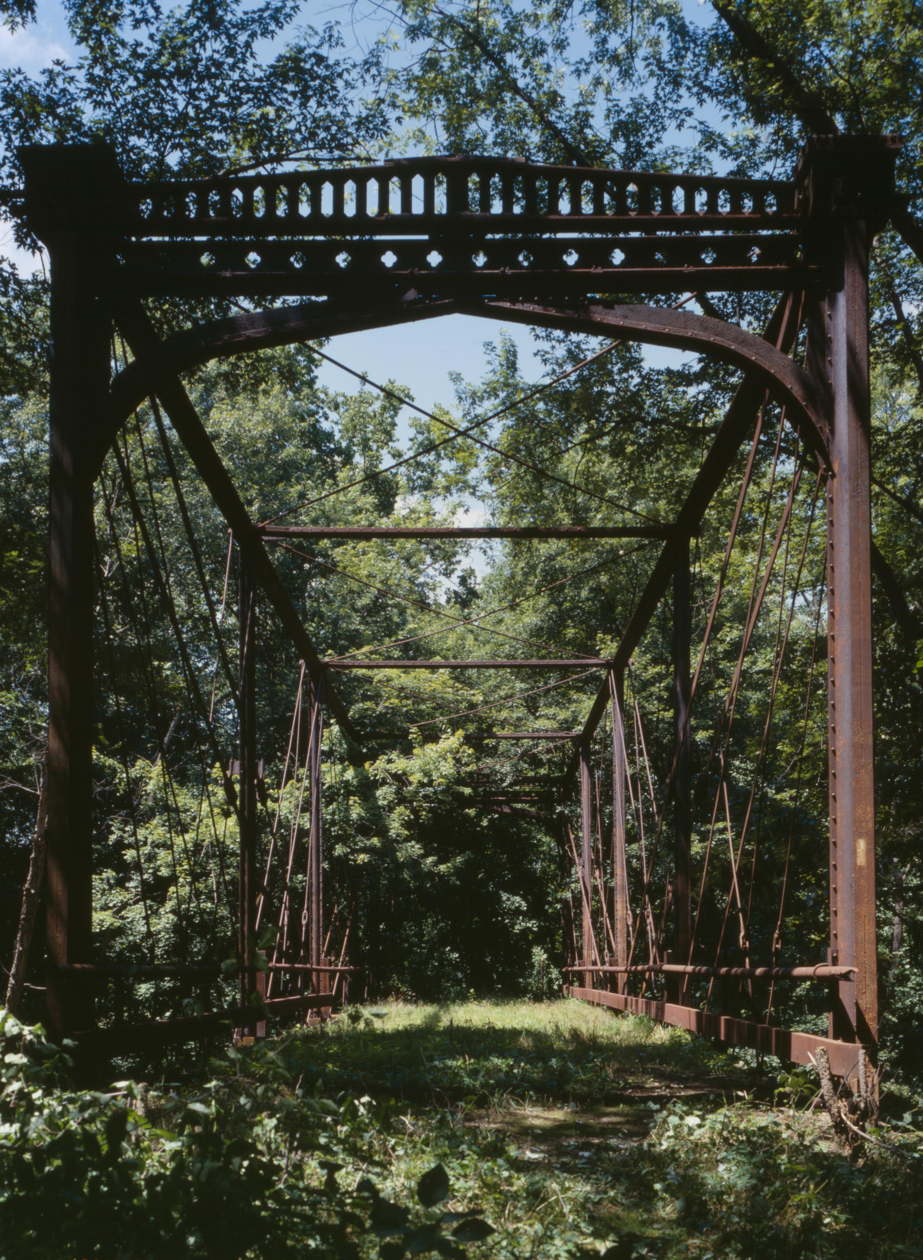
| Description |
English: Southern end of the
Zoarville Bridge, which spans Conotton Creek southeast of Zoarville in
Fairfield Township,
Tuscarawas County,
Ohio,
United States. Built in 1868 and listed on the
National Register of Historic Places, it is the only Fink through truss bridge in the United States. |
||||
| Date | |||||
| Source |
Library of Congress, Prints and Photograph Division HAER: OHIO,79-ZOARV.V,1-18
|
||||
| Author | Joseph Elliott | ||||
| Permission ( Reusing this file) |
|

File history
Click on a date/time to view the file as it appeared at that time.
| Date/Time | Thumbnail | Dimensions | User | Comment | |
|---|---|---|---|---|---|
| current | 16:46, 27 April 2009 |
| 3,154 × 4,308 (1.65 MB) | Martin H. | high res; cropped |
| 02:56, 26 April 2009 |
 | 817 × 1,024 (329 KB) | Nyttend | {{Location|40|34|38|N|81|23|30|W}} {{Information |Description={{en|Southern end of the {{w|Zoarville Bridge}}, which spans Conotton Creek southeast of Zoarville in {{w|Fairfield Township, Tuscarawas County, Ohio|Fairfield Township}}, {{w|Tuscarawas County |
File usage
Global file usage
The following other wikis use this file:
- Usage on es.wikipedia.org
- Usage on eu.wikipedia.org
- Usage on fa.wikipedia.org
- Usage on pt.wikipedia.org
- Usage on ur.wikipedia.org
- Usage on vi.wikipedia.org
- Usage on www.wikidata.org
- Usage on zh.wikipedia.org
Metadata
Original file (3,154 × 4,308 pixels, file size: 1.65 MB, MIME type: image/jpeg)
| This is a file from the
Wikimedia Commons. Information from its
description page there is shown below. Commons is a freely licensed media file repository. You can help. |
| Camera location |
| View this and other nearby images on: OpenStreetMap |
|
|---|
|
This is an image of a place or building that is listed on the
National Register of Historic Places in the
United States of America. Its reference number is
97000199. |
| Description |
English: Southern end of the
Zoarville Bridge, which spans Conotton Creek southeast of Zoarville in
Fairfield Township,
Tuscarawas County,
Ohio,
United States. Built in 1868 and listed on the
National Register of Historic Places, it is the only Fink through truss bridge in the United States. |
||||
| Date | |||||
| Source |
Library of Congress, Prints and Photograph Division HAER: OHIO,79-ZOARV.V,1-18
|
||||
| Author | Joseph Elliott | ||||
| Permission ( Reusing this file) |
|
File history
Click on a date/time to view the file as it appeared at that time.
| Date/Time | Thumbnail | Dimensions | User | Comment | |
|---|---|---|---|---|---|
| current | 16:46, 27 April 2009 |
| 3,154 × 4,308 (1.65 MB) | Martin H. | high res; cropped |
| 02:56, 26 April 2009 |
| 817 × 1,024 (329 KB) | Nyttend | {{Location|40|34|38|N|81|23|30|W}} {{Information |Description={{en|Southern end of the {{w|Zoarville Bridge}}, which spans Conotton Creek southeast of Zoarville in {{w|Fairfield Township, Tuscarawas County, Ohio|Fairfield Township}}, {{w|Tuscarawas County |
File usage
Global file usage
The following other wikis use this file:
- Usage on es.wikipedia.org
- Usage on eu.wikipedia.org
- Usage on fa.wikipedia.org
- Usage on pt.wikipedia.org
- Usage on ur.wikipedia.org
- Usage on vi.wikipedia.org
- Usage on www.wikidata.org
- Usage on zh.wikipedia.org