Size of this preview:
664 × 600 pixels. Other resolutions:
266 × 240 pixels |
531 × 480 pixels |
850 × 768 pixels |
1,134 × 1,024 pixels |
2,267 × 2,048 pixels |
3,208 × 2,898 pixels.
Original file (3,208 × 2,898 pixels, file size: 1.67 MB, MIME type: image/png)
| This is a file from the
Wikimedia Commons. Information from its
description page there is shown below. Commons is a freely licensed media file repository. You can help. |
| Description |
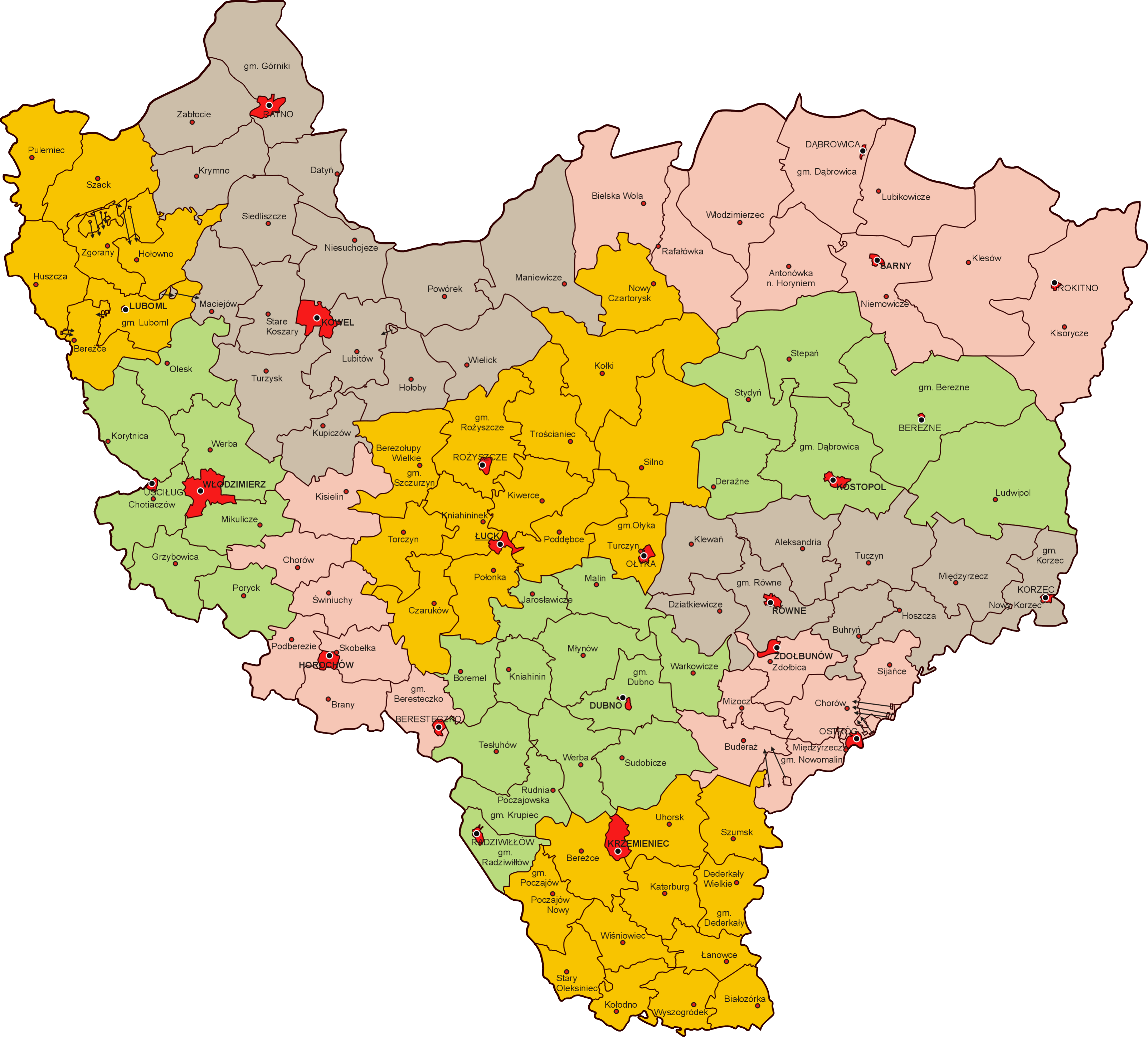
Polski: Podział administracyjny
województwa wołyńskiego w 1938 r. |
| Date | 29 March 2013 (upload date) |
| Source | własna praca na podstawie Mapa Gmin Rzeczypospolitej Polskiej, GUS 1938 |
| Author | Poznaniak |
| Permission ( Reusing this file) |
This file is licensed under the
Creative Commons
Attribution-Share Alike 2.5 Generic license.
|
File history
Click on a date/time to view the file as it appeared at that time.
| Date/Time | Thumbnail | Dimensions | User | Comment | |
|---|---|---|---|---|---|
| current | 20:59, 30 March 2013 |
| 3,208 × 2,898 (1.67 MB) | Poznaniak | {{Information |Description=Podział administracyjny województwa wołyńskiego w 1939 r. |Source=własna praca na podstawie Mapa Gmin Rzeczypospolitej Polskiej, GUS 1938 |Date=29 marca 2013 r. |Autho... |
File usage
The following pages on the English Wikipedia use this file (pages on other projects are not listed):
Global file usage
The following other wikis use this file:
- Usage on de.wikipedia.org
- Usage on hu.wikipedia.org
- Usage on it.wikipedia.org
- Usage on pl.wikipedia.org
- Usage on ru.wikipedia.org
- Usage on uk.wikipedia.org
Metadata
Size of this preview:
664 × 600 pixels. Other resolutions:
266 × 240 pixels |
531 × 480 pixels |
850 × 768 pixels |
1,134 × 1,024 pixels |
2,267 × 2,048 pixels |
3,208 × 2,898 pixels.
Original file (3,208 × 2,898 pixels, file size: 1.67 MB, MIME type: image/png)
| This is a file from the
Wikimedia Commons. Information from its
description page there is shown below. Commons is a freely licensed media file repository. You can help. |
| Description |
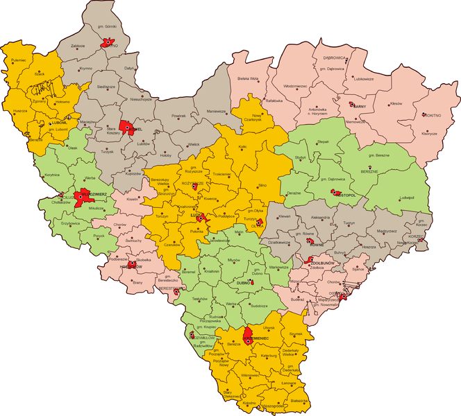
Polski: Podział administracyjny
województwa wołyńskiego w 1938 r. |
| Date | 29 March 2013 (upload date) |
| Source | własna praca na podstawie Mapa Gmin Rzeczypospolitej Polskiej, GUS 1938 |
| Author | Poznaniak |
| Permission ( Reusing this file) |
This file is licensed under the
Creative Commons
Attribution-Share Alike 2.5 Generic license.
|
File history
Click on a date/time to view the file as it appeared at that time.
| Date/Time | Thumbnail | Dimensions | User | Comment | |
|---|---|---|---|---|---|
| current | 20:59, 30 March 2013 |
| 3,208 × 2,898 (1.67 MB) | Poznaniak | {{Information |Description=Podział administracyjny województwa wołyńskiego w 1939 r. |Source=własna praca na podstawie Mapa Gmin Rzeczypospolitej Polskiej, GUS 1938 |Date=29 marca 2013 r. |Autho... |
File usage
The following pages on the English Wikipedia use this file (pages on other projects are not listed):
Global file usage
The following other wikis use this file:
- Usage on de.wikipedia.org
- Usage on hu.wikipedia.org
- Usage on it.wikipedia.org
- Usage on pl.wikipedia.org
- Usage on ru.wikipedia.org
- Usage on uk.wikipedia.org