Photos • Location


Size of this preview:
800 × 533 pixels. Other resolutions:
320 × 213 pixels |
640 × 426 pixels |
1,024 × 682 pixels |
1,280 × 852 pixels |
2,560 × 1,704 pixels |
3,900 × 2,596 pixels.
Original file (3,900 × 2,596 pixels, file size: 1.97 MB, MIME type: image/jpeg)
| This is a file from the
Wikimedia Commons. Information from its
description page there is shown below. Commons is a freely licensed media file repository. You can help. |
| Camera location |
| View this and other nearby images on: OpenStreetMap |
|
|---|
| Description |
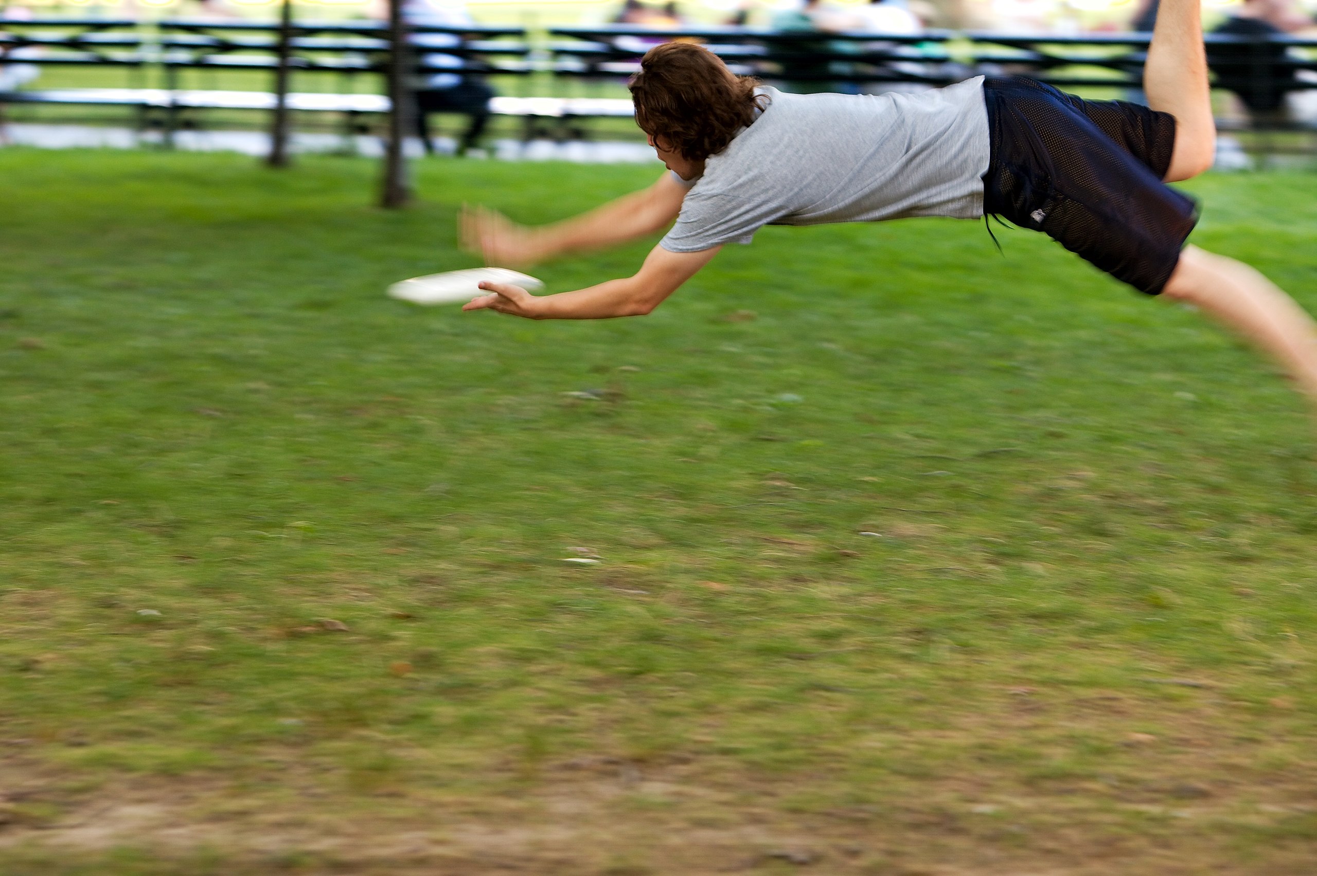
English:
Ragesoss flying through the air after a frisbee at the 2007-08-12 Wikipedia NYC picnic meetup. |
| Date | UTC |
| Source | By uploader. |
| Author | Gregory F. Maxwell < gmaxwell@gmail.com> PGP: 0xB0413BFA |
| Permission ( Reusing this file) |
GFDL 1.2 only other licensing terms available by request (especially requests by the subject of the image) |

|
Permission is granted to copy, distribute and/or modify this document under the terms of the GNU Free Documentation License, Version 1.2 only as published by the Free Software Foundation; with no Invariant Sections, no Front-Cover Texts, and no Back-Cover Texts. A copy of the license is included in the section entitled GNU Free Documentation License. | 1.2 only |
File history
Click on a date/time to view the file as it appeared at that time.
| Date/Time | Thumbnail | Dimensions | User | Comment | |
|---|---|---|---|---|---|
| current | 21:27, 15 August 2007 |
| 3,900 × 2,596 (1.97 MB) | Gmaxwell | {{location dec|40.780631|-73.968641}} {{Information |Description={{en| Ragesoss flying through the air after a frisbee at the 2007-08-12 Wikipedia NYC picnic meetup.}} |Source=By uploader. |Date=2007:08:12 22:26:56 UTC |Author=[[User: |
File usage
More than 100 pages use this file. The following list shows the first 100 pages that use this file only. A full list is available.
- User talk:Amynewyork4248
- User talk:Angiotensinogen
- User talk:AnnaKucsma
- User talk:Arnob1
- User talk:AshcroftIleum
- User talk:Benje309
- User talk:BernardM
- User talk:Blim8183
- User talk:Bloger
- User talk:Blue387
- User talk:Blutpanzer
- User talk:Bok269
- User talk:BrOnXbOmBr21
- User talk:Brianna Goldberg
- User talk:Calieber
- User talk:Cecropia
- User talk:CoolGuy
- User talk:Cowami
- User talk:CyntWorkStuff
- User talk:Daamien
- User talk:Daniel Hoz
- User talk:Deaghaidhcjjd
- User talk:Deathsythe
- User talk:Decumanus
- User talk:Defixio
- User talk:Descent~enwiki
- User talk:Drlowell
- User talk:Em79
- User talk:Fbv65edel
- User talk:GChriss
- User talk:Goatrider
- User talk:Gosgood
- User talk:Gracenotes
- User talk:HG707
- User talk:Hazelfo
- User talk:Howrealisreal
- User talk:JAF1970
- User talk:Jackalsclaw
- User talk:JahJah
- User talk:JamesMLane
- User talk:Jblossom
- User talk:Jiggz84
- User talk:Jimryan
- User talk:Jleon
- User talk:John R Murray
- User talk:Lemonhead
- User talk:LoganK
- User talk:Lordlnyc
- User talk:Lordvaluemart
- User talk:MNW-NYC-2021
- User talk:MacLachlan
- User talk:Markitos76
- User talk:Mary K Moore
- User talk:Mattman723
- User talk:Mbhskid520
- User talk:Mdozturk
- User talk:MikeTheRaptor
- User talk:Miz
- User talk:Moonstone
- User talk:Mordicai
- User talk:Myeager
- User talk:NYCJosh
- User talk:Newkai
- User talk:Nikki88
- User talk:Oboemastah
- User talk:Osbus
- User talk:Patsw
- User talk:PaulHanson
- User talk:Paul Klenk
- User talk:Polaron
- User talk:RMG
- User talk:Ran
- User talk:Rocketfairy
- User talk:Rodsan18
- User talk:Sabrebattletank
- User talk:Samosyr
- User talk:Screwball23
- User talk:Seamus215
- User talk:SeanMD80
- User talk:Seidenstud
- User talk:Semisomna
- User talk:Shadarian
- User talk:ShadowBoxer
- User talk:Sharkface217
- User talk:SignalMan
- User talk:SliceNYC
- User talk:Smaskyblue
- User talk:Sonicrazy
- User talk:Spacedragonblue
- User talk:The Lake Effect
- User talk:Theinfo
- User talk:Thistheman
- User talk:Tinlinkin
- User talk:Titelmadchen
- User talk:UNFanatic
- User talk:Volt4ire
- User talk:Waynepl107
- User talk:XLR8TION
- User talk:Xoder
- User talk:Yboord028
View more links to this file.
Global file usage
The following other wikis use this file:
- Usage on nyc.wikimedia.org
Metadata
Size of this preview:
800 × 533 pixels. Other resolutions:
320 × 213 pixels |
640 × 426 pixels |
1,024 × 682 pixels |
1,280 × 852 pixels |
2,560 × 1,704 pixels |
3,900 × 2,596 pixels.
Original file (3,900 × 2,596 pixels, file size: 1.97 MB, MIME type: image/jpeg)
| This is a file from the
Wikimedia Commons. Information from its
description page there is shown below. Commons is a freely licensed media file repository. You can help. |
| Camera location |
| View this and other nearby images on: OpenStreetMap |
|
|---|
| Description |
English:
Ragesoss flying through the air after a frisbee at the 2007-08-12 Wikipedia NYC picnic meetup. |
| Date | UTC |
| Source | By uploader. |
| Author | Gregory F. Maxwell < gmaxwell@gmail.com> PGP: 0xB0413BFA |
| Permission ( Reusing this file) |
GFDL 1.2 only other licensing terms available by request (especially requests by the subject of the image) |
|
|
Permission is granted to copy, distribute and/or modify this document under the terms of the GNU Free Documentation License, Version 1.2 only as published by the Free Software Foundation; with no Invariant Sections, no Front-Cover Texts, and no Back-Cover Texts. A copy of the license is included in the section entitled GNU Free Documentation License. | 1.2 only |
File history
Click on a date/time to view the file as it appeared at that time.
| Date/Time | Thumbnail | Dimensions | User | Comment | |
|---|---|---|---|---|---|
| current | 21:27, 15 August 2007 |
| 3,900 × 2,596 (1.97 MB) | Gmaxwell | {{location dec|40.780631|-73.968641}} {{Information |Description={{en| Ragesoss flying through the air after a frisbee at the 2007-08-12 Wikipedia NYC picnic meetup.}} |Source=By uploader. |Date=2007:08:12 22:26:56 UTC |Author=[[User: |
File usage
More than 100 pages use this file. The following list shows the first 100 pages that use this file only. A full list is available.
- User talk:Amynewyork4248
- User talk:Angiotensinogen
- User talk:AnnaKucsma
- User talk:Arnob1
- User talk:AshcroftIleum
- User talk:Benje309
- User talk:BernardM
- User talk:Blim8183
- User talk:Bloger
- User talk:Blue387
- User talk:Blutpanzer
- User talk:Bok269
- User talk:BrOnXbOmBr21
- User talk:Brianna Goldberg
- User talk:Calieber
- User talk:Cecropia
- User talk:CoolGuy
- User talk:Cowami
- User talk:CyntWorkStuff
- User talk:Daamien
- User talk:Daniel Hoz
- User talk:Deaghaidhcjjd
- User talk:Deathsythe
- User talk:Decumanus
- User talk:Defixio
- User talk:Descent~enwiki
- User talk:Drlowell
- User talk:Em79
- User talk:Fbv65edel
- User talk:GChriss
- User talk:Goatrider
- User talk:Gosgood
- User talk:Gracenotes
- User talk:HG707
- User talk:Hazelfo
- User talk:Howrealisreal
- User talk:JAF1970
- User talk:Jackalsclaw
- User talk:JahJah
- User talk:JamesMLane
- User talk:Jblossom
- User talk:Jiggz84
- User talk:Jimryan
- User talk:Jleon
- User talk:John R Murray
- User talk:Lemonhead
- User talk:LoganK
- User talk:Lordlnyc
- User talk:Lordvaluemart
- User talk:MNW-NYC-2021
- User talk:MacLachlan
- User talk:Markitos76
- User talk:Mary K Moore
- User talk:Mattman723
- User talk:Mbhskid520
- User talk:Mdozturk
- User talk:MikeTheRaptor
- User talk:Miz
- User talk:Moonstone
- User talk:Mordicai
- User talk:Myeager
- User talk:NYCJosh
- User talk:Newkai
- User talk:Nikki88
- User talk:Oboemastah
- User talk:Osbus
- User talk:Patsw
- User talk:PaulHanson
- User talk:Paul Klenk
- User talk:Polaron
- User talk:RMG
- User talk:Ran
- User talk:Rocketfairy
- User talk:Rodsan18
- User talk:Sabrebattletank
- User talk:Samosyr
- User talk:Screwball23
- User talk:Seamus215
- User talk:SeanMD80
- User talk:Seidenstud
- User talk:Semisomna
- User talk:Shadarian
- User talk:ShadowBoxer
- User talk:Sharkface217
- User talk:SignalMan
- User talk:SliceNYC
- User talk:Smaskyblue
- User talk:Sonicrazy
- User talk:Spacedragonblue
- User talk:The Lake Effect
- User talk:Theinfo
- User talk:Thistheman
- User talk:Tinlinkin
- User talk:Titelmadchen
- User talk:UNFanatic
- User talk:Volt4ire
- User talk:Waynepl107
- User talk:XLR8TION
- User talk:Xoder
- User talk:Yboord028
View more links to this file.
Global file usage
The following other wikis use this file:
- Usage on nyc.wikimedia.org