Size of this preview:
800 × 451 pixels. Other resolutions:
320 × 181 pixels |
640 × 361 pixels |
1,024 × 578 pixels |
1,280 × 722 pixels |
2,680 × 1,512 pixels.
Original file (2,680 × 1,512 pixels, file size: 1.97 MB, MIME type: image/jpeg)
| This is a file from the
Wikimedia Commons. Information from its
description page there is shown below. Commons is a freely licensed media file repository. You can help. |
Summary
| Description |
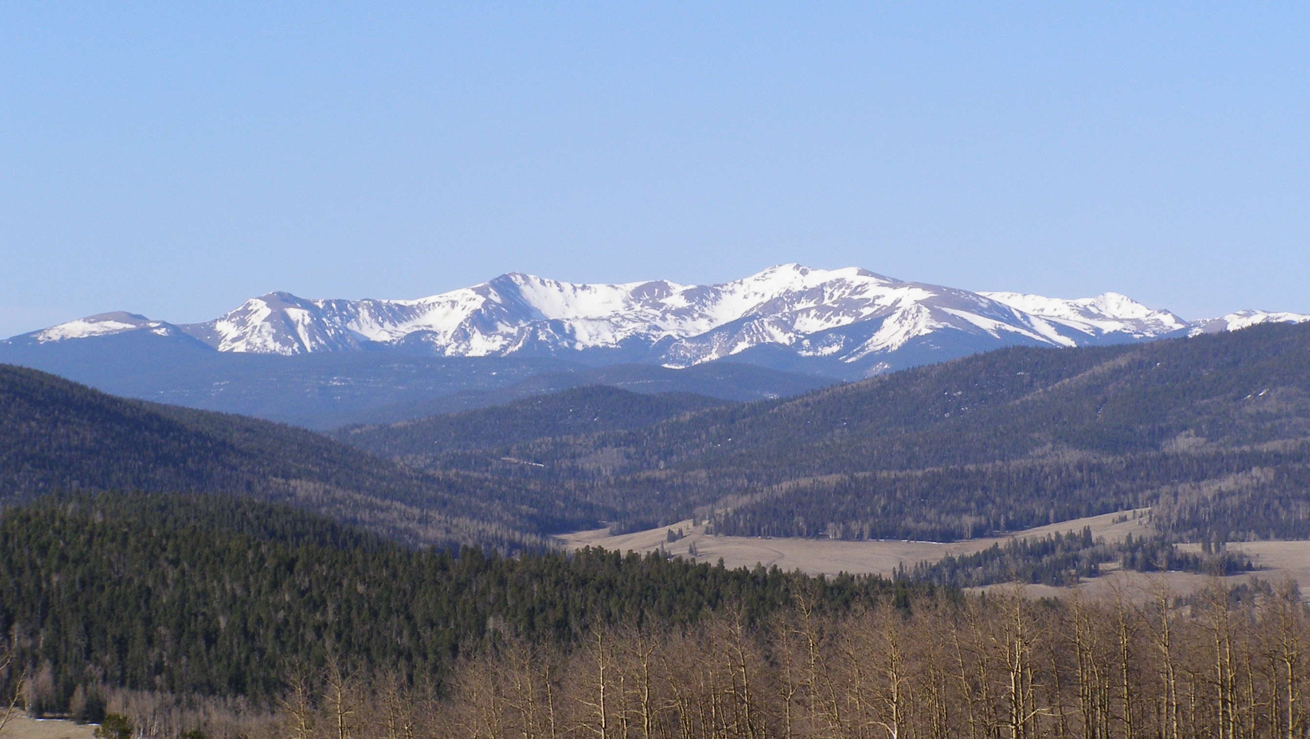
English: Wheeler Peak group, taken from along Forest Road 1950 in Valle Vidal, from a scenic viewpoint halfway between Comanche Point and Shuree Ponds. Whether or not you consider Mount Walter as a significant summit, it blocks the actual summit of Wheeler Peak, when viewing from Bobcat Pass, Red River Pass, NM-578 or Valle Vidal. |
| Date | |
| Source |
|
| Author | David Herrera from Albuquerque, NM, Bernalillo |
Licensing
This file is licensed under the
Creative Commons
Attribution 2.0 Generic license.
- You are free:
- to share – to copy, distribute and transmit the work
- to remix – to adapt the work
- Under the following conditions:
- attribution – You must give appropriate credit, provide a link to the license, and indicate if changes were made. You may do so in any reasonable manner, but not in any way that suggests the licensor endorses you or your use.
| This image, originally posted to Flickr, was reviewed on September 19, 2010 by the administrator or reviewer File Upload Bot (Magnus Manske), who confirmed that it was available on Flickr under the stated license on that date. |
File history
Click on a date/time to view the file as it appeared at that time.
| Date/Time | Thumbnail | Dimensions | User | Comment | |
|---|---|---|---|---|---|
| current | 20:01, 10 October 2017 |
| 2,680 × 1,512 (1.97 MB) | Tillman | Cropped 5 % horizontally and 28 % vertically using CropTool with lossless mode. |
| 21:00, 19 September 2010 |
 | 2,816 × 2,112 (3.02 MB) | File Upload Bot (Magnus Manske) | {{Information |Description=Taken from along Forest Road 1950 in Valle Vidal, from a scenic viewpoint halfway between Comanche Point and Shuree Ponds. Whether or not you consider Mount Walter as a significant summit, it blocks the actual summit of Wheeler |
File usage
The following pages on the English Wikipedia use this file (pages on other projects are not listed):
Global file usage
The following other wikis use this file:
- Usage on fy.wikipedia.org
- Usage on hsb.wikipedia.org
- Usage on hy.wikipedia.org
- Usage on ja.wikipedia.org
- Usage on nn.wikipedia.org
- Usage on no.wikipedia.org
- Usage on pl.wikipedia.org
- Usage on pl.wikivoyage.org
- Usage on ru.wikipedia.org
Metadata
Size of this preview:
800 × 451 pixels. Other resolutions:
320 × 181 pixels |
640 × 361 pixels |
1,024 × 578 pixels |
1,280 × 722 pixels |
2,680 × 1,512 pixels.
Original file (2,680 × 1,512 pixels, file size: 1.97 MB, MIME type: image/jpeg)
| This is a file from the
Wikimedia Commons. Information from its
description page there is shown below. Commons is a freely licensed media file repository. You can help. |
Summary
| Description |
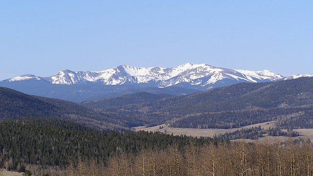
English: Wheeler Peak group, taken from along Forest Road 1950 in Valle Vidal, from a scenic viewpoint halfway between Comanche Point and Shuree Ponds. Whether or not you consider Mount Walter as a significant summit, it blocks the actual summit of Wheeler Peak, when viewing from Bobcat Pass, Red River Pass, NM-578 or Valle Vidal. |
| Date | |
| Source |
|
| Author | David Herrera from Albuquerque, NM, Bernalillo |
Licensing
This file is licensed under the
Creative Commons
Attribution 2.0 Generic license.
- You are free:
- to share – to copy, distribute and transmit the work
- to remix – to adapt the work
- Under the following conditions:
- attribution – You must give appropriate credit, provide a link to the license, and indicate if changes were made. You may do so in any reasonable manner, but not in any way that suggests the licensor endorses you or your use.
| This image, originally posted to Flickr, was reviewed on September 19, 2010 by the administrator or reviewer File Upload Bot (Magnus Manske), who confirmed that it was available on Flickr under the stated license on that date. |
File history
Click on a date/time to view the file as it appeared at that time.
| Date/Time | Thumbnail | Dimensions | User | Comment | |
|---|---|---|---|---|---|
| current | 20:01, 10 October 2017 |
| 2,680 × 1,512 (1.97 MB) | Tillman | Cropped 5 % horizontally and 28 % vertically using CropTool with lossless mode. |
| 21:00, 19 September 2010 |
| 2,816 × 2,112 (3.02 MB) | File Upload Bot (Magnus Manske) | {{Information |Description=Taken from along Forest Road 1950 in Valle Vidal, from a scenic viewpoint halfway between Comanche Point and Shuree Ponds. Whether or not you consider Mount Walter as a significant summit, it blocks the actual summit of Wheeler |
File usage
The following pages on the English Wikipedia use this file (pages on other projects are not listed):
Global file usage
The following other wikis use this file:
- Usage on fy.wikipedia.org
- Usage on hsb.wikipedia.org
- Usage on hy.wikipedia.org
- Usage on ja.wikipedia.org
- Usage on nn.wikipedia.org
- Usage on no.wikipedia.org
- Usage on pl.wikipedia.org
- Usage on pl.wikivoyage.org
- Usage on ru.wikipedia.org