Photos • Location


Size of this preview:
800 × 352 pixels. Other resolutions:
320 × 141 pixels |
640 × 282 pixels |
1,024 × 451 pixels |
2,000 × 880 pixels.
Original file (2,000 × 880 pixels, file size: 1.04 MB, MIME type: image/jpeg)
| This is a file from the
Wikimedia Commons. Information from its
description page there is shown below. Commons is a freely licensed media file repository. You can help. |
Summary
| Description |
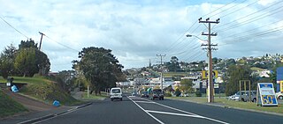
English: The main road on
Whangaparaoa Peninsula in
Auckland,
New Zealand. Coordinates are approximate. |
| Date | |
| Source | Self-photographed |
| Author | Ingolfson |
| Camera location |
| View this and other nearby images on: OpenStreetMap |
|
|---|
Licensing
| I, the copyright holder of this work, release this work into the
public domain. This applies worldwide. In some countries this may not be legally possible; if so: I grant anyone the right to use this work for any purpose, without any conditions, unless such conditions are required by law. |
File history
Click on a date/time to view the file as it appeared at that time.
| Date/Time | Thumbnail | Dimensions | User | Comment | |
|---|---|---|---|---|---|
| current | 21:09, 29 December 2010 |
| 2,000 × 880 (1.04 MB) | Ingolfson | == {{int:filedesc}} == {{Information |Description={{en|The main road on Whangaparoa Peninsula in Auckland, New Zealand.}} |Source={{own}} (Own picture). |Date=2010 |Author=Uploader. |Permi |
File usage
The following pages on the English Wikipedia use this file (pages on other projects are not listed):
Global file usage
The following other wikis use this file:
- Usage on fr.wikipedia.org
- Usage on www.wikidata.org
Metadata
Size of this preview:
800 × 352 pixels. Other resolutions:
320 × 141 pixels |
640 × 282 pixels |
1,024 × 451 pixels |
2,000 × 880 pixels.
Original file (2,000 × 880 pixels, file size: 1.04 MB, MIME type: image/jpeg)
| This is a file from the
Wikimedia Commons. Information from its
description page there is shown below. Commons is a freely licensed media file repository. You can help. |
Summary
| Description |
English: The main road on
Whangaparaoa Peninsula in
Auckland,
New Zealand. Coordinates are approximate. |
| Date | |
| Source | Self-photographed |
| Author | Ingolfson |
| Camera location |
| View this and other nearby images on: OpenStreetMap |
|
|---|
Licensing
| I, the copyright holder of this work, release this work into the
public domain. This applies worldwide. In some countries this may not be legally possible; if so: I grant anyone the right to use this work for any purpose, without any conditions, unless such conditions are required by law. |
File history
Click on a date/time to view the file as it appeared at that time.
| Date/Time | Thumbnail | Dimensions | User | Comment | |
|---|---|---|---|---|---|
| current | 21:09, 29 December 2010 |
| 2,000 × 880 (1.04 MB) | Ingolfson | == {{int:filedesc}} == {{Information |Description={{en|The main road on Whangaparoa Peninsula in Auckland, New Zealand.}} |Source={{own}} (Own picture). |Date=2010 |Author=Uploader. |Permi |
File usage
The following pages on the English Wikipedia use this file (pages on other projects are not listed):
Global file usage
The following other wikis use this file:
- Usage on fr.wikipedia.org
- Usage on www.wikidata.org