
Original file (SVG file, nominally 1,425 × 995 pixels, file size: 1.49 MB)
| This is a file from the
Wikimedia Commons. Information from its
description page there is shown below. Commons is a freely licensed media file repository. You can help. |
| Description |
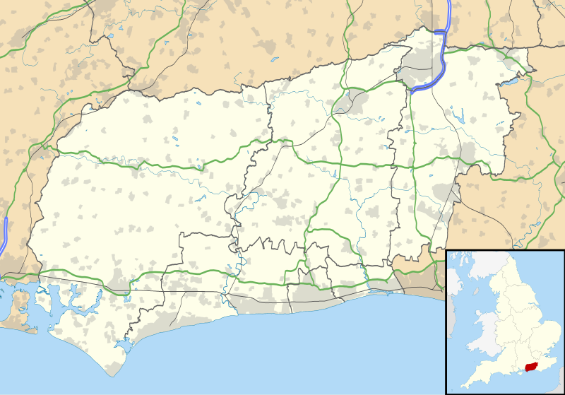
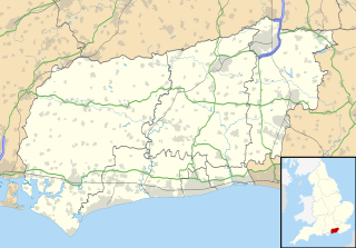
Map of West Sussex, UK with the following information shown:
Equirectangular map projection on WGS 84 datum, with N/S stretched 155% Geographic limits:
|
| Date | |
| Source |
|
| Author | Nilfanion, created using Ordnance Survey data |
| Permission ( Reusing this file) |
This file is licensed under the
Creative Commons
Attribution-Share Alike 3.0 Unported license. Attribution: Contains Ordnance Survey data © Crown copyright and database right
|
| Other versions | File:West Sussex UK district map (blank).svg - Blank map |
| SVG development |
.svg)
File history
Click on a date/time to view the file as it appeared at that time.
| Date/Time | Thumbnail | Dimensions | User | Comment | |
|---|---|---|---|---|---|
| current | 19:18, 26 September 2010 |
| 1,425 × 995 (1.49 MB) | Nilfanion | {{Information |Description=Map of West Sussex, UK with the following information shown: *Administrative borders *Coastline, lakes and rivers *Roads and railways *Urban areas Equirectangular map projection on WGS 84 datum, with N/S stret |
File usage
More than 100 pages use this file. The following list shows the first 100 pages that use this file only. A full list is available.
- Adversane
- Albourne
- Aldingbourne
- Aldwick
- Amberley, West Sussex
- Amberley Museum & Heritage Centre
- Angmering
- Apuldram
- Ardingly
- Arundel
- Arundel Cathedral
- Ashington, West Sussex
- Ashurst, West Sussex
- Ashurst Wood
- Balcombe
- Barlavington
- Barnham, West Sussex
- Bepton
- Bersted
- Bewbush
- Bignor
- Billingshurst
- Bognor Regis
- Bosham
- Boxgrove
- Bramber
- Brighton City Airport
- Broadfield, West Sussex
- Burgess Hill
- Chichester
- Chichester Cathedral
- Chichester Cross
- Clapham, West Sussex
- Coolham
- Cowdray House
- Cuckfield
- Dial Post
- Earnley
- East Grinstead
- Elmer, West Sussex
- Felpham
- Fernhurst
- Findon, West Sussex
- Fishbourne Roman Palace
- Furnace Green
- Gatwick Airport
- Gatwick Airport railway station
- Goring-by-Sea
- Gossops Green
- Hassocks
- Haywards Heath
- Henfield
- Horsted Keynes
- Hurstpierpoint
- Ifield, West Sussex
- Lancing, West Sussex
- Langley Green, West Sussex
- List of places in West Sussex
- Littlehampton
- Lyminster
- Maidenbower
- Mannings Heath
- Manor Royal
- Middleton-on-Sea
- Midhurst
- North Horsham
- Northgate, West Sussex
- Pagham
- Pease Pottage
- Petworth
- Poling, West Sussex
- Pound Hill
- Pulborough
- RAF Tangmere
- Rustington
- Saint Hill Manor
- Selsey
- Shoreham-by-Sea
- Slindon
- Small Dole
- Sompting
- Southgate, West Sussex
- Southwater
- Southwick, West Sussex
- Standen
- Steyning
- Storrington
- Storrington and Sullington
- Three Bridges, West Sussex
- Tilgate
- Turners Hill
- Uppark
- WWT Arundel
- Wakehurst Place
- Washington, West Sussex
- West Green, West Sussex
- West Hoathly
- West Tarring
- Westbourne, West Sussex
- Wick, West Sussex
View more links to this file.
Global file usage
The following other wikis use this file:
- Usage on ar.wikipedia.org
- Usage on bg.wikipedia.org
- Usage on ceb.wikipedia.org
- Usage on en.wikinews.org
- Usage on es.wikipedia.org
- Aeropuerto de Londres-Gatwick
- Crawley
- Chichester
- Plantilla:Mapa de localización de Sussex Occidental
- Littlehampton
- Horsham
- Walberton
- Haywards Heath
- Abingworth
- Henfield
- Easebourne
- Coldwaltham
- Barns Green
- Billingshurst
- Ardingly
- Copthorne
- Cuckfield
- East Grinstead
- East Wittering
- Amberley
- Birdham
- Balcombe
- Ashington (Sussex Occidental)
- Bosham
- Bolney
- Thorney Island (Sussex Occidental)
- Runcton
- Scayne's Hill
- Rusper
- Selsey
- Handcross
- Hurstpierpoint
- Hunston
- Kirdford
- Ifold
- Cowfold
- Crawley Down
- Fernhurst
- Findon
- Fishbourne
- Fittleworth
- Graffham
- Ford (Sussex Occidental)
- Broadbridge Heath
- Christ's Hospital
View more global usage of this file.
Metadata
Original file (SVG file, nominally 1,425 × 995 pixels, file size: 1.49 MB)
| This is a file from the
Wikimedia Commons. Information from its
description page there is shown below. Commons is a freely licensed media file repository. You can help. |
| Description |
Map of West Sussex, UK with the following information shown:
Equirectangular map projection on WGS 84 datum, with N/S stretched 155% Geographic limits:
|
| Date | |
| Source |
|
| Author | Nilfanion, created using Ordnance Survey data |
| Permission ( Reusing this file) |
This file is licensed under the
Creative Commons
Attribution-Share Alike 3.0 Unported license. Attribution: Contains Ordnance Survey data © Crown copyright and database right
|
| Other versions | File:West Sussex UK district map (blank).svg - Blank map |
| SVG development |
File history
Click on a date/time to view the file as it appeared at that time.
| Date/Time | Thumbnail | Dimensions | User | Comment | |
|---|---|---|---|---|---|
| current | 19:18, 26 September 2010 |
| 1,425 × 995 (1.49 MB) | Nilfanion | {{Information |Description=Map of West Sussex, UK with the following information shown: *Administrative borders *Coastline, lakes and rivers *Roads and railways *Urban areas Equirectangular map projection on WGS 84 datum, with N/S stret |
File usage
More than 100 pages use this file. The following list shows the first 100 pages that use this file only. A full list is available.
- Adversane
- Albourne
- Aldingbourne
- Aldwick
- Amberley, West Sussex
- Amberley Museum & Heritage Centre
- Angmering
- Apuldram
- Ardingly
- Arundel
- Arundel Cathedral
- Ashington, West Sussex
- Ashurst, West Sussex
- Ashurst Wood
- Balcombe
- Barlavington
- Barnham, West Sussex
- Bepton
- Bersted
- Bewbush
- Bignor
- Billingshurst
- Bognor Regis
- Bosham
- Boxgrove
- Bramber
- Brighton City Airport
- Broadfield, West Sussex
- Burgess Hill
- Chichester
- Chichester Cathedral
- Chichester Cross
- Clapham, West Sussex
- Coolham
- Cowdray House
- Cuckfield
- Dial Post
- Earnley
- East Grinstead
- Elmer, West Sussex
- Felpham
- Fernhurst
- Findon, West Sussex
- Fishbourne Roman Palace
- Furnace Green
- Gatwick Airport
- Gatwick Airport railway station
- Goring-by-Sea
- Gossops Green
- Hassocks
- Haywards Heath
- Henfield
- Horsted Keynes
- Hurstpierpoint
- Ifield, West Sussex
- Lancing, West Sussex
- Langley Green, West Sussex
- List of places in West Sussex
- Littlehampton
- Lyminster
- Maidenbower
- Mannings Heath
- Manor Royal
- Middleton-on-Sea
- Midhurst
- North Horsham
- Northgate, West Sussex
- Pagham
- Pease Pottage
- Petworth
- Poling, West Sussex
- Pound Hill
- Pulborough
- RAF Tangmere
- Rustington
- Saint Hill Manor
- Selsey
- Shoreham-by-Sea
- Slindon
- Small Dole
- Sompting
- Southgate, West Sussex
- Southwater
- Southwick, West Sussex
- Standen
- Steyning
- Storrington
- Storrington and Sullington
- Three Bridges, West Sussex
- Tilgate
- Turners Hill
- Uppark
- WWT Arundel
- Wakehurst Place
- Washington, West Sussex
- West Green, West Sussex
- West Hoathly
- West Tarring
- Westbourne, West Sussex
- Wick, West Sussex
View more links to this file.
Global file usage
The following other wikis use this file:
- Usage on ar.wikipedia.org
- Usage on bg.wikipedia.org
- Usage on ceb.wikipedia.org
- Usage on en.wikinews.org
- Usage on es.wikipedia.org
- Aeropuerto de Londres-Gatwick
- Crawley
- Chichester
- Plantilla:Mapa de localización de Sussex Occidental
- Littlehampton
- Horsham
- Walberton
- Haywards Heath
- Abingworth
- Henfield
- Easebourne
- Coldwaltham
- Barns Green
- Billingshurst
- Ardingly
- Copthorne
- Cuckfield
- East Grinstead
- East Wittering
- Amberley
- Birdham
- Balcombe
- Ashington (Sussex Occidental)
- Bosham
- Bolney
- Thorney Island (Sussex Occidental)
- Runcton
- Scayne's Hill
- Rusper
- Selsey
- Handcross
- Hurstpierpoint
- Hunston
- Kirdford
- Ifold
- Cowfold
- Crawley Down
- Fernhurst
- Findon
- Fishbourne
- Fittleworth
- Graffham
- Ford (Sussex Occidental)
- Broadbridge Heath
- Christ's Hospital
View more global usage of this file.