
Size of this PNG preview of this SVG file:
800 × 547 pixels. Other resolutions:
320 × 219 pixels |
640 × 437 pixels |
1,024 × 700 pixels |
1,280 × 875 pixels |
2,560 × 1,750 pixels |
1,425 × 974 pixels.
Original file (SVG file, nominally 1,425 × 974 pixels, file size: 720 KB)
| This is a file from the
Wikimedia Commons. Information from its
description page there is shown below. Commons is a freely licensed media file repository. You can help. |
.svg)
| Description |
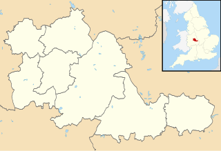
Map of the West Midlands, UK with districts shown. Equirectangular map projection on WGS 84 datum, with N/S stretched 160% Geographic limits:
|
| Date | |
| Source | Ordnance Survey OpenData. Most data from Boundary-Line product. Lake data from Meridian 2 product. Inset derived from England location map.svg by Spischot. |
| Author | Nilfanion, created using Ordnance Survey data |
| Permission ( Reusing this file) |
This file is licensed under the
Creative Commons
Attribution-Share Alike 3.0 Unported license. Attribution: Contains Ordnance Survey data © Crown copyright and database right
|
| Annotations | This image is annotated: View the annotations at Commons |
File history
Click on a date/time to view the file as it appeared at that time.
| Date/Time | Thumbnail | Dimensions | User | Comment | |
|---|---|---|---|---|---|
| current | 08:21, 22 August 2010 |
| 1,425 × 974 (720 KB) | Nilfanion | +inset, water colour tweak |
| 23:58, 16 July 2010 |
 | 1,425 × 974 (366 KB) | Nilfanion | {{Information |Description=Map of the West Midlands, UK with districts shown. Equirectangular map projection on WGS 84 datum, with N/S stretched 160% Geographic limits: *West: 2.22W *East: 1.40W *North: 52.68N *South: 52.33N |Source= |
File usage
The following pages on the English Wikipedia use this file (pages on other projects are not listed):
Global file usage
The following other wikis use this file:
- Usage on ast.wikipedia.org
- Usage on ca.wikipedia.org
- Usage on de.wikipedia.org
- Villa Park
- Birmingham Airport
- Stourbridge
- Coventry Building Society Arena
- St. Andrew’s Stadium
- The Hawthorns
- Molineux Stadium
- Bescot Stadium
- Vorlage:Positionskarte England West Midlands
- Utilita Arena Birmingham
- Meriden (West Midlands)
- SkyDome Arena
- New Cross Hospital
- Alexander Stadium
- Resorts World Arena
- Usage on es.wikipedia.org
.svg)
Size of this PNG preview of this SVG file:
800 × 547 pixels. Other resolutions:
320 × 219 pixels |
640 × 437 pixels |
1,024 × 700 pixels |
1,280 × 875 pixels |
2,560 × 1,750 pixels |
1,425 × 974 pixels.
Original file (SVG file, nominally 1,425 × 974 pixels, file size: 720 KB)
| This is a file from the
Wikimedia Commons. Information from its
description page there is shown below. Commons is a freely licensed media file repository. You can help. |
| Description |
Map of the West Midlands, UK with districts shown. Equirectangular map projection on WGS 84 datum, with N/S stretched 160% Geographic limits:
|
| Date | |
| Source | Ordnance Survey OpenData. Most data from Boundary-Line product. Lake data from Meridian 2 product. Inset derived from England location map.svg by Spischot. |
| Author | Nilfanion, created using Ordnance Survey data |
| Permission ( Reusing this file) |
This file is licensed under the
Creative Commons
Attribution-Share Alike 3.0 Unported license. Attribution: Contains Ordnance Survey data © Crown copyright and database right
|
| Annotations | This image is annotated: View the annotations at Commons |
File history
Click on a date/time to view the file as it appeared at that time.
| Date/Time | Thumbnail | Dimensions | User | Comment | |
|---|---|---|---|---|---|
| current | 08:21, 22 August 2010 |
| 1,425 × 974 (720 KB) | Nilfanion | +inset, water colour tweak |
| 23:58, 16 July 2010 |
| 1,425 × 974 (366 KB) | Nilfanion | {{Information |Description=Map of the West Midlands, UK with districts shown. Equirectangular map projection on WGS 84 datum, with N/S stretched 160% Geographic limits: *West: 2.22W *East: 1.40W *North: 52.68N *South: 52.33N |Source= |
File usage
The following pages on the English Wikipedia use this file (pages on other projects are not listed):
Global file usage
The following other wikis use this file:
- Usage on ast.wikipedia.org
- Usage on ca.wikipedia.org
- Usage on de.wikipedia.org
- Villa Park
- Birmingham Airport
- Stourbridge
- Coventry Building Society Arena
- St. Andrew’s Stadium
- The Hawthorns
- Molineux Stadium
- Bescot Stadium
- Vorlage:Positionskarte England West Midlands
- Utilita Arena Birmingham
- Meriden (West Midlands)
- SkyDome Arena
- New Cross Hospital
- Alexander Stadium
- Resorts World Arena
- Usage on es.wikipedia.org