
Original file (SVG file, nominally 1,042 × 1,266 pixels, file size: 2.18 MB)
| This is a file from the
Wikimedia Commons. Information from its
description page there is shown below. Commons is a freely licensed media file repository. You can help. |
| Description |
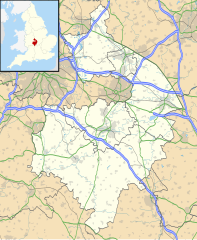
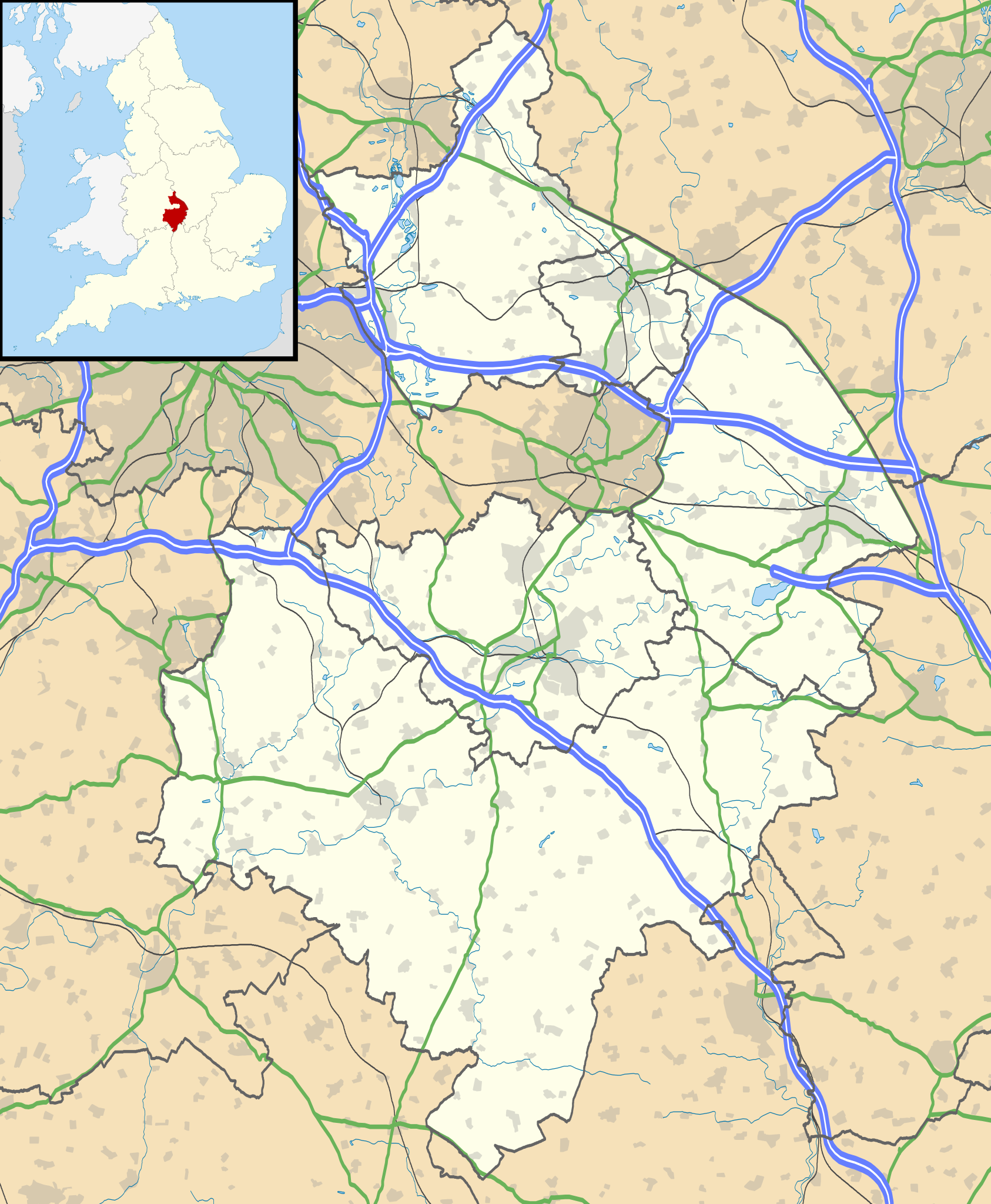
Map of Warwickshire, UK with the following information shown:
Equirectangular map projection on WGS 84 datum, with N/S stretched 160% Geographic limits:
|
| Date | |
| Source |
|
| Author | Nilfanion, created using Ordnance Survey data |
| Permission ( Reusing this file) |
This file is licensed under the
Creative Commons
Attribution-Share Alike 3.0 Unported license. Attribution: Contains Ordnance Survey data © Crown copyright and database right
|
| Other versions | File:Warwickshire UK district map (blank).svg - Blank map |
.svg)
File history
Click on a date/time to view the file as it appeared at that time.
| Date/Time | Thumbnail | Dimensions | User | Comment | |
|---|---|---|---|---|---|
| current | 19:17, 26 September 2010 |
| 1,042 × 1,266 (2.18 MB) | Nilfanion | {{Information |Description=Map of Warwickshire, UK with the following information shown: *Administrative borders *Coastline, lakes and rivers *Roads and railways *Urban areas Equirectangular map projection on WGS 84 datum, with N/S str |
File usage
More than 100 pages use this file. The following list shows the first 100 pages that use this file only. A full list is available.
- Abbot's Salford
- Admington
- Alcester
- Alderminster
- Ansley, Warwickshire
- Ansty, Warwickshire
- Arrow, Warwickshire
- Ashow
- Astley, Warwickshire
- Aston Cantlow
- Atherstone
- Atherstone on Stour
- Austrey, Warwickshire
- Baddesley Ensor
- Battle of Edgehill
- Bedworth
- Bidford-on-Avon
- Bilton, Warwickshire
- Binley Woods
- Bodymoor Heath
- Bourton-on-Dunsmore
- Brandon, Warwickshire
- Brinklow
- Broadwell, Warwickshire
- Brownsover
- Bulkington
- Burton Green
- Charlecote Park
- Coleshill, Warwickshire
- Combe Fields
- Compton Wynyates
- Corley services
- Coughton Court
- Coventry Airport
- Curdworth
- Draycote
- Dunchurch
- Edge Hill, Warwickshire
- Flecknoe
- Gaydon
- Great Alne
- Harborough Magna
- Henley-in-Arden
- Hillmorton
- Kenilworth
- Kenilworth Castle
- Kineton
- Kingsbury, Warwickshire
- Leamington Spa
- Leek Wootton
- Lillington, Warwickshire
- List of places in Warwickshire
- Long Compton
- Long Lawford
- Lord Leycester Hospital
- Mancetter
- Monks Kirby
- Napton on the Hill
- New Bilton
- Newbold-on-Avon
- Newton, Warwickshire
- Newton Regis
- No Man's Heath, Warwickshire
- Nuneaton
- Oxhill, Warwickshire
- Polesworth
- Princethorpe
- RAF Gaydon
- Radford Semele
- Radway
- Rugby, Warwickshire
- Rugby Radio Station
- Ryton-on-Dunsmore
- Shilton, Warwickshire
- Shipston-on-Stour
- Southam
- Stoneleigh, Warwickshire
- Stratford-upon-Avon
- Stretton-on-Dunsmore
- Stretton-under-Fosse
- Studley, Warwickshire
- Thurlaston, Warwickshire
- Ullenhall
- Walton, Warwickshire
- Warmington, Warwickshire
- Warwick
- Warwick Castle
- Warwickshire
- Water Orton
- Welford-on-Avon
- Wellesbourne
- Wellesbourne Watermill
- Whitnash
- Wibtoft
- Willey, Warwickshire
- Willoughby, Warwickshire
- Wilmcote
- Withybrook
- Wolfhampcote
- Wolston
View more links to this file.
Global file usage
The following other wikis use this file:
- Usage on ar.wikipedia.org
- Usage on bg.wikipedia.org
- Usage on ceb.wikipedia.org
- Usage on es.wikipedia.org
- Warwick
- Stratford-upon-Avon
- Rugby (Warwickshire)
- Nuneaton
- Plantilla:Mapa de localización de Warwickshire
- Ansley (Warwickshire)
- Arley (Warwickshire)
- Astley (Warwickshire)
- Water Orton
- Baxterley
- Baddesley Ensor
- Austrey
- Atherstone
- Wishaw (Warwickshire)
- Coleshill (Warwickshire)
- Caldecote (Warwickshire)
- Wolston
- Bentley (Warwickshire)
- Merevale
- Kingsbury (Warwickshire)
- Alcester
- Alderminster
- Atherstone on Stour
- Harbury
- Royal Leamington Spa
- Broom (Warwickshire)
- Bubbenhall
- Hurley (Warwickshire)
- Bulkington
- Curdworth
- Kineton
- Claverdon
- Cawston (Warwickshire)
- Aspley Heath
- Dunchurch
- Barford (Warwickshire)
- Bearley
- Bedworth
- Earlswood
- Henley-in-Arden
- Bidford-on-Avon
- Bishop's Itchington
- Binley Woods
- Bramcote
- Fillongley
View more global usage of this file.
Metadata
Original file (SVG file, nominally 1,042 × 1,266 pixels, file size: 2.18 MB)
| This is a file from the
Wikimedia Commons. Information from its
description page there is shown below. Commons is a freely licensed media file repository. You can help. |
| Description |
Map of Warwickshire, UK with the following information shown:
Equirectangular map projection on WGS 84 datum, with N/S stretched 160% Geographic limits:
|
| Date | |
| Source |
|
| Author | Nilfanion, created using Ordnance Survey data |
| Permission ( Reusing this file) |
This file is licensed under the
Creative Commons
Attribution-Share Alike 3.0 Unported license. Attribution: Contains Ordnance Survey data © Crown copyright and database right
|
| Other versions | File:Warwickshire UK district map (blank).svg - Blank map |
File history
Click on a date/time to view the file as it appeared at that time.
| Date/Time | Thumbnail | Dimensions | User | Comment | |
|---|---|---|---|---|---|
| current | 19:17, 26 September 2010 |
| 1,042 × 1,266 (2.18 MB) | Nilfanion | {{Information |Description=Map of Warwickshire, UK with the following information shown: *Administrative borders *Coastline, lakes and rivers *Roads and railways *Urban areas Equirectangular map projection on WGS 84 datum, with N/S str |
File usage
More than 100 pages use this file. The following list shows the first 100 pages that use this file only. A full list is available.
- Abbot's Salford
- Admington
- Alcester
- Alderminster
- Ansley, Warwickshire
- Ansty, Warwickshire
- Arrow, Warwickshire
- Ashow
- Astley, Warwickshire
- Aston Cantlow
- Atherstone
- Atherstone on Stour
- Austrey, Warwickshire
- Baddesley Ensor
- Battle of Edgehill
- Bedworth
- Bidford-on-Avon
- Bilton, Warwickshire
- Binley Woods
- Bodymoor Heath
- Bourton-on-Dunsmore
- Brandon, Warwickshire
- Brinklow
- Broadwell, Warwickshire
- Brownsover
- Bulkington
- Burton Green
- Charlecote Park
- Coleshill, Warwickshire
- Combe Fields
- Compton Wynyates
- Corley services
- Coughton Court
- Coventry Airport
- Curdworth
- Draycote
- Dunchurch
- Edge Hill, Warwickshire
- Flecknoe
- Gaydon
- Great Alne
- Harborough Magna
- Henley-in-Arden
- Hillmorton
- Kenilworth
- Kenilworth Castle
- Kineton
- Kingsbury, Warwickshire
- Leamington Spa
- Leek Wootton
- Lillington, Warwickshire
- List of places in Warwickshire
- Long Compton
- Long Lawford
- Lord Leycester Hospital
- Mancetter
- Monks Kirby
- Napton on the Hill
- New Bilton
- Newbold-on-Avon
- Newton, Warwickshire
- Newton Regis
- No Man's Heath, Warwickshire
- Nuneaton
- Oxhill, Warwickshire
- Polesworth
- Princethorpe
- RAF Gaydon
- Radford Semele
- Radway
- Rugby, Warwickshire
- Rugby Radio Station
- Ryton-on-Dunsmore
- Shilton, Warwickshire
- Shipston-on-Stour
- Southam
- Stoneleigh, Warwickshire
- Stratford-upon-Avon
- Stretton-on-Dunsmore
- Stretton-under-Fosse
- Studley, Warwickshire
- Thurlaston, Warwickshire
- Ullenhall
- Walton, Warwickshire
- Warmington, Warwickshire
- Warwick
- Warwick Castle
- Warwickshire
- Water Orton
- Welford-on-Avon
- Wellesbourne
- Wellesbourne Watermill
- Whitnash
- Wibtoft
- Willey, Warwickshire
- Willoughby, Warwickshire
- Wilmcote
- Withybrook
- Wolfhampcote
- Wolston
View more links to this file.
Global file usage
The following other wikis use this file:
- Usage on ar.wikipedia.org
- Usage on bg.wikipedia.org
- Usage on ceb.wikipedia.org
- Usage on es.wikipedia.org
- Warwick
- Stratford-upon-Avon
- Rugby (Warwickshire)
- Nuneaton
- Plantilla:Mapa de localización de Warwickshire
- Ansley (Warwickshire)
- Arley (Warwickshire)
- Astley (Warwickshire)
- Water Orton
- Baxterley
- Baddesley Ensor
- Austrey
- Atherstone
- Wishaw (Warwickshire)
- Coleshill (Warwickshire)
- Caldecote (Warwickshire)
- Wolston
- Bentley (Warwickshire)
- Merevale
- Kingsbury (Warwickshire)
- Alcester
- Alderminster
- Atherstone on Stour
- Harbury
- Royal Leamington Spa
- Broom (Warwickshire)
- Bubbenhall
- Hurley (Warwickshire)
- Bulkington
- Curdworth
- Kineton
- Claverdon
- Cawston (Warwickshire)
- Aspley Heath
- Dunchurch
- Barford (Warwickshire)
- Bearley
- Bedworth
- Earlswood
- Henley-in-Arden
- Bidford-on-Avon
- Bishop's Itchington
- Binley Woods
- Bramcote
- Fillongley
View more global usage of this file.