
Original file (SVG file, nominally 2,003 × 2,195 pixels, file size: 443 KB)
| This is a file from the
Wikimedia Commons. Information from its
description page there is shown below. Commons is a freely licensed media file repository. You can help. |
Summary
| Description |
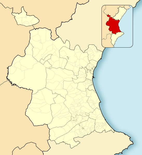
English: Location map of
Province of Valencia
Equirectangular projection, N/S stretching 130 %. Geographic limits of the map:
Español: Mapa de localización de la
Provincia de Valencia
Proyección equirrectangular, N/S estirada 130 %. Límites geográficos del mapa:
|
|
| Date | ||
| Source | Own work based on: EspañaLoc.svg | |
| Author | Miguillen | |
| SVG development | This W3C-invalid
locator map was created with
Adobe Illustrator, and with Inkscape.
|
Licensing
- You are free:
- to share – to copy, distribute and transmit the work
- to remix – to adapt the work
- Under the following conditions:
- attribution – You must give appropriate credit, provide a link to the license, and indicate if changes were made. You may do so in any reasonable manner, but not in any way that suggests the licensor endorses you or your use.
- share alike – If you remix, transform, or build upon the material, you must distribute your contributions under the same or compatible license as the original.
File history
Click on a date/time to view the file as it appeared at that time.
| Date/Time | Thumbnail | Dimensions | User | Comment | |
|---|---|---|---|---|---|
| current | 15:32, 8 December 2010 |
| 2,003 × 2,195 (443 KB) | Miguillen | colores |
| 10:47, 24 November 2010 |
 | 2,003 × 2,195 (443 KB) | Miguillen | límites | |
| 10:36, 24 November 2010 |
 | 2,003 × 2,195 (531 KB) | Miguillen | Diferencio terriotorio CCAA y añado mapa de ubicación en ella | |
| 16:00, 16 November 2010 |
 | 2,003 × 2,195 (407 KB) | Miguillen | trazos | |
| 15:55, 16 November 2010 |
 | 2,003 × 2,195 (382 KB) | Miguillen | == {{int:filedesc}} == {{Information |Description={{en|Location map of Province of Valencia}} Equirectangular projection, N/S stretching 130 %. Geographic limits of the map: * N: ° N * S: ° N * W: ° O * E: ° E {{es|Ma |
File usage
- Alcàsser
- Alfauir
- Algímia d'Alfara
- Barx
- Benifairó de la Valldigna
- Benigànim
- Burjassot
- Carcaixent
- Carlet
- Castellonet de la Conquesta
- Chera, Valencia
- Cofrentes
- Cueva de Bolomor
- Cullera
- Daimús
- Dos Aguas
- Foios
- La Font de la Figuera
- Llombai
- Mislata
- Mogente/Moixent
- Moncada, Valencia
- Ontinyent
- Paterna
- Primera División de Baloncesto
- Puerto de Sagunto
- Puçol
- Quart de Poblet
- Sagunto
- Salem, Valencia
- Simat de la Valldigna
- Sinarcas
- Tavernes de la Valldigna
- Torrent, Valencia
- Valencia History Museum
- Xeraco
- Xeresa
- Xirivella
- User:Ceahjlazco1882/Infobox settlement Sandbox
- Module:Location map/data/Spain Province of Valencia
- Module:Location map/data/Spain Province of Valencia/doc
Global file usage
The following other wikis use this file:
- Usage on ar.wikipedia.org
- Usage on ast.wikipedia.org
- Usage on ba.wikipedia.org
- Usage on bn.wikipedia.org
- Usage on ca.wikipedia.org
- Usage on ceb.wikipedia.org
- Usage on eo.wikipedia.org
- Torrent (Valencio)
- Ŝativo
- La Llosa de Ranes
- Oliva
- Tavernes de la Valldigna
- Cullera
- Sagunto
- Albaida
- Xeraco
- Ontinyent
- Sueca
- Chiva
- Albal
- València Estació del Nord (stacidomo)
- València Joaquín Sorolla (stacidomo)
- Gandia (stacidomo)
- Platja i Grau de Gandia (stacidomo)
- València-Sant Isidre (stacidomo)
- València-Cabanyal (stacidomo)
- València La Font de Sant Lluís (stacidomo)
- Cheste
- Cheste (stacidomo)
- Xirivella L'Alter (stacidomo)
- Xirivella
- Circuit Ricardo Tormo (stacidomo)
- Buñol
- Buñol (stacidomo)
- Chiva (stacidomo)
- Venta Mina-Siete Aguas (stacidomo)
- Utiel (stacidomo)
- Utiel
- Aldaia (stacidomo)
- Aldaia
- Siete Aguas (stacidomo)
- Siete Aguas
- Requena (stacidomo)
- Requena
- San Antonio de Requena (stacidomo)
- Loriguilla-Reva (stacidomo)
View more global usage of this file.
Metadata
Original file (SVG file, nominally 2,003 × 2,195 pixels, file size: 443 KB)
| This is a file from the
Wikimedia Commons. Information from its
description page there is shown below. Commons is a freely licensed media file repository. You can help. |
Summary
| Description |
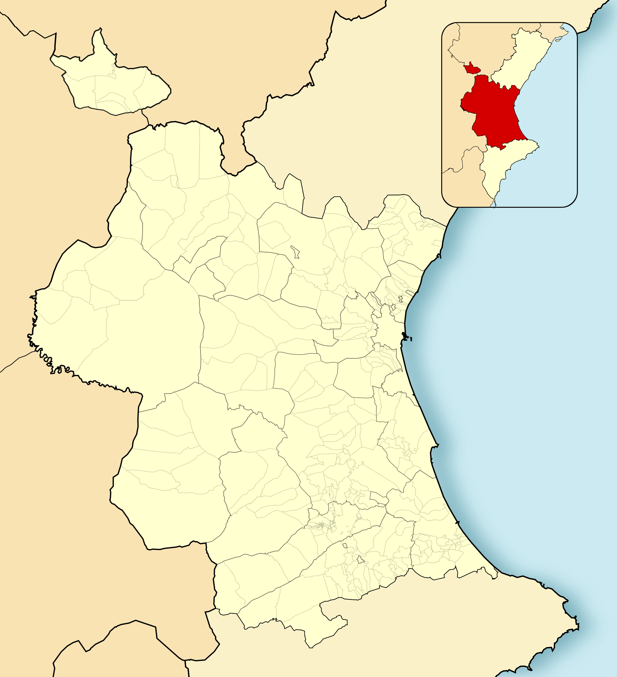
English: Location map of
Province of Valencia
Equirectangular projection, N/S stretching 130 %. Geographic limits of the map:
Español: Mapa de localización de la
Provincia de Valencia
Proyección equirrectangular, N/S estirada 130 %. Límites geográficos del mapa:
|
|
| Date | ||
| Source | Own work based on: EspañaLoc.svg | |
| Author | Miguillen | |
| SVG development | This W3C-invalid
locator map was created with
Adobe Illustrator, and with Inkscape.
|
Licensing
- You are free:
- to share – to copy, distribute and transmit the work
- to remix – to adapt the work
- Under the following conditions:
- attribution – You must give appropriate credit, provide a link to the license, and indicate if changes were made. You may do so in any reasonable manner, but not in any way that suggests the licensor endorses you or your use.
- share alike – If you remix, transform, or build upon the material, you must distribute your contributions under the same or compatible license as the original.
File history
Click on a date/time to view the file as it appeared at that time.
| Date/Time | Thumbnail | Dimensions | User | Comment | |
|---|---|---|---|---|---|
| current | 15:32, 8 December 2010 |
| 2,003 × 2,195 (443 KB) | Miguillen | colores |
| 10:47, 24 November 2010 |
| 2,003 × 2,195 (443 KB) | Miguillen | límites | |
| 10:36, 24 November 2010 |
| 2,003 × 2,195 (531 KB) | Miguillen | Diferencio terriotorio CCAA y añado mapa de ubicación en ella | |
| 16:00, 16 November 2010 |
| 2,003 × 2,195 (407 KB) | Miguillen | trazos | |
| 15:55, 16 November 2010 |
| 2,003 × 2,195 (382 KB) | Miguillen | == {{int:filedesc}} == {{Information |Description={{en|Location map of Province of Valencia}} Equirectangular projection, N/S stretching 130 %. Geographic limits of the map: * N: ° N * S: ° N * W: ° O * E: ° E {{es|Ma |
File usage
- Alcàsser
- Alfauir
- Algímia d'Alfara
- Barx
- Benifairó de la Valldigna
- Benigànim
- Burjassot
- Carcaixent
- Carlet
- Castellonet de la Conquesta
- Chera, Valencia
- Cofrentes
- Cueva de Bolomor
- Cullera
- Daimús
- Dos Aguas
- Foios
- La Font de la Figuera
- Llombai
- Mislata
- Mogente/Moixent
- Moncada, Valencia
- Ontinyent
- Paterna
- Primera División de Baloncesto
- Puerto de Sagunto
- Puçol
- Quart de Poblet
- Sagunto
- Salem, Valencia
- Simat de la Valldigna
- Sinarcas
- Tavernes de la Valldigna
- Torrent, Valencia
- Valencia History Museum
- Xeraco
- Xeresa
- Xirivella
- User:Ceahjlazco1882/Infobox settlement Sandbox
- Module:Location map/data/Spain Province of Valencia
- Module:Location map/data/Spain Province of Valencia/doc
Global file usage
The following other wikis use this file:
- Usage on ar.wikipedia.org
- Usage on ast.wikipedia.org
- Usage on ba.wikipedia.org
- Usage on bn.wikipedia.org
- Usage on ca.wikipedia.org
- Usage on ceb.wikipedia.org
- Usage on eo.wikipedia.org
- Torrent (Valencio)
- Ŝativo
- La Llosa de Ranes
- Oliva
- Tavernes de la Valldigna
- Cullera
- Sagunto
- Albaida
- Xeraco
- Ontinyent
- Sueca
- Chiva
- Albal
- València Estació del Nord (stacidomo)
- València Joaquín Sorolla (stacidomo)
- Gandia (stacidomo)
- Platja i Grau de Gandia (stacidomo)
- València-Sant Isidre (stacidomo)
- València-Cabanyal (stacidomo)
- València La Font de Sant Lluís (stacidomo)
- Cheste
- Cheste (stacidomo)
- Xirivella L'Alter (stacidomo)
- Xirivella
- Circuit Ricardo Tormo (stacidomo)
- Buñol
- Buñol (stacidomo)
- Chiva (stacidomo)
- Venta Mina-Siete Aguas (stacidomo)
- Utiel (stacidomo)
- Utiel
- Aldaia (stacidomo)
- Aldaia
- Siete Aguas (stacidomo)
- Siete Aguas
- Requena (stacidomo)
- Requena
- San Antonio de Requena (stacidomo)
- Loriguilla-Reva (stacidomo)
View more global usage of this file.