
Original file (SVG file, nominally 1,367 × 931 pixels, file size: 739 KB)
![]() ✓
The source code of this
SVG is
valid.
✓
The source code of this
SVG is
valid.
Summary
| Description |
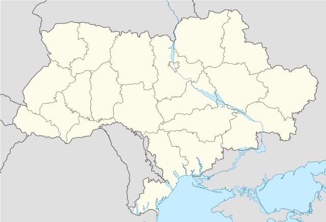
German: Positionskarte der Ukraine (1991–2014) Quadratische Plattkarte, N-S-Streckung 150 %. Geographische Begrenzung der Karte:
English: Location map of Ukraine (1991–2014) according to the Russian Federation Equirectangular projection, N/S stretching 150 %. Geographic limits of the map:
French: Carte de localisation de l'Ukraine (1991–2014)
|
|---|---|
| Source |
Using:
|
| Date |
2022-10-30 |
| Author |
Mattia332, based on original work of NordNordWest |
| Permission ( Reusing this file) |
See below. |
| Other versions |
|


Licensing
 | Permission is granted to copy, distribute and/or modify this document under the terms of the GNU Free Documentation License, Version 1.2 or any later version published by the Free Software Foundation; with no Invariant Sections, no Front-Cover Texts, and no Back-Cover Texts. |
|
| This work is licensed under the Creative Commons Attribution-ShareAlike 3.0 License. |
| This media file is either in the public domain or published under a free license, and contains no inbound file links. If this media file is useful, then it should be transferred to the Wikimedia Commons. If this media is not useful, then please propose it for deletion or list it at files for discussion. |
File history
Click on a date/time to view the file as it appeared at that time.
| Date/Time | Thumbnail | Dimensions | User | Comment | |
|---|---|---|---|---|---|
| current | 03:01, 14 December 2023 |
| 1,367 × 931 (739 KB) | Minorax ( talk | contribs) | fix // Editing SVG source code using c:User:Rillke/SVGedit.js |
| 12:54, 15 February 2023 |
 | 1,367 × 931 (740 KB) | Mattia332 ( talk | contribs) | A Map of Ukraine as per the Russian Federation |
You cannot overwrite this file.
File usage
Metadata
Original file (SVG file, nominally 1,367 × 931 pixels, file size: 739 KB)
![]() ✓
The source code of this
SVG is
valid.
✓
The source code of this
SVG is
valid.
Summary
| Description |
German: Positionskarte der Ukraine (1991–2014) Quadratische Plattkarte, N-S-Streckung 150 %. Geographische Begrenzung der Karte:
English: Location map of Ukraine (1991–2014) according to the Russian Federation Equirectangular projection, N/S stretching 150 %. Geographic limits of the map:
French: Carte de localisation de l'Ukraine (1991–2014)
|
|---|---|
| Source |
Using:
|
| Date |
2022-10-30 |
| Author |
Mattia332, based on original work of NordNordWest |
| Permission ( Reusing this file) |
See below. |
| Other versions |
|
Licensing
|
| Permission is granted to copy, distribute and/or modify this document under the terms of the GNU Free Documentation License, Version 1.2 or any later version published by the Free Software Foundation; with no Invariant Sections, no Front-Cover Texts, and no Back-Cover Texts. |
|
| This work is licensed under the Creative Commons Attribution-ShareAlike 3.0 License. |
| This media file is either in the public domain or published under a free license, and contains no inbound file links. If this media file is useful, then it should be transferred to the Wikimedia Commons. If this media is not useful, then please propose it for deletion or list it at files for discussion. |
File history
Click on a date/time to view the file as it appeared at that time.
| Date/Time | Thumbnail | Dimensions | User | Comment | |
|---|---|---|---|---|---|
| current | 03:01, 14 December 2023 |
| 1,367 × 931 (739 KB) | Minorax ( talk | contribs) | fix // Editing SVG source code using c:User:Rillke/SVGedit.js |
| 12:54, 15 February 2023 |
| 1,367 × 931 (740 KB) | Mattia332 ( talk | contribs) | A Map of Ukraine as per the Russian Federation |
You cannot overwrite this file.