Photos • Location


Size of this preview:
567 × 600 pixels. Other resolutions:
227 × 240 pixels |
454 × 480 pixels |
726 × 768 pixels |
968 × 1,024 pixels |
1,500 × 1,586 pixels.
Original file (1,500 × 1,586 pixels, file size: 1.22 MB, MIME type: image/jpeg)
| This is a file from the
Wikimedia Commons. Information from its
description page there is shown below. Commons is a freely licensed media file repository. You can help. |
| Description |
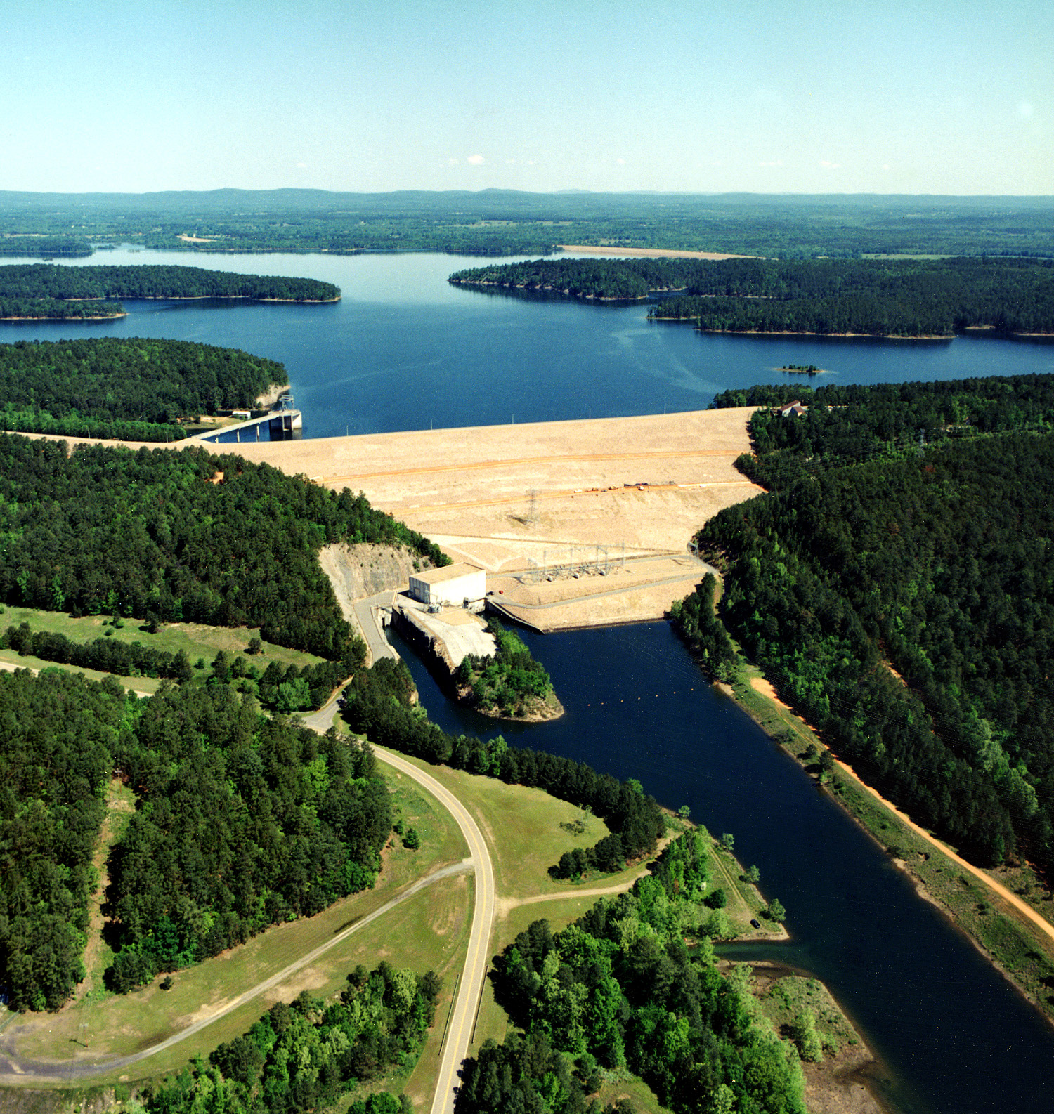
English: DeGray Dam and Lake on the Caddo River in
Hot Spring County, Arkansas.
|
|||
| Date | not specified or unknown | |||
| Source |
U.S. Army Corps of Engineers Digital Visual Library Image page Image description page Digital Visual Library home page |
|||
| Author | Alfred Dulaney, U.S. Army Corps of Engineers | |||
| Permission ( Reusing this file) |
|
| Camera location |
| View this and other nearby images on: OpenStreetMap |
|
|---|
[[Category:Hot Spring County, Arkansas|DeGray]
File history
Click on a date/time to view the file as it appeared at that time.
| Date/Time | Thumbnail | Dimensions | User | Comment | |
|---|---|---|---|---|---|
| current | 16:08, 7 April 2007 |
| 1,500 × 1,586 (1.22 MB) | DanMS | {{Information | Description = {{en|DeGray Dam and Lake on the Caddo River in Hot Spring County, Arkansas, USA. The dam is located approximately seven miles (11 km) north-northwest of Arkadelphia, Arkansas. The dam was completed in 1972 by the U.S. Army |
File usage
The following pages on the English Wikipedia use this file (pages on other projects are not listed):
Global file usage
The following other wikis use this file:
- Usage on en.wikivoyage.org
- Usage on kbp.wikipedia.org
- Usage on www.wikidata.org
Metadata
Size of this preview:
567 × 600 pixels. Other resolutions:
227 × 240 pixels |
454 × 480 pixels |
726 × 768 pixels |
968 × 1,024 pixels |
1,500 × 1,586 pixels.
Original file (1,500 × 1,586 pixels, file size: 1.22 MB, MIME type: image/jpeg)
| This is a file from the
Wikimedia Commons. Information from its
description page there is shown below. Commons is a freely licensed media file repository. You can help. |
| Description |
English: DeGray Dam and Lake on the Caddo River in
Hot Spring County, Arkansas.
|
|||
| Date | not specified or unknown | |||
| Source |
U.S. Army Corps of Engineers Digital Visual Library Image page Image description page Digital Visual Library home page |
|||
| Author | Alfred Dulaney, U.S. Army Corps of Engineers | |||
| Permission ( Reusing this file) |
|
| Camera location |
| View this and other nearby images on: OpenStreetMap |
|
|---|
[[Category:Hot Spring County, Arkansas|DeGray]
File history
Click on a date/time to view the file as it appeared at that time.
| Date/Time | Thumbnail | Dimensions | User | Comment | |
|---|---|---|---|---|---|
| current | 16:08, 7 April 2007 |
| 1,500 × 1,586 (1.22 MB) | DanMS | {{Information | Description = {{en|DeGray Dam and Lake on the Caddo River in Hot Spring County, Arkansas, USA. The dam is located approximately seven miles (11 km) north-northwest of Arkadelphia, Arkansas. The dam was completed in 1972 by the U.S. Army |
File usage
The following pages on the English Wikipedia use this file (pages on other projects are not listed):
Global file usage
The following other wikis use this file:
- Usage on en.wikivoyage.org
- Usage on kbp.wikipedia.org
- Usage on www.wikidata.org