No higher resolution available.
Tt-map.png (324 × 350 pixels, file size: 4 KB, MIME type: image/png)
| This is a file from the
Wikimedia Commons. Information from its
description page there is shown below. Commons is a freely licensed media file repository. You can help. |
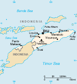
| Description | Map of East Timor (wp-EN). | |||
| Date | Unknown date | |||
| Source | Original map in the CIA World Factbook (wp-EN). | |||
| Author | CIA World Factbook | |||
| Permission ( Reusing this file) |
|
|||
| Other versions |
|

File history
Click on a date/time to view the file as it appeared at that time.
| Date/Time | Thumbnail | Dimensions | User | Comment | |
|---|---|---|---|---|---|
| current | 15:05, 13 March 2022 |
| 324 × 350 (4 KB) | Lojwe | Cropped 2 % horizontally, 1 % vertically using CropTool with precise mode. |
| 19:59, 5 March 2005 |
 | 330 × 355 (5 KB) | Alfio | CIA map of East Timor |
File usage
The following pages on the English Wikipedia use this file (pages on other projects are not listed):
Global file usage
The following other wikis use this file:
- Usage on ckb.wikipedia.org
- Usage on en.wikinews.org
- Usage on fa.wikipedia.org
- Usage on gl.wikipedia.org
- Usage on he.wikipedia.org
- Usage on hu.wikipedia.org
- Usage on id.wikipedia.org
- Usage on it.wikipedia.org
- Usage on jv.wikipedia.org
- Usage on map-bms.wikipedia.org
- Usage on mzn.wikipedia.org
- Usage on pap.wikipedia.org
- Usage on sv.wikipedia.org
- Usage on tr.wiktionary.org
- Usage on udm.wikipedia.org
- Usage on vi.wikipedia.org
Metadata
No higher resolution available.
Tt-map.png (324 × 350 pixels, file size: 4 KB, MIME type: image/png)
| This is a file from the
Wikimedia Commons. Information from its
description page there is shown below. Commons is a freely licensed media file repository. You can help. |
| Description | Map of East Timor (wp-EN). | |||
| Date | Unknown date | |||
| Source | Original map in the CIA World Factbook (wp-EN). | |||
| Author | CIA World Factbook | |||
| Permission ( Reusing this file) |
|
|||
| Other versions |
|
File history
Click on a date/time to view the file as it appeared at that time.
| Date/Time | Thumbnail | Dimensions | User | Comment | |
|---|---|---|---|---|---|
| current | 15:05, 13 March 2022 |
| 324 × 350 (4 KB) | Lojwe | Cropped 2 % horizontally, 1 % vertically using CropTool with precise mode. |
| 19:59, 5 March 2005 |
| 330 × 355 (5 KB) | Alfio | CIA map of East Timor |
File usage
The following pages on the English Wikipedia use this file (pages on other projects are not listed):
Global file usage
The following other wikis use this file:
- Usage on ckb.wikipedia.org
- Usage on en.wikinews.org
- Usage on fa.wikipedia.org
- Usage on gl.wikipedia.org
- Usage on he.wikipedia.org
- Usage on hu.wikipedia.org
- Usage on id.wikipedia.org
- Usage on it.wikipedia.org
- Usage on jv.wikipedia.org
- Usage on map-bms.wikipedia.org
- Usage on mzn.wikipedia.org
- Usage on pap.wikipedia.org
- Usage on sv.wikipedia.org
- Usage on tr.wiktionary.org
- Usage on udm.wikipedia.org
- Usage on vi.wikipedia.org