
Size of this PNG preview of this SVG file:
477 × 599 pixels. Other resolutions:
191 × 240 pixels |
382 × 480 pixels |
611 × 768 pixels |
815 × 1,024 pixels |
1,630 × 2,048 pixels |
1,034 × 1,299 pixels.
Original file (SVG file, nominally 1,034 × 1,299 pixels, file size: 1.67 MB)
| This is a file from the
Wikimedia Commons. Information from its
description page there is shown below. Commons is a freely licensed media file repository. You can help. |
Summary
.svg)
.svg)
.svg)
.svg)
.svg)
.svg)
.svg)

-en.svg)

.svg)
.svg)
.svg)

_(US48).svg)
_(small_islands_magnified)_(-mini_map_-rivers).svg)
.svg)
_(extra_close)_(US48).svg)
.svg)
_(zoom).svg)

.svg)


_(UNMIK).svg)
.svg)
_(disputed_hatched).svg)
_(claimed_and_disputed_hatched).svg)
.svg)
.svg)
_(%2Ball_claims_hatched).svg)

.svg)
_(shade).svg)
_(shade)_(special_marker).svg)
_(-mini_map).svg)
_(-mini_map).svg)
_(-mini_map).svg)


.svg)

.svg)
Licensing
I, the copyright holder of this work, hereby publish it under the following licenses:

|
Permission is granted to copy, distribute and/or modify this document under the terms of the GNU Free Documentation License, Version 1.2 or any later version published by the Free Software Foundation; with no Invariant Sections, no Front-Cover Texts, and no Back-Cover Texts. A copy of the license is included in the section entitled GNU Free Documentation License. |
This file is licensed under the
Creative Commons
Attribution-Share Alike 3.0 Unported license.
- You are free:
- to share – to copy, distribute and transmit the work
- to remix – to adapt the work
- Under the following conditions:
- attribution – You must give appropriate credit, provide a link to the license, and indicate if changes were made. You may do so in any reasonable manner, but not in any way that suggests the licensor endorses you or your use.
- share alike – If you remix, transform, or build upon the material, you must distribute your contributions under the same or compatible license as the original.
You may select the license of your choice.

|
I'd greatly appreciate, that you attribute this media file to Wikimedia Commons, if used outside Wikipedia or Commons. For use in publications such as books, newspapers, blogs, websites, please insert
here the following line:
|
File history
Click on a date/time to view the file as it appeared at that time.
| Date/Time | Thumbnail | Dimensions | User | Comment | |
|---|---|---|---|---|---|
| current | 18:07, 17 June 2011 |
| 1,034 × 1,299 (1.67 MB) | Foroa | Reverted to version as of 13:40, 17 June 2011 |
| 17:49, 17 June 2011 |
 | 1,034 × 1,299 (1.68 MB) | Gryffindor | Reverted to version as of 12:50, 17 June 2011 | |
| 13:40, 17 June 2011 |
 | 1,034 × 1,299 (1.67 MB) | TUBS | rv: [http://commons.wikimedia.org/wiki/User_talk:Gryffindor#File:Trentino-Alto_Adige_in_Italy.svg] | |
| 12:50, 17 June 2011 |
 | 1,034 × 1,299 (1.68 MB) | Gryffindor | Reverted to version as of 23:28, 15 June 2011 the depiction of the provinces is in order as they are de-facto regions | |
| 06:21, 16 June 2011 |
 | 1,034 × 1,299 (1.67 MB) | TUBS | Reverted to version as of 06:49, 14 June 2011. Please save as a new file. Borders shouldn't differ in that map series | |
| 23:28, 15 June 2011 |
 | 1,034 × 1,299 (1.68 MB) | Gryffindor | Reverted to version as of 20:15, 13 June 2011 both are autonomous provinces in an autonomous region, others do not have that | |
| 06:49, 14 June 2011 |
 | 1,034 × 1,299 (1.67 MB) | TUBS | Reverted to version as of 12:27, 7 March 2011: please give new filename and move to new category. doesn't make sense: other province borders aren' shown either | |
| 20:15, 13 June 2011 |
 | 1,034 × 1,299 (1.68 MB) | Kmusser | add province boundary | |
| 12:27, 7 March 2011 |
 | 1,034 × 1,299 (1.67 MB) | TUBS |
File usage
The following pages on the English Wikipedia use this file (pages on other projects are not listed):
Global file usage
The following other wikis use this file:
- Usage on als.wikipedia.org
- Usage on ar.wikipedia.org
- Usage on ast.wikipedia.org
- Usage on az.wikipedia.org
- Usage on bcl.wikipedia.org
- Usage on bg.wikipedia.org
- Usage on ca.wikipedia.org
- Usage on ceb.wikipedia.org
- Usage on co.wikipedia.org
- Usage on crh.wikipedia.org
- Usage on cs.wikipedia.org
- Usage on cy.wikipedia.org
- Usage on de.wikipedia.org
- Usage on de.wikivoyage.org
- Usage on diq.wikipedia.org
- Usage on el.wikipedia.org
- Usage on eo.wikivoyage.org
- Usage on fi.wikipedia.org
- Usage on frr.wikipedia.org
- Usage on fr.wikipedia.org
- Usage on fr.wiktionary.org
- Usage on ga.wikipedia.org
- Usage on gd.wikipedia.org
- Usage on gl.wikipedia.org
- Usage on ia.wikipedia.org
- Usage on id.wikipedia.org
- Usage on incubator.wikimedia.org
- Usage on it.wikipedia.org
- Usage on it.wikivoyage.org
- Usage on jam.wikipedia.org
- Usage on kab.wikipedia.org
- Usage on ko.wikipedia.org
- Usage on la.wikipedia.org
- Usage on lb.wikipedia.org
- Usage on lij.wikipedia.org
- Usage on lld.wikipedia.org
- Usage on lmo.wikipedia.org
- Usage on lv.wikipedia.org
View more global usage of this file.
Size of this PNG preview of this SVG file:
477 × 599 pixels. Other resolutions:
191 × 240 pixels |
382 × 480 pixels |
611 × 768 pixels |
815 × 1,024 pixels |
1,630 × 2,048 pixels |
1,034 × 1,299 pixels.
Original file (SVG file, nominally 1,034 × 1,299 pixels, file size: 1.67 MB)
| This is a file from the
Wikimedia Commons. Information from its
description page there is shown below. Commons is a freely licensed media file repository. You can help. |
Summary
| Description |
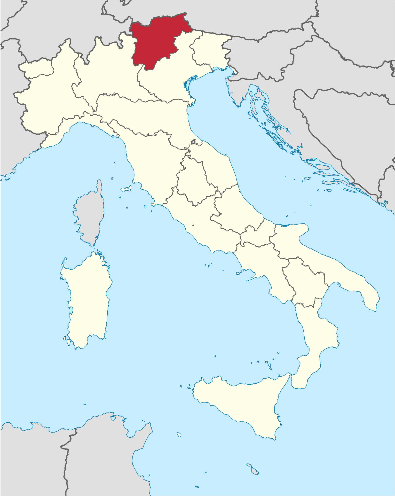
Deutsch: Lage der autonomen Region Trentino-Südtirol in
Italien.
English: Location of the autonomous region Trentino-South Tyrol in northern
Italy. |
||||||||||||||||||||||||||||||||||||
| Date | |||||||||||||||||||||||||||||||||||||
| Source | Own work | ||||||||||||||||||||||||||||||||||||
| Author |
TUBS
|
||||||||||||||||||||||||||||||||||||
| Other versions |
 |
||||||||||||||||||||||||||||||||||||
| SVG development | |||||||||||||||||||||||||||||||||||||
Licensing
I, the copyright holder of this work, hereby publish it under the following licenses:
|
|
Permission is granted to copy, distribute and/or modify this document under the terms of the GNU Free Documentation License, Version 1.2 or any later version published by the Free Software Foundation; with no Invariant Sections, no Front-Cover Texts, and no Back-Cover Texts. A copy of the license is included in the section entitled GNU Free Documentation License. |
This file is licensed under the
Creative Commons
Attribution-Share Alike 3.0 Unported license.
- You are free:
- to share – to copy, distribute and transmit the work
- to remix – to adapt the work
- Under the following conditions:
- attribution – You must give appropriate credit, provide a link to the license, and indicate if changes were made. You may do so in any reasonable manner, but not in any way that suggests the licensor endorses you or your use.
- share alike – If you remix, transform, or build upon the material, you must distribute your contributions under the same or compatible license as the original.
You may select the license of your choice.
|
|
I'd greatly appreciate, that you attribute this media file to Wikimedia Commons, if used outside Wikipedia or Commons. For use in publications such as books, newspapers, blogs, websites, please insert
here the following line:
|
File history
Click on a date/time to view the file as it appeared at that time.
| Date/Time | Thumbnail | Dimensions | User | Comment | |
|---|---|---|---|---|---|
| current | 18:07, 17 June 2011 |
| 1,034 × 1,299 (1.67 MB) | Foroa | Reverted to version as of 13:40, 17 June 2011 |
| 17:49, 17 June 2011 |
| 1,034 × 1,299 (1.68 MB) | Gryffindor | Reverted to version as of 12:50, 17 June 2011 | |
| 13:40, 17 June 2011 |
| 1,034 × 1,299 (1.67 MB) | TUBS | rv: [http://commons.wikimedia.org/wiki/User_talk:Gryffindor#File:Trentino-Alto_Adige_in_Italy.svg] | |
| 12:50, 17 June 2011 |
| 1,034 × 1,299 (1.68 MB) | Gryffindor | Reverted to version as of 23:28, 15 June 2011 the depiction of the provinces is in order as they are de-facto regions | |
| 06:21, 16 June 2011 |
| 1,034 × 1,299 (1.67 MB) | TUBS | Reverted to version as of 06:49, 14 June 2011. Please save as a new file. Borders shouldn't differ in that map series | |
| 23:28, 15 June 2011 |
| 1,034 × 1,299 (1.68 MB) | Gryffindor | Reverted to version as of 20:15, 13 June 2011 both are autonomous provinces in an autonomous region, others do not have that | |
| 06:49, 14 June 2011 |
| 1,034 × 1,299 (1.67 MB) | TUBS | Reverted to version as of 12:27, 7 March 2011: please give new filename and move to new category. doesn't make sense: other province borders aren' shown either | |
| 20:15, 13 June 2011 |
| 1,034 × 1,299 (1.68 MB) | Kmusser | add province boundary | |
| 12:27, 7 March 2011 |
| 1,034 × 1,299 (1.67 MB) | TUBS |
File usage
The following pages on the English Wikipedia use this file (pages on other projects are not listed):
Global file usage
The following other wikis use this file:
- Usage on als.wikipedia.org
- Usage on ar.wikipedia.org
- Usage on ast.wikipedia.org
- Usage on az.wikipedia.org
- Usage on bcl.wikipedia.org
- Usage on bg.wikipedia.org
- Usage on ca.wikipedia.org
- Usage on ceb.wikipedia.org
- Usage on co.wikipedia.org
- Usage on crh.wikipedia.org
- Usage on cs.wikipedia.org
- Usage on cy.wikipedia.org
- Usage on de.wikipedia.org
- Usage on de.wikivoyage.org
- Usage on diq.wikipedia.org
- Usage on el.wikipedia.org
- Usage on eo.wikivoyage.org
- Usage on fi.wikipedia.org
- Usage on frr.wikipedia.org
- Usage on fr.wikipedia.org
- Usage on fr.wiktionary.org
- Usage on ga.wikipedia.org
- Usage on gd.wikipedia.org
- Usage on gl.wikipedia.org
- Usage on ia.wikipedia.org
- Usage on id.wikipedia.org
- Usage on incubator.wikimedia.org
- Usage on it.wikipedia.org
- Usage on it.wikivoyage.org
- Usage on jam.wikipedia.org
- Usage on kab.wikipedia.org
- Usage on ko.wikipedia.org
- Usage on la.wikipedia.org
- Usage on lb.wikipedia.org
- Usage on lij.wikipedia.org
- Usage on lld.wikipedia.org
- Usage on lmo.wikipedia.org
- Usage on lv.wikipedia.org
View more global usage of this file.