Photos • Location


Size of this preview:
400 × 600 pixels. Other resolutions:
160 × 240 pixels |
320 × 480 pixels |
512 × 768 pixels |
682 × 1,024 pixels |
1,365 × 2,048 pixels |
3,648 × 5,472 pixels.
Original file (3,648 × 5,472 pixels, file size: 7.77 MB, MIME type: image/jpeg)
| This is a file from the
Wikimedia Commons. Information from its
description page there is shown below. Commons is a freely licensed media file repository. You can help. |
Summary
| Camera location |
| View this and other nearby images on: OpenStreetMap |
|
|---|
| Description |
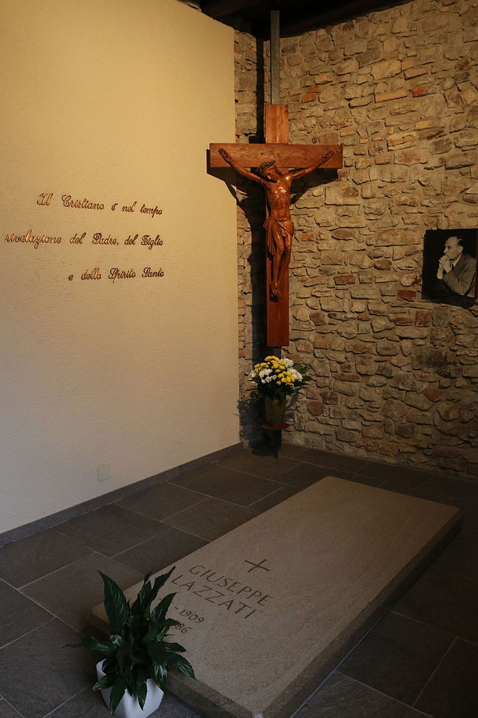
English: The tomb of Giuseppe Lazzati in the Hermitage San Salvatore, locations Crevenna, Erba (CO), Italy
Italiano: La tomba di Giuseppe Lazzati all'Eremo San Salvatore, località Cravenna, Erba (CO) |
| Date | |
| Source | Own work |
| Author | Maxperot |
Licensing
| I, the copyright holder of this work, release this work into the
public domain. This applies worldwide. In some countries this may not be legally possible; if so: I grant anyone the right to use this work for any purpose, without any conditions, unless such conditions are required by law. |
File history
Click on a date/time to view the file as it appeared at that time.
| Date/Time | Thumbnail | Dimensions | User | Comment | |
|---|---|---|---|---|---|
| current | 22:12, 29 February 2016 |
| 3,648 × 5,472 (7.77 MB) | Maxperot | {{Information |Description ={{en|1=The tomb of Giuseppe Lazzati in the Hermitage San Salvatore, locations Crevenna, Erba (CO), Italy}} {{it|1=La tomba di Giuseppe Lazzati all'Eremo San Salvatore, località Cravenna, Erba (CO)}} |Source ={{ow... |
File usage
The following pages on the English Wikipedia use this file (pages on other projects are not listed):
Global file usage
The following other wikis use this file:
- Usage on fr.wikipedia.org
- Usage on it.wikipedia.org
- Usage on pt.wikipedia.org
- Usage on www.wikidata.org
Metadata
Size of this preview:
400 × 600 pixels. Other resolutions:
160 × 240 pixels |
320 × 480 pixels |
512 × 768 pixels |
682 × 1,024 pixels |
1,365 × 2,048 pixels |
3,648 × 5,472 pixels.
Original file (3,648 × 5,472 pixels, file size: 7.77 MB, MIME type: image/jpeg)
| This is a file from the
Wikimedia Commons. Information from its
description page there is shown below. Commons is a freely licensed media file repository. You can help. |
Summary
| Camera location |
| View this and other nearby images on: OpenStreetMap |
|
|---|
| Description |
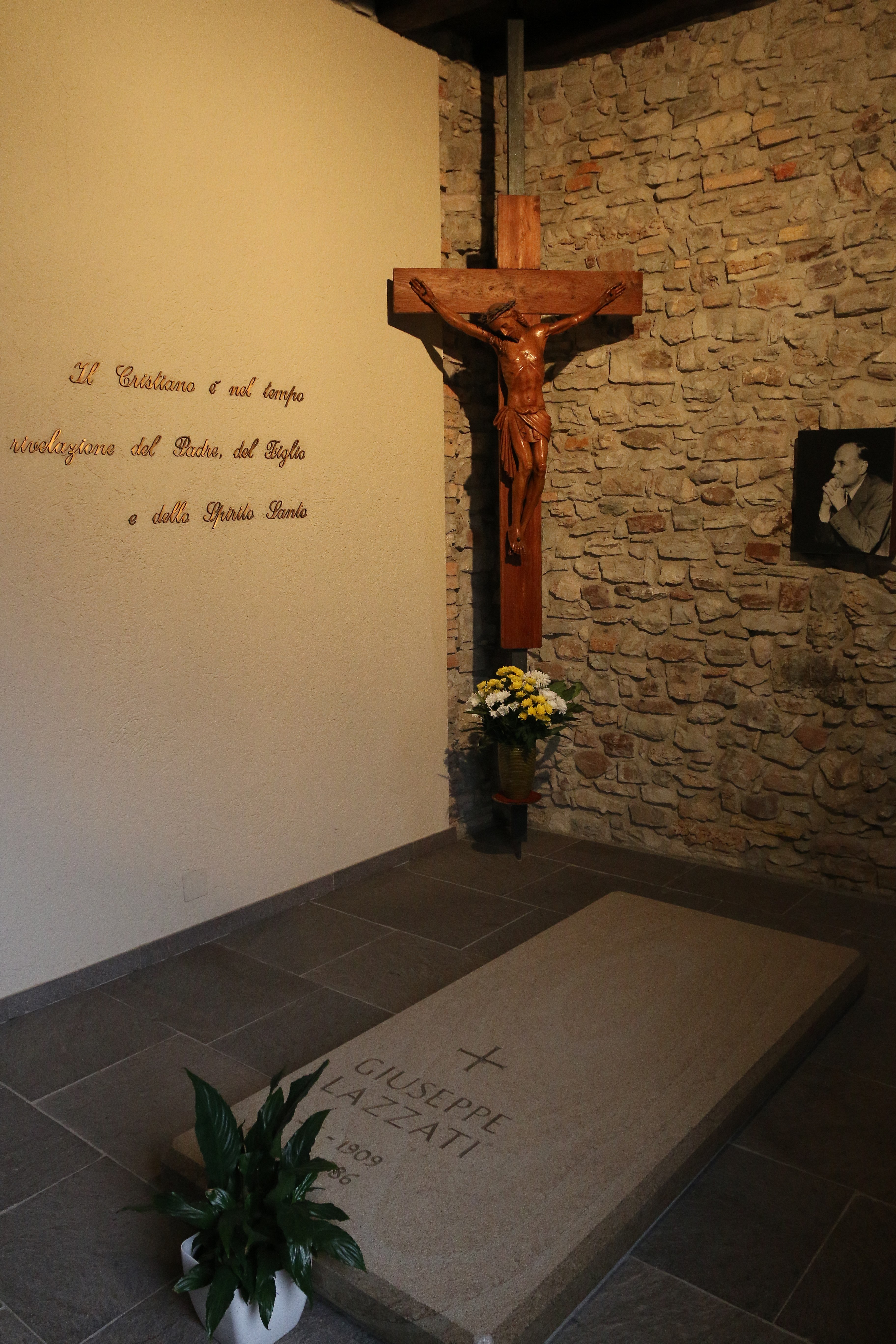
English: The tomb of Giuseppe Lazzati in the Hermitage San Salvatore, locations Crevenna, Erba (CO), Italy
Italiano: La tomba di Giuseppe Lazzati all'Eremo San Salvatore, località Cravenna, Erba (CO) |
| Date | |
| Source | Own work |
| Author | Maxperot |
Licensing
| I, the copyright holder of this work, release this work into the
public domain. This applies worldwide. In some countries this may not be legally possible; if so: I grant anyone the right to use this work for any purpose, without any conditions, unless such conditions are required by law. |
File history
Click on a date/time to view the file as it appeared at that time.
| Date/Time | Thumbnail | Dimensions | User | Comment | |
|---|---|---|---|---|---|
| current | 22:12, 29 February 2016 |
| 3,648 × 5,472 (7.77 MB) | Maxperot | {{Information |Description ={{en|1=The tomb of Giuseppe Lazzati in the Hermitage San Salvatore, locations Crevenna, Erba (CO), Italy}} {{it|1=La tomba di Giuseppe Lazzati all'Eremo San Salvatore, località Cravenna, Erba (CO)}} |Source ={{ow... |
File usage
The following pages on the English Wikipedia use this file (pages on other projects are not listed):
Global file usage
The following other wikis use this file:
- Usage on fr.wikipedia.org
- Usage on it.wikipedia.org
- Usage on pt.wikipedia.org
- Usage on www.wikidata.org