Original file (4,767 × 3,222 pixels, file size: 7.42 MB, MIME type: image/jpeg)
| This is a file from the
Wikimedia Commons. Information from its
description page there is shown below. Commons is a freely licensed media file repository. You can help. |
Summary
| Description |
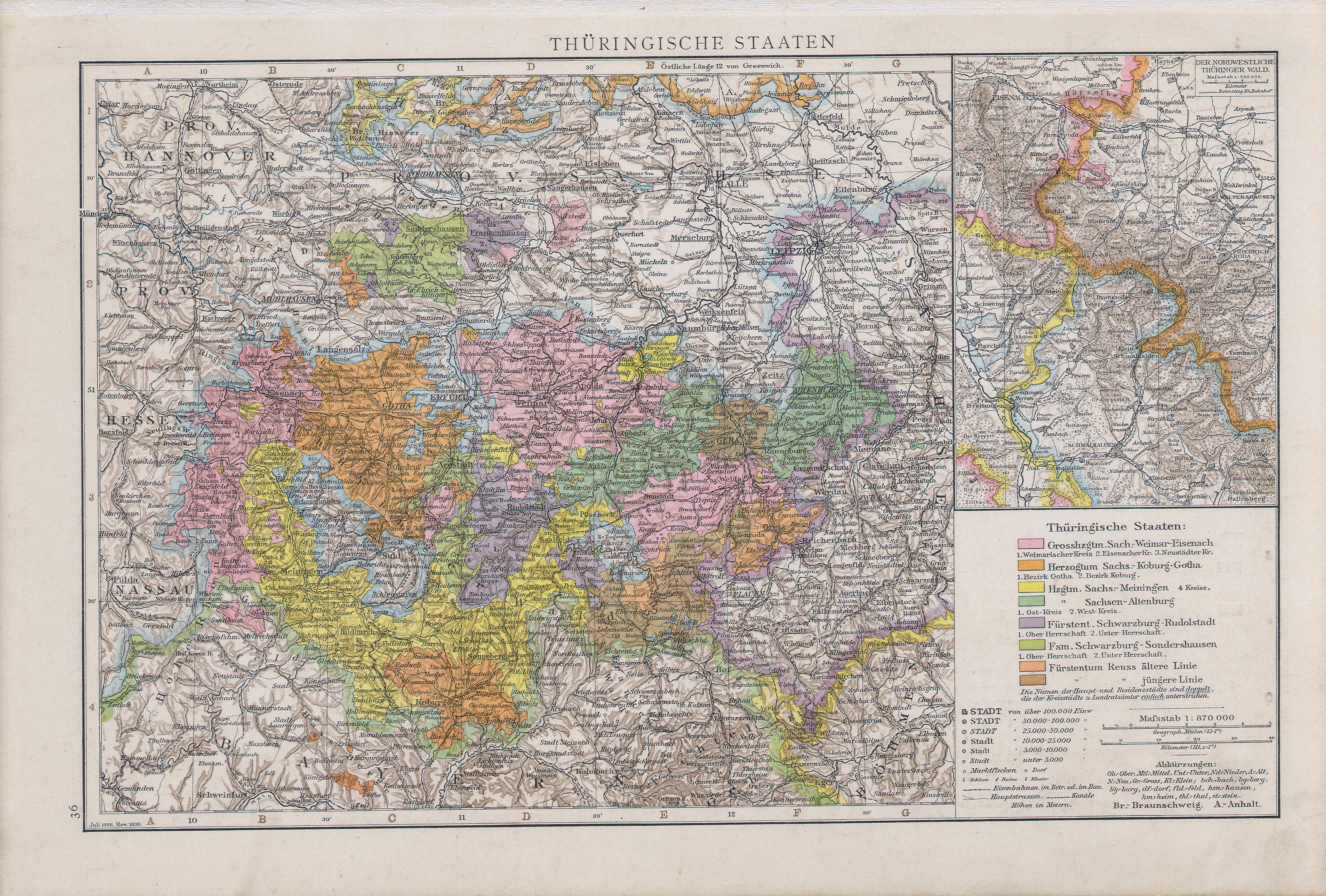
English: Map of Thuringian States, 1890
Slovenčina: Mapa durínskych štátov, 1890 |
| Date | |
| Source |
Allgemeiner Handatlas : in 120 Kartenseiten nebst alphabetischem Namenverzeichnis / hrsg. von der geographischen Anstalt von Velhagen & Klasing in Leipzig, 2.,verm. und verb. Aufl., 2. rev. Abdruck, Erschienen: Bielefeld u. Leipzig : Velhagen & Klasing, 1890, S. 36. |
| Author | Andree, Richard |
Licensing
|
This work is in the public domain in its country of origin and other countries and areas where the copyright term is the author's life plus 70 years or fewer.
| |
| This file has been identified as being free of known restrictions under copyright law, including all related and neighboring rights. | |
File history
Click on a date/time to view the file as it appeared at that time.
| Date/Time | Thumbnail | Dimensions | User | Comment | |
|---|---|---|---|---|---|
| current | 09:27, 9 July 2008 |
| 4,767 × 3,222 (7.42 MB) | Matriosa | {{Information |Description={{en|1=Map of Thuringian States, 1890}} {{sk|1=Mapa durínskych štátov, 1890}} |Source=Allgemeiner handatlas. 1890 |Author=Andree |Date=1890 |Permission= |other_versions= }} {{ImageUpload|full}} [[Category:Old maps of Thuring |
File usage
Global file usage
The following other wikis use this file:
- Usage on ast.wikipedia.org
- Usage on cs.wikipedia.org
- Usage on de.wikipedia.org
- Usage on es.wikipedia.org
- Usage on eu.wikipedia.org
- Usage on mk.wikipedia.org
- Usage on sk.wikipedia.org
- Usage on sl.wikipedia.org
- Usage on sv.wikipedia.org
Metadata
Original file (4,767 × 3,222 pixels, file size: 7.42 MB, MIME type: image/jpeg)
| This is a file from the
Wikimedia Commons. Information from its
description page there is shown below. Commons is a freely licensed media file repository. You can help. |
Summary
| Description |
English: Map of Thuringian States, 1890
Slovenčina: Mapa durínskych štátov, 1890 |
| Date | |
| Source |
Allgemeiner Handatlas : in 120 Kartenseiten nebst alphabetischem Namenverzeichnis / hrsg. von der geographischen Anstalt von Velhagen & Klasing in Leipzig, 2.,verm. und verb. Aufl., 2. rev. Abdruck, Erschienen: Bielefeld u. Leipzig : Velhagen & Klasing, 1890, S. 36. |
| Author | Andree, Richard |
Licensing
|
This work is in the public domain in its country of origin and other countries and areas where the copyright term is the author's life plus 70 years or fewer.
| |
| This file has been identified as being free of known restrictions under copyright law, including all related and neighboring rights. | |
File history
Click on a date/time to view the file as it appeared at that time.
| Date/Time | Thumbnail | Dimensions | User | Comment | |
|---|---|---|---|---|---|
| current | 09:27, 9 July 2008 |
| 4,767 × 3,222 (7.42 MB) | Matriosa | {{Information |Description={{en|1=Map of Thuringian States, 1890}} {{sk|1=Mapa durínskych štátov, 1890}} |Source=Allgemeiner handatlas. 1890 |Author=Andree |Date=1890 |Permission= |other_versions= }} {{ImageUpload|full}} [[Category:Old maps of Thuring |
File usage
Global file usage
The following other wikis use this file:
- Usage on ast.wikipedia.org
- Usage on cs.wikipedia.org
- Usage on de.wikipedia.org
- Usage on es.wikipedia.org
- Usage on eu.wikipedia.org
- Usage on mk.wikipedia.org
- Usage on sk.wikipedia.org
- Usage on sl.wikipedia.org
- Usage on sv.wikipedia.org