Original file (4,323 × 2,763 pixels, file size: 1.64 MB, MIME type: image/jpeg)
| This is a file from the
Wikimedia Commons. Information from its
description page there is shown below. Commons is a freely licensed media file repository. You can help. |
| Description |
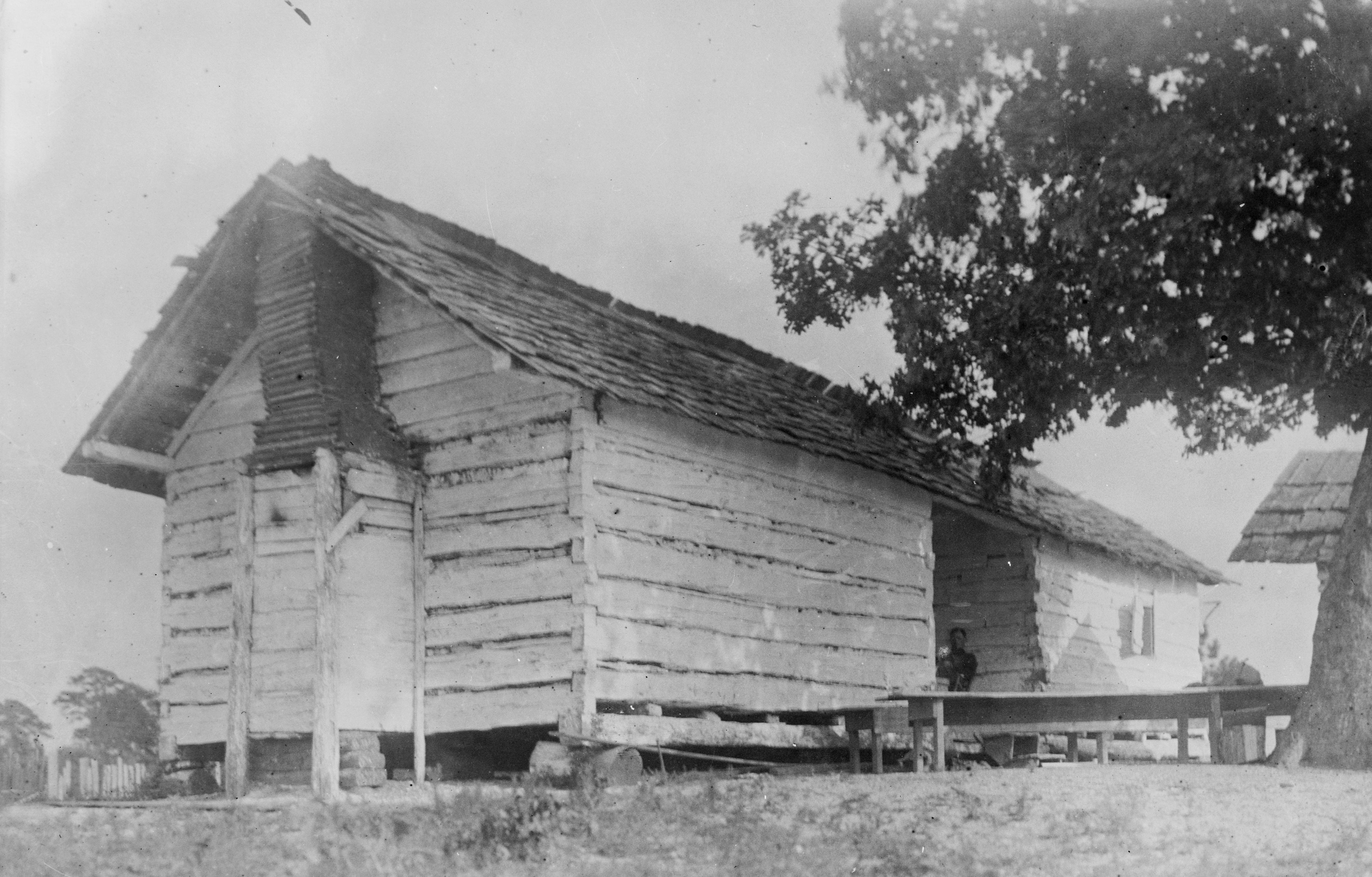
English: Thornhill Plantation, County Road 19, Watsonia, Greene County, AL. OLD SLAVE QUARTERS. |
|||||
| Date | ||||||
| Source |
Historic American Buildings Survey,Library of Congress, Prints & Photographs Division, HABS [or HAER or HALS], Reproduction number "HABS ALA,32-WATSO,1-30"
|
|||||
| Author | Alex Bush, Photographer | |||||
| Permission ( Reusing this file) |
|


File history
Click on a date/time to view the file as it appeared at that time.
| Date/Time | Thumbnail | Dimensions | User | Comment | |
|---|---|---|---|---|---|
| current | 20:38, 27 March 2009 |
| 4,323 × 2,763 (1.64 MB) | Martin H. | High res; cropped |
| 22:58, 24 November 2008 |
 | 868 × 568 (300 KB) | Altairisfar | == Summary == {{Information |Description={{en|Thornhill Plantation, County Road 19, Watsonia, Greene County, AL. OLD SLAVE QUARTERS.}} |Source=Historic American Buildings Survey,Library of Congress, Prints & Photographs Division, HABS [or HAER or HALS], R |
File usage
Global file usage
The following other wikis use this file:
- Usage on simple.wikipedia.org
Metadata
Original file (4,323 × 2,763 pixels, file size: 1.64 MB, MIME type: image/jpeg)
| This is a file from the
Wikimedia Commons. Information from its
description page there is shown below. Commons is a freely licensed media file repository. You can help. |
| Description |
English: Thornhill Plantation, County Road 19, Watsonia, Greene County, AL. OLD SLAVE QUARTERS. |
|||||
| Date | ||||||
| Source |
Historic American Buildings Survey,Library of Congress, Prints & Photographs Division, HABS [or HAER or HALS], Reproduction number "HABS ALA,32-WATSO,1-30"
|
|||||
| Author | Alex Bush, Photographer | |||||
| Permission ( Reusing this file) |
|
File history
Click on a date/time to view the file as it appeared at that time.
| Date/Time | Thumbnail | Dimensions | User | Comment | |
|---|---|---|---|---|---|
| current | 20:38, 27 March 2009 |
| 4,323 × 2,763 (1.64 MB) | Martin H. | High res; cropped |
| 22:58, 24 November 2008 |
| 868 × 568 (300 KB) | Altairisfar | == Summary == {{Information |Description={{en|Thornhill Plantation, County Road 19, Watsonia, Greene County, AL. OLD SLAVE QUARTERS.}} |Source=Historic American Buildings Survey,Library of Congress, Prints & Photographs Division, HABS [or HAER or HALS], R |
File usage
Global file usage
The following other wikis use this file:
- Usage on simple.wikipedia.org