
Original file (1,489 × 1,765 pixels, file size: 1.34 MB, MIME type: image/jpeg)
| This is a file from the
Wikimedia Commons. Information from its
description page there is shown below. Commons is a freely licensed media file repository. You can help. |
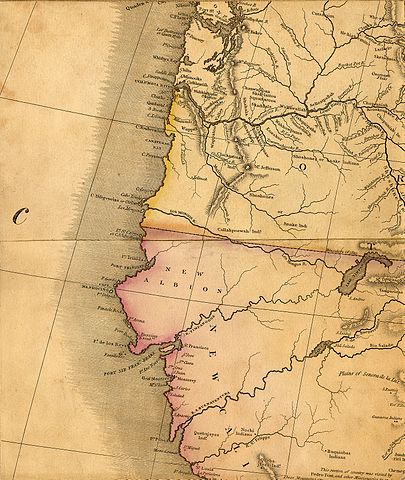
| Description | Henry S. Tanner's 1822 Map of North America - part showing the Pacific Coast with fictive Rivers from the Rocky Mountains to the Pacific Ocean. | |||||||||||||||||||
| Date | ||||||||||||||||||||
| Source | http://www.lib.utulsa.edu/Speccoll/collections/maps/tanner/tanner1.htm | |||||||||||||||||||
| Author |
|
|||||||||||||||||||
| Permission ( Reusing this file) |
|
|||||||||||||||||||

File history
Click on a date/time to view the file as it appeared at that time.
| Date/Time | Thumbnail | Dimensions | User | Comment | |
|---|---|---|---|---|---|
| current | 11:27, 30 November 2008 |
| 1,489 × 1,765 (1.34 MB) | H-stt | {{Information |Description= Henry S. Tanner's 1822 Map of North America - part showing the Pacific Coast with fictive Rivers from the Rocky Mountains to the Pacific Ocean. |Source= http://www.lib.utulsa.edu/Speccoll/collections/maps/tanner/tanner1.htm |Da |
File usage
Global file usage
The following other wikis use this file:
- Usage on he.wikipedia.org
Metadata
Original file (1,489 × 1,765 pixels, file size: 1.34 MB, MIME type: image/jpeg)
| This is a file from the
Wikimedia Commons. Information from its
description page there is shown below. Commons is a freely licensed media file repository. You can help. |
| Description | Henry S. Tanner's 1822 Map of North America - part showing the Pacific Coast with fictive Rivers from the Rocky Mountains to the Pacific Ocean. | |||||||||||||||||||
| Date | ||||||||||||||||||||
| Source | http://www.lib.utulsa.edu/Speccoll/collections/maps/tanner/tanner1.htm | |||||||||||||||||||
| Author |
|
|||||||||||||||||||
| Permission ( Reusing this file) |
|
|||||||||||||||||||
File history
Click on a date/time to view the file as it appeared at that time.
| Date/Time | Thumbnail | Dimensions | User | Comment | |
|---|---|---|---|---|---|
| current | 11:27, 30 November 2008 |
| 1,489 × 1,765 (1.34 MB) | H-stt | {{Information |Description= Henry S. Tanner's 1822 Map of North America - part showing the Pacific Coast with fictive Rivers from the Rocky Mountains to the Pacific Ocean. |Source= http://www.lib.utulsa.edu/Speccoll/collections/maps/tanner/tanner1.htm |Da |
File usage
Global file usage
The following other wikis use this file:
- Usage on he.wikipedia.org