
Original file (SVG file, nominally 839 × 781 pixels, file size: 218 KB)
| This is a file from the
Wikimedia Commons. Information from its
description page there is shown below. Commons is a freely licensed media file repository. You can help. |
Summary
| Description |
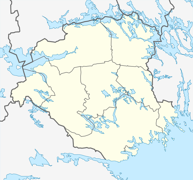
English: Location map of Södermanland county in Sweden
Equirectangular projection, N/S stretching 195 %. Geographic limits of the map:
Deutsch: Positionskarte von Södermanland län in Schweden
Quadratische Plattkarte, N-S-Streckung 195 %. Geographische Begrenzung der Karte:
|
| Date | |
| Source | Own work |
| Author | Erik Frohne |
Licensing

|
Permission is granted to copy, distribute and/or modify this document under the terms of the GNU Free Documentation License, Version 1.2 or any later version published by the Free Software Foundation; with no Invariant Sections, no Front-Cover Texts, and no Back-Cover Texts. A copy of the license is included in the section entitled GNU Free Documentation License. |
- You are free:
- to share – to copy, distribute and transmit the work
- to remix – to adapt the work
- Under the following conditions:
- attribution – You must give appropriate credit, provide a link to the license, and indicate if changes were made. You may do so in any reasonable manner, but not in any way that suggests the licensor endorses you or your use.
File history
Click on a date/time to view the file as it appeared at that time.
| Date/Time | Thumbnail | Dimensions | User | Comment | |
|---|---|---|---|---|---|
| current | 14:11, 29 January 2009 |
| 839 × 781 (218 KB) | Erik Frohne | {{Information |Description={{en|1=Location map of Södermanland county in Sweden Equirectangular projection, N/S stretching 195 %. Geographic limits of the map: * N: 59.60° N * S: 58.50° N * W: 15.50° E * E: 17.80° E}} {{de|1=Positionskarte von Söd |
File usage
More than 100 pages use this file. The following list shows the first 100 pages that use this file only. A full list is available.
- Abborrberget
- Alberga, Sweden
- Arnö
- Aspen (Julita)
- Baggetorp
- Bergshammar
- Bettna
- Bie, Sweden
- Björkvik
- Björnlunda
- Buskhyttan
- Bälgviken
- Djulö kvarn
- Duveholmssjön
- Enstaberga
- Eskilstuna
- Flen
- Forssjö
- Frösjön
- Galten (basin)
- Gnesta
- Hallbosjön
- Hällberga
- Hällbybrunn
- Hälleforsnäs
- Härad, Sweden
- Hållsta
- Högsjö
- Jönåker
- Katrineholm
- Kjulaås
- Klämmingen
- Kolsnaren
- Kvicksund
- Likstammen
- Lockvattnet
- Luvsjön
- Långhalsen
- Malmköping
- Mariefred
- Mariefred Charterhouse
- Marielund, Strängnäs
- Marmorbyn
- Marviken, Södermanland
- Mellösa
- Merlänna
- Murder of Bobby Äikiä
- Naten
- Nyby bruk
- Nyköping
- Näsnaren
- Nävekvarn
- Nävsjön
- Orrhammar
- Orrhammaren
- Oxbacken
- Oxelösund
- Runtuna
- Sillen
- Sjösa
- Skebokvarn
- Skogstorp, Eskilstuna Municipality
- Sköldinge
- Sparreholm
- Stallarholmen
- Stavsjö
- Stensund och Krymla
- Stigtomta
- Stjärnhov
- Stockholm Skavsta Airport
- Strängnäs
- Strängnäs Cathedral
- Strångsjö
- Sund, Trosa
- Sundbyholm
- Svalsta
- Södermanland County
- Tisnaren
- Torshälla
- Torshälla huvud
- Trosa
- Träskaten
- Tumbo
- Tystberga
- Vagnhärad
- Valla, Sweden
- Vansö kyrkby
- Vingåker
- Visnaren
- Vrena
- Västerljung
- Västra Borsökna
- Yngaren
- Ältaren
- Ängsholmen, Eskilstuna Municipality
- Ärla
- Äsköping
- Åkers styckebruk
- Åkerö Manor
- Ålberga
View more links to this file.
Global file usage
The following other wikis use this file:
- Usage on ar.wikipedia.org
- Usage on bg.wikipedia.org
- Usage on ceb.wikipedia.org
- Usage on da.wikipedia.org
- Usage on de.wikipedia.org
- Mariefred
- Eskilstuna
- Nyköping
- Strängnäs
- Flughafen Stockholm-Skavsta
- Katrineholm
- Vingåker
- Trosa
- Gnesta
- Torshälla
- Tunavallen
- Flen
- Åkers styckebruk
- Oxelösund
- Båven
- Tvären
- Wikipedia:Kartenwerkstatt/Positionskarten/Europa
- Vorlage:Positionskarte Schweden Södermanland
- Bie
- Vagnhärad
- Fjällskäfte
- Hälleforsnäs
View more global usage of this file.
Original file (SVG file, nominally 839 × 781 pixels, file size: 218 KB)
| This is a file from the
Wikimedia Commons. Information from its
description page there is shown below. Commons is a freely licensed media file repository. You can help. |
Summary
| Description |
English: Location map of Södermanland county in Sweden
Equirectangular projection, N/S stretching 195 %. Geographic limits of the map:
Deutsch: Positionskarte von Södermanland län in Schweden
Quadratische Plattkarte, N-S-Streckung 195 %. Geographische Begrenzung der Karte:
|
| Date | |
| Source | Own work |
| Author | Erik Frohne |
Licensing
|
|
Permission is granted to copy, distribute and/or modify this document under the terms of the GNU Free Documentation License, Version 1.2 or any later version published by the Free Software Foundation; with no Invariant Sections, no Front-Cover Texts, and no Back-Cover Texts. A copy of the license is included in the section entitled GNU Free Documentation License. |
- You are free:
- to share – to copy, distribute and transmit the work
- to remix – to adapt the work
- Under the following conditions:
- attribution – You must give appropriate credit, provide a link to the license, and indicate if changes were made. You may do so in any reasonable manner, but not in any way that suggests the licensor endorses you or your use.
File history
Click on a date/time to view the file as it appeared at that time.
| Date/Time | Thumbnail | Dimensions | User | Comment | |
|---|---|---|---|---|---|
| current | 14:11, 29 January 2009 |
| 839 × 781 (218 KB) | Erik Frohne | {{Information |Description={{en|1=Location map of Södermanland county in Sweden Equirectangular projection, N/S stretching 195 %. Geographic limits of the map: * N: 59.60° N * S: 58.50° N * W: 15.50° E * E: 17.80° E}} {{de|1=Positionskarte von Söd |
File usage
More than 100 pages use this file. The following list shows the first 100 pages that use this file only. A full list is available.
- Abborrberget
- Alberga, Sweden
- Arnö
- Aspen (Julita)
- Baggetorp
- Bergshammar
- Bettna
- Bie, Sweden
- Björkvik
- Björnlunda
- Buskhyttan
- Bälgviken
- Djulö kvarn
- Duveholmssjön
- Enstaberga
- Eskilstuna
- Flen
- Forssjö
- Frösjön
- Galten (basin)
- Gnesta
- Hallbosjön
- Hällberga
- Hällbybrunn
- Hälleforsnäs
- Härad, Sweden
- Hållsta
- Högsjö
- Jönåker
- Katrineholm
- Kjulaås
- Klämmingen
- Kolsnaren
- Kvicksund
- Likstammen
- Lockvattnet
- Luvsjön
- Långhalsen
- Malmköping
- Mariefred
- Mariefred Charterhouse
- Marielund, Strängnäs
- Marmorbyn
- Marviken, Södermanland
- Mellösa
- Merlänna
- Murder of Bobby Äikiä
- Naten
- Nyby bruk
- Nyköping
- Näsnaren
- Nävekvarn
- Nävsjön
- Orrhammar
- Orrhammaren
- Oxbacken
- Oxelösund
- Runtuna
- Sillen
- Sjösa
- Skebokvarn
- Skogstorp, Eskilstuna Municipality
- Sköldinge
- Sparreholm
- Stallarholmen
- Stavsjö
- Stensund och Krymla
- Stigtomta
- Stjärnhov
- Stockholm Skavsta Airport
- Strängnäs
- Strängnäs Cathedral
- Strångsjö
- Sund, Trosa
- Sundbyholm
- Svalsta
- Södermanland County
- Tisnaren
- Torshälla
- Torshälla huvud
- Trosa
- Träskaten
- Tumbo
- Tystberga
- Vagnhärad
- Valla, Sweden
- Vansö kyrkby
- Vingåker
- Visnaren
- Vrena
- Västerljung
- Västra Borsökna
- Yngaren
- Ältaren
- Ängsholmen, Eskilstuna Municipality
- Ärla
- Äsköping
- Åkers styckebruk
- Åkerö Manor
- Ålberga
View more links to this file.
Global file usage
The following other wikis use this file:
- Usage on ar.wikipedia.org
- Usage on bg.wikipedia.org
- Usage on ceb.wikipedia.org
- Usage on da.wikipedia.org
- Usage on de.wikipedia.org
- Mariefred
- Eskilstuna
- Nyköping
- Strängnäs
- Flughafen Stockholm-Skavsta
- Katrineholm
- Vingåker
- Trosa
- Gnesta
- Torshälla
- Tunavallen
- Flen
- Åkers styckebruk
- Oxelösund
- Båven
- Tvären
- Wikipedia:Kartenwerkstatt/Positionskarten/Europa
- Vorlage:Positionskarte Schweden Södermanland
- Bie
- Vagnhärad
- Fjällskäfte
- Hälleforsnäs
View more global usage of this file.